2 On The Road Blog

After 12 years of full-time rving, we've sold our truck and trailer but we're still traveling. Email us at wowpegasus@hotmail.com if you would like to contact us.


Monday, July 30, 2012

Ireland Trip - Car and Roads


The speed limit signs looked a little different than we are used to.


On the motorway headed out of Dublin.  Speed limit was 100 kph.  About 60 mph.


There were three signs like this for each exit off the motorway.  The first one had three slashes, the second had two and the third had three.  Don't know what exactly them meant.   Just an indication of the upcoming exit, I guess.


The 2012 Ford Focus we rented with Jolene in the driver's seat.  Yep, she was driving a manual transmission vehicle on the wrong side of the road while driving from the wrong side of the vehicle.   A challenge but she did a great job!!!  Better than I did as a navigator! The picture above it is one of the many different kinds of vehicles we saw on the road.  There were lots of these Toyota pickups/SUV/???
 
In the states, green indicates diesel and black is unleaded.  Had to be careful to put the right fuel in the car.  It was a diesel.

Look Ma, no fuel cap.  Yup, you just stuck the nozzle in and started pumping.  Wonderful.  Much better than misplacing gas caps.


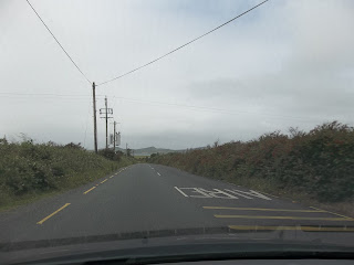
Typical N road (national road).  There's M roads (motorways), N roads (National), R Roads (regional) and L roads (local).  Width and condition degrated with each lowering of the designation.  Notice the two tour buses.  It was real interesting when two big vehicles met. 

Over a bridge where the road got even narrower.


Tunnel of trees were common.


Following a semi through a small town.  Most times there were cars parked on both sides of the street.

RV's in Ireland aren't very big.  This is typical.

We saw lots of car makes that aren't seen on the streets in the USA.


Colorful small town but only one car at a time when there were cars parked on both sides of the street.

The curves didn't have speed limit signs.  Just SLOW, SLOWER or VERY SLOW painted on the pavement.  This photo was in the one of the Gaelic speaking areas so, I think this is SLOW in Irish.  I didn't even notice that when I took the photo.  I was trying to show the red-flowering bushes on each side of the road.

A typical curve sign.  The road really wasn't as curvy as this sign shows but we did go down Corkscrew Hill and it as a series of switchbacks.


I bet the semis were only about 60' long but they all had a Long Vehicle sign.

All the semis were cabovers too.  It's apparent why once you get out on the roads in Ireland.  The bushes grow up to the edge of the pavement and it's difficult to see if it is save to emerge from an intersection.

Traffic calming sign.  We just figured this was a reduced speed sign.  

We saw a few large, power-generating windmills in the country.

Thru a tunnel


Typical exit sign.


The towns were listed in the reverse order that you see in the states.  The town the furthest away was listed first.

Another make you don't see in the states.

There were a lot of roads that had stone fences on each side but most of the time there were covered in vegetation so you couldn't see them.


We saw lots of Flagger Ahead signs but this is the only flagger we saw.


Ireland Trip - Cliffs of Moher


As described in Wikipedia:  The Cliffs of Moher (Irish: Aillte an Mhothair) are located at the southwestern edge of the Burren region in County Clare, Ireland. They rise 120 metres (390 ft) above the Atlantic Ocean at Hag's Head, and reach their maximum height of 214 metres (702 ft) just north of O'Brien's Tower, eight kilometres to the north. The cliffs receive almost one million visitors a year.  
The cliffs take their name from an old fort called Moher that once stood on Hag's Head, the southernmost point of the cliffs


Jolene climbed the hill via these stairs while I crutched up the path alongside it.

 
O'Brien's Tower is a round stone tower near the midpoint of the cliffs built in 1835 by Sir Cornelius O'Brien to impress female visitors.


Most of the rock fences we saw in Ireland had rocks placed horizonily like this one but there weren't always capped with rocks like this.

The visitor center was built into the side of a hill.


There were also shops built into the hill.


Ireland Trip - Bunratty Castle and Folk Park


Small part of the history of the castle from Wikipedia:  Bunratty Castle (Irish: Caisleán Bhun Raithe, meaning "Castle at the Mouth of the Ratty") is a large tower house in County Clare, Ireland. It lies in the centre of Bunratty village (Irish: Bun Ráite), by the N18 road between Limerick and Ennis, near Shannon Town and its airport. The name Bunratty, Bun Raite (or possibly, Bun na Raite) in Irish, means the 'bottom' or end of the 'Ratty' river. This river, alongside the castle, flows into the nearby Shannon estuary. From the top of the castle, one can look over to the estuary and the airport.


The present structure was completed by the MacNamara family around 1425 and was briefly occupied by the Siodhachain (Sheehan) clan, but 50 years later was in the hands of the O'Briens, the most powerful clan in Munster.

In 1646, during the Irish Confederate Wars, Barnabas O'Brien, 6th Earl of Thomond, allowed a large English Parliamentary garrison to land in Bunratty. The castle was besieged and taken by the forces of Confederate Ireland under Donagh MacCarthy, Viscount Muskerry.

When Barnaby, or Barnabas O'Brien, 6th Earl of Thomond, left Bunratty for England in 1646 for his own safety, during the Confederate wars, he was the last member of the O'Brien Clan ever to reside in Bunratty Castle. He was actually christened Brian O'Brien, after his famous ancestor Brian Boru, but being a political gymnast, he preferred a more English appellation to appease the King, and to be socially acceptable in the climate of the time.

Bunratty Castle and its lands were granted to the Studdert family. They left the castle in 1804 (allowing it to fall into disrepair), to reside in the more comfortable and modern adjacent Bunratty House built by the family. The reasons for the move are bound up in family arguments over the eldest son marrying his first cousin.

For some time in the mid Nineteenth century the castle was used as a Barracks by the Royal Irish Constabulary,[2] the colonial era police force.

In 1954 the castle was purchased and restored by the 7th Viscount Gort. He reroofed the castle, which had no longer been lived in as much at the time, and saved it from ruin.


The house of a fishing-farming family in West Clare. The thatch is roped down to protect it against the Atlantic  gales


The present cstle, last of a series on the same site was built around 1425.  During the 16th and 17th centuries it was an important stronghold of the O'Briens - kings and later earls, of Thomond or North Munnster.

The main block has three floors, each consisting of a single great room, or hall.   The castle is entered by a drawbridge to the Main Guard.


This Mountain Farmhouse is a poor farmer's house of a type found on the borders of Limerick and Kerry.  It has a loft for extra sleeping space.


Bunratty House with a herd of Irish Red Deer in front.  This late Georgian dwelling (Built 1804) of the type occupied by minor gentry in the 19th century.  It was home to the Studdart Family, descendants of the O'Brien's who lived in Bunratty Castle.


Gardens adjacent to Bunratty House.


Top of Ardcroney Church as seen from the gardens.  More on the church later.


A horse, a donkey and a rooster were in the field to the side of Ardcroney Church.


The stream feedign the horizontal mill.


A working corn mill based on findings of an excavation in Mashanaglas, County Cork.


Vertical mill.


A classical example of a rural undershop watermill.


Rock-lined stream that leaves the vertical mill.


Durty Nelly's was adjacent to the castle so that is where we ate.