
 |
| Since I took the optional Rothenburg tour, I got on the bus in the morning for a 1 1/2 hour ride. In Wurzburg, I saw the Festung Marienberg. This is a reconstructed, 13th-century fortress with formal terrace gardens that houses art & history museums. |
 |
| I also saw the Wallfahrtskirche Käppele from the bus. Visitation of Mary chapel. In 1640 a local fisherman erected a sculpture of the Virgin Mary holding the dead body of Jesus. Ten years later four miracle cures were reported in connection with the statue. The first chapel was built around the pietà around 1650. The cures began to attract pilgrims to the site. In 1690 and 1713, the original chapel was increased in size. Construction started in April 1748 and finished in 1750 but the interior furnishings were not finished until 1821. |
 |
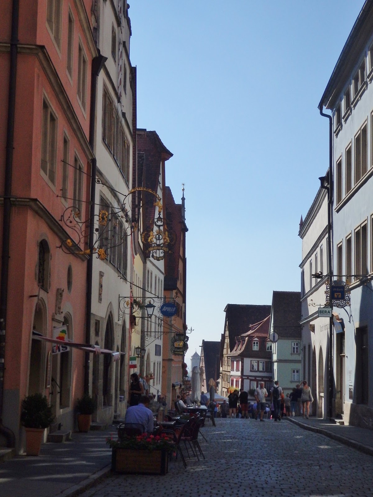
| Rothenburg ob der Tauber (Rothenberg over the Taber River) is well known for its well-preserved medieval old town. Rothenburg was a Free Imperial City, from the late Middle Ages to 1803. This means that the Holy Roman Empire declared it was a self-ruling city that was represented in the general assembly of the Empire. |
 |
| St. Wolfgang's Church (St. Wolfgangskirche) was built by the shepherds of the town for their patron saint. It is actually incorporated into the town's fortifications. |
 |
| As we stood in this spot I watched cars moving in both directions thru this small archway called Klingentor (Klingen Gate). This is an opening in the old town's fortified wall. |
 |
| On the other side of the tower were stairs leading to the top of the wall. We climbed them and looked out over the town. |

 |
| Individuals and other entities are able to buy plaques that are embedded into the old fortified wall. |


 |
| After a short distance, we came back down. |
 |
| Looking back the way towards Klingentor. |
 |
| Click to enlarge for reading. |
 |
| As with many of the old buildings, there's a pulley at the top that was used to lift supplies into the storage area at the top. |


 |
| Buildings were taxed based on the amount of land they occupied so upper stories were often built larger. |
 |
| St Jakobs Kirche |
 |
| A building in the Kirchplatz had and interesting way to put the windows. |
 |
| If you know how to read them, you could tell the time and date. |
 |
| More photo of the exterior of St Jakobs Kirche. |

 |
| Beautiful entrance on the building facing the front of the church |
 |
| Heading into the Parktplatz on Herrngasse |
 |
| Marien-Apotheke, a drug store. |
 |
| Stadt Rothenburg ob der Tauber, Rothenburg City Hall |
 |
| Straight from the Rothenburg City Tourism website:
The former tavern was previously the exclusive preserve of the great and good of the Town Council. Now it welcomes all visitors to Rothenburg. Stop and absorb a little bit of Rothenburg’s venerable history: the clock on the facade of the building illustrates the legend of the Master Draught from 1631. The doors of the clock open every hour on the hour between 10 a.m. and 10 p.m. At the behest of Count Tilly, Mayor Nusch drank 3 1/4 liters of Franconian wine in a single gulp, thus saving Rothenburg from destruction.
Look up at the gable of the Ratstrinkstube and you will be amazed: as well as the large town clock dating back to 1683 and the date display, you will also see a sun dial from 1768 and the famous city coat of arms!
|


 |
| Next we headed off to the Christmas museum. Have you ever heard of Christmas pyramids? |

 |
| Back out on the street I started noticing all the fancy business signs This one is on the pharmacy building in a previous photo. |

 |
| Headed down Obere Schmiedgasse. |


 |
| Straight from the Rothenburg Tourism website: "One of the most famous postcard images from Rothenburg ob der Tauber is definitely the Plönlein. A narrow half-timbered building with a small fountain in front, it is framed by the Kobolzeller tower and the higher Siebers Tower, with lovingly restored townhouses to the right and left, creating a charmingly picturesque effect. The word “Plönlein” derives from the Latin “planum” meaning “flat square”.
Both gate towers were built as part of the first expansion of the town in 1204. The Kobolzeller Tower secured the entrance to the town from the Tauber Valley. Built from dressed quarry stones, the Siebers Tower protected the southern gate until the Infirmary Quarter was incorporated within the town fortifications in the 14th century."
|
 |
The Plonlein and Siebers Tower.
|
 |
This is the Siebers Tower.
|
 |
| Exterior view of Siebers Tower. |
 |
| Love the "eye" windows on this youth hostel. |
 |
| Once again I'm back out along the fortified wall. |
 |
| The wall looks short on this side but it's quite a drop on the other |
 |
| The Kobolzellertor has an amphitheater at its base.. |
 |
| The wall follows the contour of the land. |
 |
| Headed back into town to eat lunch at the Ratsstube Restaurant. This pork and spatzle meal. Spatzle is a kind of soft egg noodle found in the cuisines of southern Germany, Austria, Switzerland and Hungary. It tasted better than it looked. |
 |
| After lunch I walked around town some more. This house was built in 1270. Read more about it in the next photo. |

 |
| I climbed to the top of the eastern wall thinking I would stay on it all the way around the town. |
 |
| It was real skinny where there were stairs going down. |
 |
| This is how they handle rain running off the roofs when the homes are so close together. |

 |
| I saw these in quite a few place on roof but I don't know what they do. |
 |
| Don't you just love the weaving rooflines? |

 |
| Someone even had a rooster statue |
 |
| Looking down into the back yards. |
 |
| Inside one of the towers. |
 |
| This gable definitely needed work. |
 |
| I also saw these scalloped plastic tiles on the roofs. |
 |
| Spitalbastei. See info on next photo |

 |
| Inside Spitalbastei |
 |
| I descended into the old moat area. |
 |
| Pig's Tower. Read about it in next photo. |


 |
| Plaque on Pig's Tower |
 |
| Pig's Tower entrance. Looks like the opening above the door was for pouring boiling oil or hot pitch on invaders. |
 |
| Into the tower |
 |
| Going up. |

 |
| Lime tower with Reichsstadthalle to right. |
 |
| Inside of Lime Tower |
 |
| Lime Tower is the one with the amphitheater at the base. |
 |
| Plaque in the wall sponsored by New Mexico State University. |

 |
| Why would there be a door in the wall? |
 |
| Looks like we'll take a peek out it. |
 |
| Ah! The garderobe (a lavatory in a medieval building) if that's what they call it in a medieval fortress wall. |
 |
| View from the An Der Eich Look Out Point shows the towers of St Jakobs Kirche in the distance |
 |
| Defensive wall moved down to another level and Kobelzellertor is the next tower. |
 |
 |
| Notice the bottles hanging on the wall? |
 |
| These are bocksbeutel bottles, a design used in this area that is used for the best wines from the city's own winery. |
 |
| This house is built right into the wall. |
 |
| Saw a lot of wind turbines on the way back to Wurzburg. |
 |
| Three busloads went to Rothenburg. |
 |
| I recognize the corn but I don't know what the other crop is. |
 |
| Can't get a good photo as we fly by. Maybe beets? Sugar beets? |
 |
| Price per liter for fuel. So 3.79 x 1.269 = 4.81 euro at today's rate = $5.27 per gallon. So quit complaining about the price of gas. |
 |
| Vineyards growing straight up the hillside. |
 |
| Back in Wurzburg. |

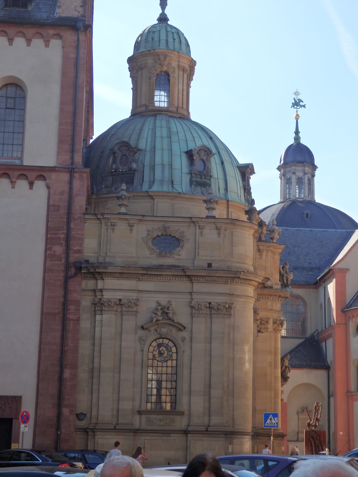 |
| Back of the Würzburger Cathedral. Much of Wurzburg was destroyed by the Allied forces on March 16, 1945. 5,000 people died. They were burned to death, killed by collapsing walls or were suffocated in cellars. |
 |
| Statue outside the cathedral |
 |
| The interior of the cathedral was all redone after the war. There is a large Menorah in the back of the church. |
 |
| The northern wall (one to the left) collapsed after the air raid. |
 |
| Front of the cathedral |
 |
| Tram running through town. Our guide took us to a memorial of the air raid of March 16, 1945 that is located by the Rathaus. Only 7 buildings survived in the city center so almost everything you see is post war. |
