
 |
| Price Park is adjacent to Cone Park |
 |
| We hiked all of these trails. Tanawha Trail goes to the left of this map for over 13 miles. We didn't go down it that far. Maybe only a couple miles west of Holloway Mountain Road. There was a parking lot at the junction of that road and the trail where we parked for two walks. For the rest of the walks we drove down skinny, windy Shulls Mill Road. |
 |
| This is the start of the Boone Fork Trail. Counter-clockwise on the map. |
 |
| The meadow didn't last for long then we were into the rhododendrons. All the paths in this park required at least some portions through thick rhodys. You had to watch you head and your feet a lot. Not like the leisurely walk along the carriage roads in Cone park. |
 |
| A few places water ran with the trail. |
 |
| Looks like the end of the road. |
 |
| Of course there was a way around it. We passed by this three times during our walks and it was a nice cool place to stop under the overhang. |
 |
| Price Park trails had lots of muddy patches. |
 |
| Nolan did a lot of ducking on these trails and we were doing some limb breaking to get the rhodys out of the path. This was a muddy spot that had a higher trail to the left. |

 |
| The Mountains to Sea Trail ran with the Boone Fork Loop, Old Johns River Road and the Tanawha Trail through Price Park. |
 |
| At this spot the Mountains to Sea Trail required a creek crossing guaranteed to get your feet wet. This is one section we didn't do. Later we hiked Old Johns River Road to the spot on the other side of the creek. |
 |
| This trip we only hiked up Boone Fork Trail for 1.5 miles before we went to the creek to see Hebron Falls. The creek here is completely covered in boulders. |
 |
| We decided to climb up the stream. If you click on this photo to enlarge it, you can see people at the top of the rocks climbing down. |
 |
| Looking downstream |
 |
| Finally found some falls. |
 |
| Wider view. We went to the left of where Nolan is and tried to climb up. Nolan went down instead. We managed to halt his progress down the incline then common sense and our old bones decided not to climb any further. |
 |
| Hiking back along the trail we took a side path to get by the stream again |
 |
| Don't you just love the tree growing out of the rock? |
 |
| Ok, we decided to do the whole Boone Fork Trail but we took it clockwise, which is backwards according to the trail markers (picture of one further in the post). |
 |
| Love how the tree started on the rock but sent one root off to the ground. |
 |
| This tree just grew around the rock. |
 |
| We descended a lot until we got to the lowest points. We were so happy we had done the trail backwards because the ascend back up was more gradual. |
 |
| I don't know how many times we crossed the stream. There were at least three bridges but most of the crossings were stone to stone. |
 |
| Silly guy! |


 |
| Interesting stairs. |
 |
| Yep the trail goes through the rocks. |

 |
| This rock path around huge boulders was so pretty. |
 |
| After going around the boulders we had to climb some more. |
 |
| Time to go down some steps |
 |
| Definitely not the wide, level carriage trails of Cone park. |
 |
| Markers on trees led the way. |
 |
| I called this section the ankle buster. Just a jumble of roots. |
 |
| There were markers like this every 1/2 mile. |
 |
| Course I forgot to take a photo until we were just about done. BFT stands for Boone Fork Trail. |
 |
| Nolan and I both took photos of this butterfly... |
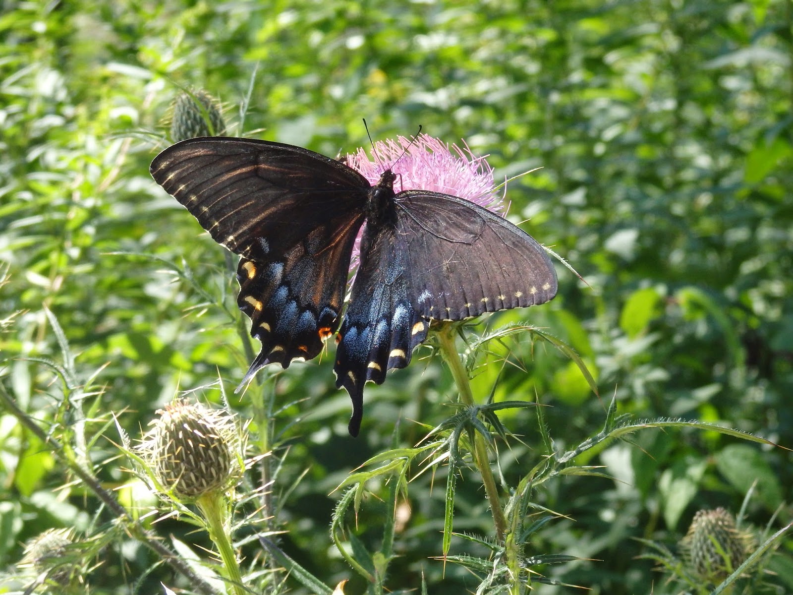 |
| Maybe it was my lower angle that caused the glare in this photo. |
 |
| The Green Knob trail was rated moderate/strenuous so I had decided we wouldn't do it. The trip we were going to take the Old John's River Road (OJRR)but accidently got on the Green Knob. The car was parked where the arrow is. We walked down the Blue Ridge parkway a short distance to get to the start of the OJRR but saw a trail leading off the road. We took it thinking it would get us to the OJRR. Wrong. |
 |
| We walked a level trail through some trees for a short distance then broke out into a berry covered meadow with a steep uphill climb. |
 |
| Then back into the woods we went. We started seeing markers like this. |
 |
| We continued to climb. We met a couple that didn't know the name of the trail. At this point we didn't either. They told us it was a loop and that we were following it backwards, the harder way. Figures. We had already figured we were going backwards according to the markers. |
 |
| We continued to climb. Met a couple of gals and had a nice chat with them. They confirmed we were on the Green Knob Loop but insisted that the climb was worth it. |
 |
| We continued backwards. |
 |
| I was taking too long to take photos while I was catching my breath so Nolan got ahead. He decided this marker was just the perfect place to wait for me. |
 |
| We broke out into a meadow where the markers continued. |
 |
| Then we headed downwards into the trees. |
 |
| The trail, and markers, continued to another meadow. |
 |
| Back into the trees, we come to the Blue Ridge Parkway bridge over Sims Creek. |
 |
| I told Nolan he needed a camouflage shirt if he really wanted to hide. |
 |
| It was interesting to cross under the bridge. |


 |
| This dead tree was still standing and covered in fungi |
 |
| Back to stream crossing. |
 |
| We ended up at Sims Pond along the Blue Ridge Parkway. Just where we had parked the car..... ok, not just where we parked it. It was in the parking lot along the road. LOL |
 |
| The next time we went out, we walked Old John's River Road. Was this dilapidated old cabin along the way. |
 |
| We descended, climbed, descended, crossed a creek, ascended then walked along a rhody infested ridge. |
 |
| The trail became a water runoff with drop offs then descended these rocks to the Boone Fork. This is where we got to the point directly across from where we had walked the Boone Fork Trail before. The stream crossing we didn't do. |
 |
| Another walk we did was a section of the Mountain to Sea trail between Old John's River Road to Shulls Mill Road. We had a couple of gals with a puppy behind us. After walking for a while we turned around and met up with them. The dog had disturbed some bees and had gotten stung multiple times. We hadn't see any bees when we had walked down the trail but we kept a sharp eye on the way back and saw this nest 30 foot up a tree. Looks like a wasps nest to me. |
 |
| The trail had descended from Shulls Mill Road and I took photos on the way back up. Good excuse to stop and catch my breath. |
 |
| Didn't want to fall off the trail here. |
 |
| The trail the gal at the Tourist Information Center had recommended was the Price Lake Trail. It started along the Parkway and was paved for a short distance. Here's where the paving ends and the rock/dirt/rhody roots begin. |
 |
| We were surprised that the trees were starting to change color since it was only mid-August when we walked this. |

 |
| Into the rhodys and mud. |
 |
| Another ankle twister section. |
 |
| This rhody tangled up in itself. |
 |
| There were some boardwalk sections over the mud. |
 |
| Just a fallen tree with colorful fungi. |
 |
| There were a few bridges on the trail around the lake. |
 |
| The trail on the west side of the lake had some sections that had concrete edging. It wasn't in the best repair. |


 |
| Whoo! It's a shark. |
 |
| Nope just a rock we had to go around. |
 |
| I wonder what insect was eating these leaves. |
 |
| Saw these along Shulls Mill Road. They were quite a distance from us but we could tell these turkeys were huge! |
 |
| We kept seeing these on the trails and we thought they were something that came off the rhododendrons. |
 |
| Wrong. They are the fruit off of a magnolia tree. I am holding one of them in front of the trunk of a magnolia tree. |
 |
| Looking up into the magnolia trees |
 |
| Magnolia tree leaves are huge. |
 |
| We saw a lot of these too. I think they are ironweed. The butterflies really liked them. |
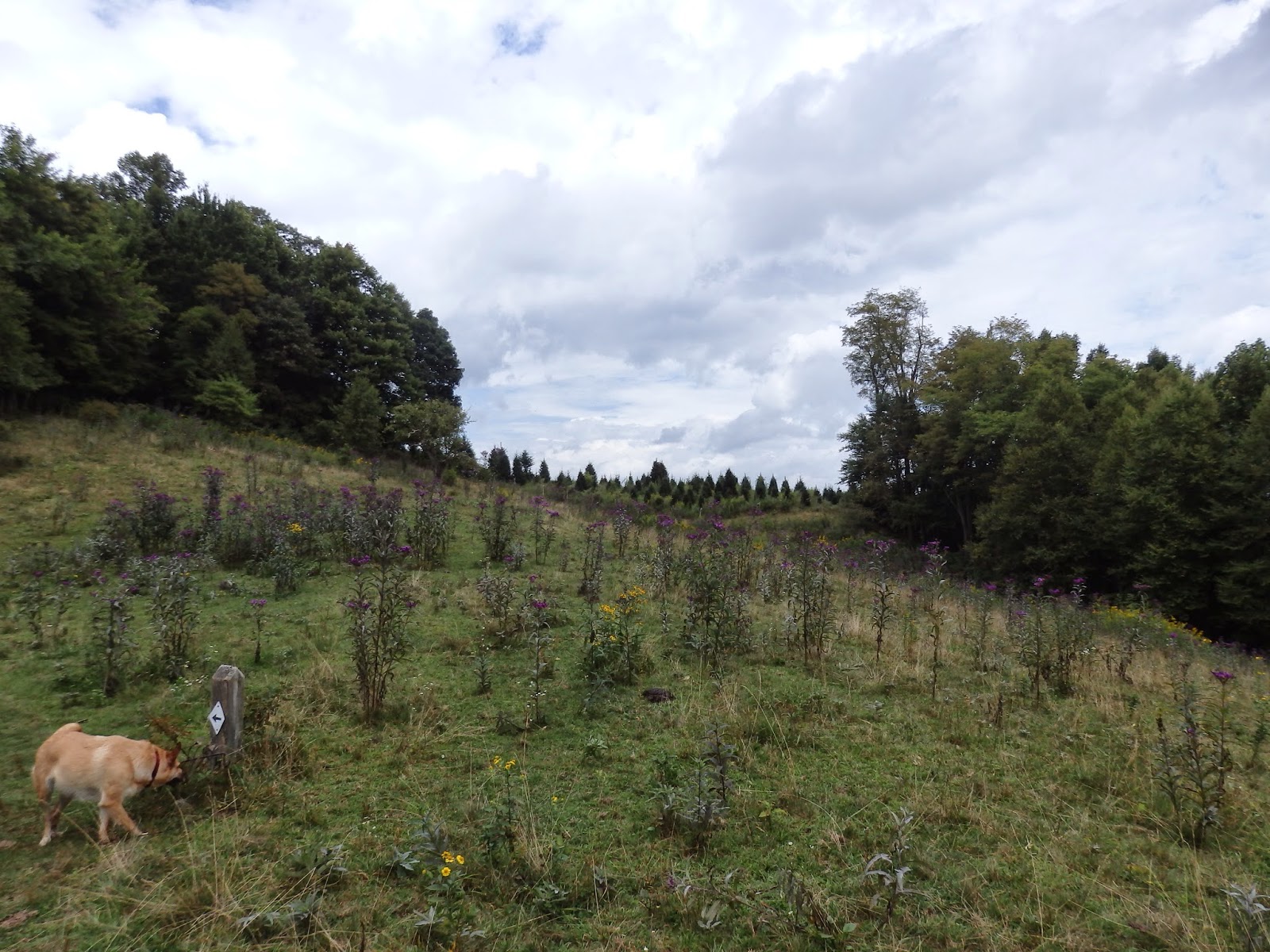 |
| Cow pasture full with ironweed. |
