
 |
| Read each one of these photos for the story. You may have to click on the photo to enlarge it for reading. |


 |
| Just up the road from the first information spot is another called "The Lake That Tilted". This is a segment of old Hwy 287. |
 |
| The information panel there told the stories of some of the people in the area. |

 |
| There were two paths to walk. First we went down "A Leap Just in Time". |
 |
| The walk was down a part of the old road to where a landslide had taken out a cabin and a section of the road. |

 |
| The path to the other story panel was new. |

 |
| You can see track from the old road to the Hilgard Resort. |


 |
| One cabin was in the water and you could see the remains of others on land. |
 |
| Nolan had to check out the double sided outhouse. |

 |
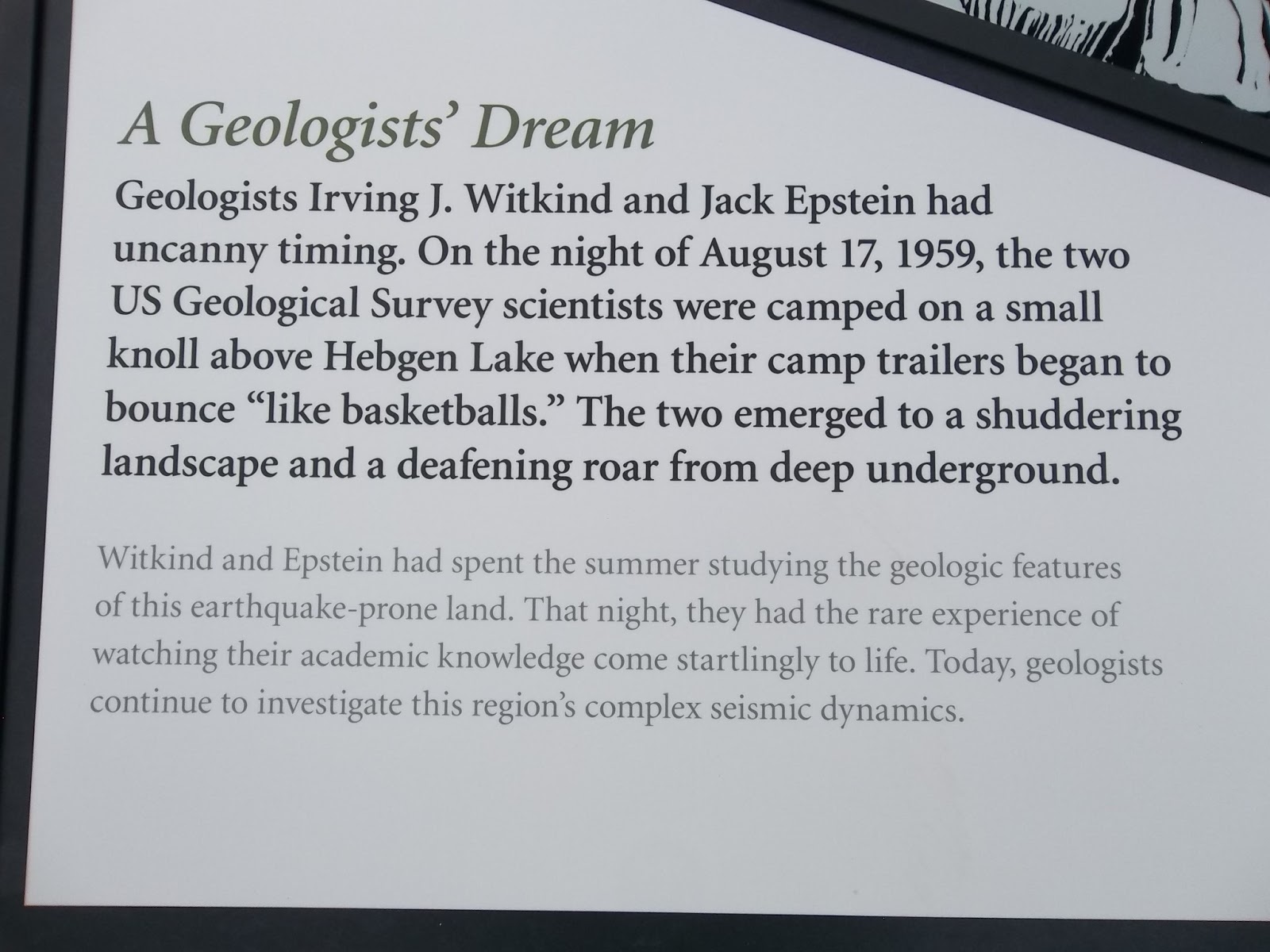
| More information from the panel. |

 |
| I saw one of the canals before we got to the panel and I had wondered about it. |


 |
| The next stop along the road was called "Refuge Point". |


 |
| We walked a ways down the trail and could see the top of one cabin in the grass on the other side of the river. |


 |
| The Visitor Center was being remodeled so it was closed. |
 |
| It's cool looking windowed area looked out over the landslide. |
 |
| On the way back I got this photo of the earthen dam that held up through the earthquake and subsequent aftershocks. |

1 comment:
Great photos! Very informational as well. Seems like a great trip! I definitely need to visit.
Greg Samuels
Stoltzfus
Post a Comment