 |
| You can see the fog around the base of this mountain as we headed south out of Page, AZ |


 |
| Through the mountain and descending into the valley. |


 |
| Look in the mirror. Something is following me! |

|
| You can see the fog around the base of this mountain as we headed south out of Page, AZ |
|
| Through the mountain and descending into the valley. |
|
| Look in the mirror. Something is following me! |
 |
| Antelope Canyon is a slot canyon on Navajo land east of Page, Arizona. Antelope Canyon includes two separate, scenic slot canyon sections and we went to Upper Antelope Canyon. |
 |
| The visit included a hoop dance demonstration. This man is rank in the top 20 in the world. |

 |
| We got in one of the trucks pictured in the first photo for our trip to Antelope Canyon. |
 |
| Sandstone formations along the highway SE of Page. |
 |
| We left the highway onto a dirt road. |
 |
| The road entered the wash below the canyon and the sand was very deep in places. |
 |
| Formations along the side of the wash |
 |
| The entrance to the slot canyon. |
 |
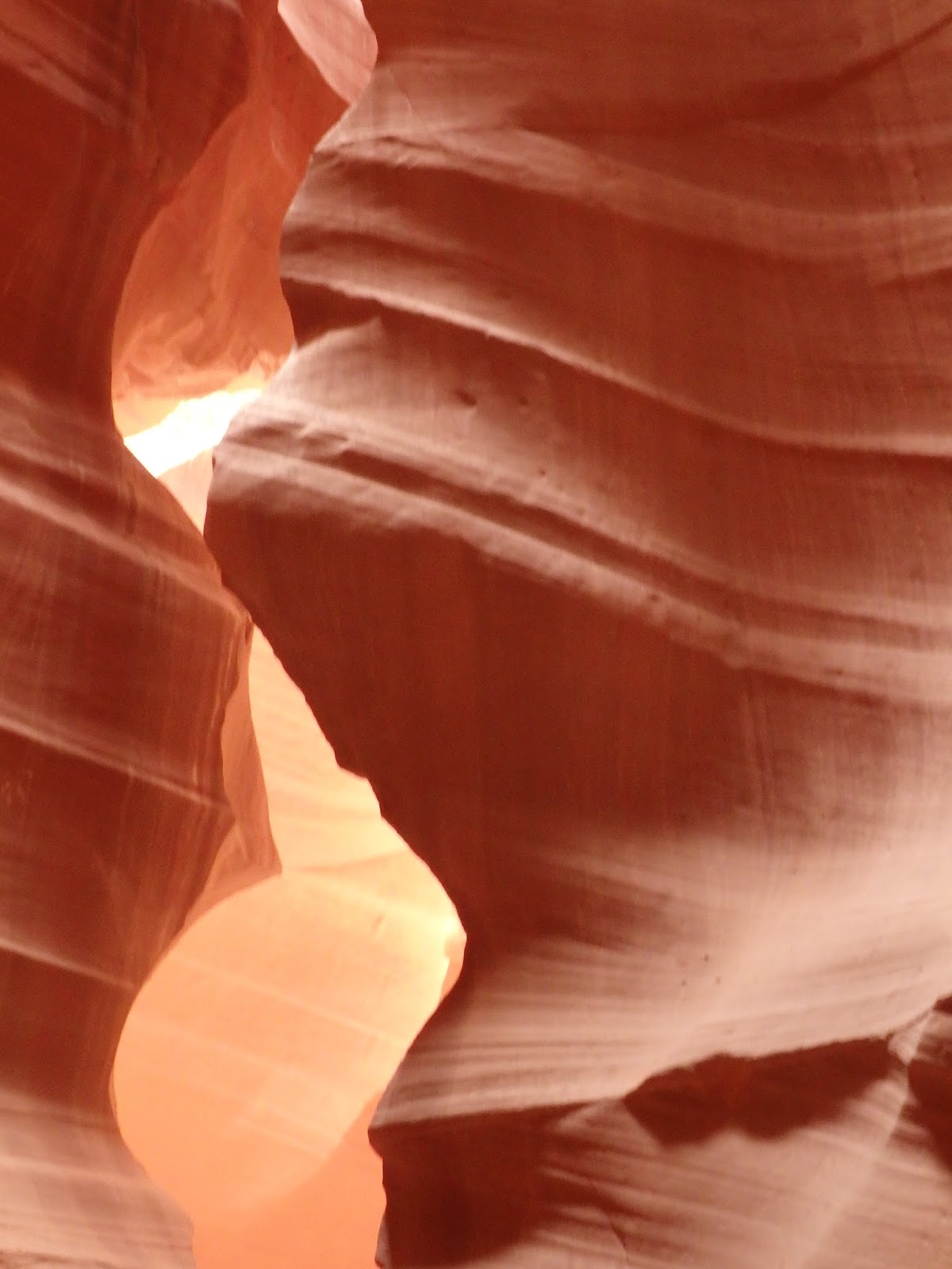
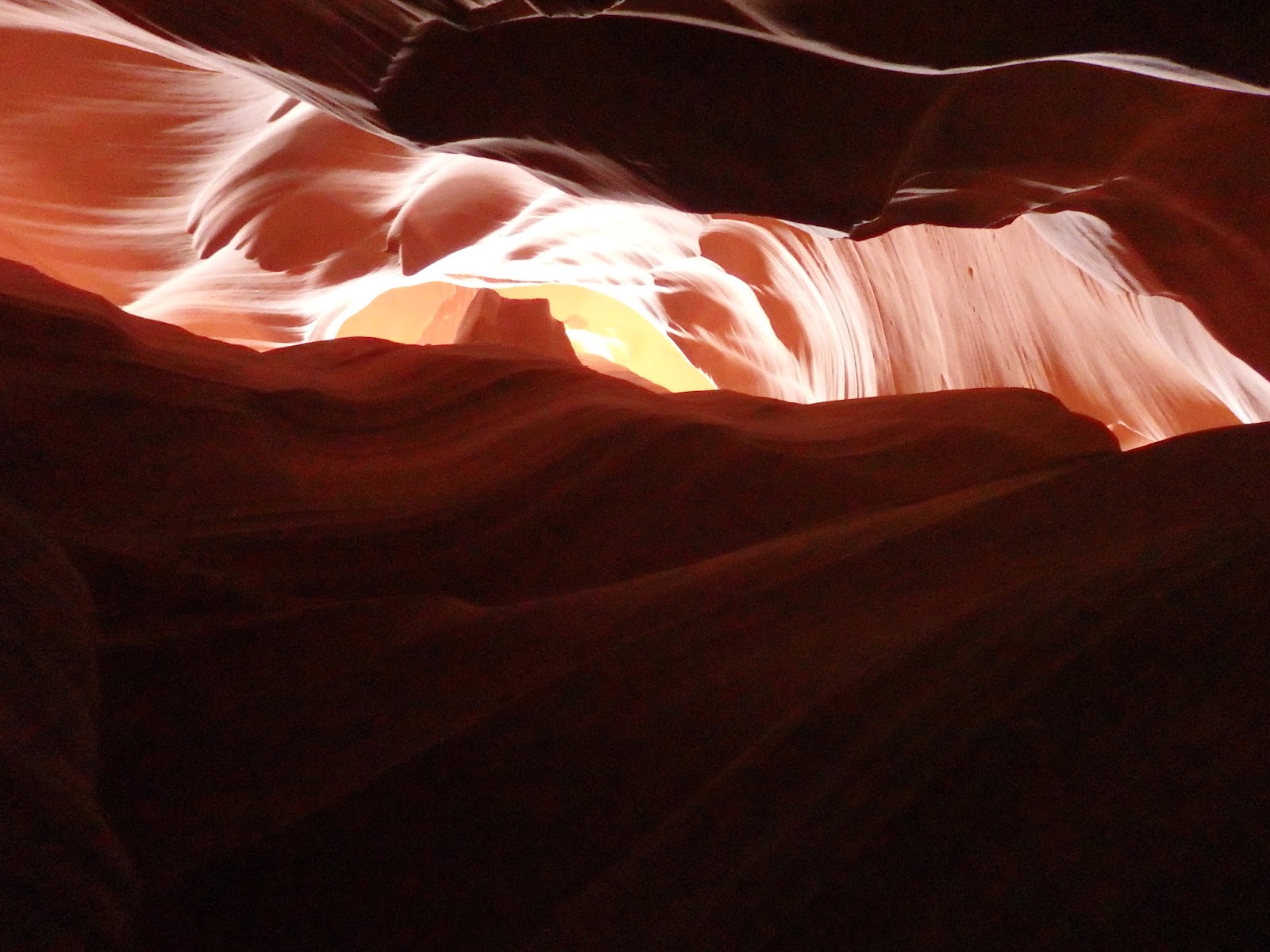
| Water is the main creator of the slot canyon and you can see streaks where water has ran down from the top. |
 |
| One of the wider sections. |
 |
| We were there too late in the day for the sunbeams to go clear to the floor of the canyon and it was a cloudy day. |

 |
| The tour guide kept taking people's cameras and taking good photos. I know she took mine a lot and recommended it as a good camera for the light conditions in the canyon. |
 |
| I just have a point-and-shoot camera and I was amazed at how different the photos looked. Some of the above were really red and this one is dark. |


 |
| Looks like this branch was washed in and got stuck. |


 |
| I think this one had a name but I don't know what it was. |
 |
| More debris stuck in the top of the slot. |
 |
| I think this one might have been called the wave. |

 |
| Some of the photos are taken looking straight up. |


 |
| Our tour guide did a great job. Oh the wind was blowing slightly outside and sand was dropping down on us in places so her hat was extremely useful in keeping it off of her. |


 |
| Or tour guide took this photo of us. |
 |
| This nest was at the top of the canyon and way up on the wall. |
 |
| You can see it in this photo. Don't know what varmit made it. |
 |
| Leaving the canyon. |
 |
| The path to Horseshoe Bend by Page, AZ |

 |
| The view from the top of the hill. The orange rock all around this area is Navajo Sandstone, the largest sandstone layer in the United States. Composed of sand dunes from the Jurassic age, it stretches from Northern Arizona to Wyoming. At up to 2000 feet thick, the sandstone is very strong as a whole, using the compression of its own weight to hold it together. But there are places where the sandstone is not strong: the exposed rocks on the top and sides. |
 |
| Approaching the edge of the cliff. |
 |
| The Colorado in Glen Canyon makes a 270 degree curve in an entrenched meander. Water flows in on the right and out on the left. |
 |
| Boats on the river look mighty small from here. |


