
My husband and I kept hearing about how wonderful the museums were in Cody, Wyoming, so we decided to take a trip there. We visited friends along the way, so our trip started by heading north.
 |
| We consulted RoadsideAmerican.com to see what interesting things we could stop to see along the way. The first of these was the Little Golden Gate Bridge by Ridgefield, WA. This is on personal property, so we just walked along the edge of the road. As with all the photos on this blog, you can get a larger photo by clicking on the photo. |
 |
| They also had a little yellow submarine on the property. |

 |
| Roadside end of the Little Golden Gate Bridge. After this stop, we headed further into Washington and stayed with friends for the night. The next day we headed to the Museum of Glass in Tacoma, WA. |
 |
| In the hallway leading to the bathrooms, they displayed drawings by children, ... |
 |
| And the Glass Shops rendition of the drawing. |

 |
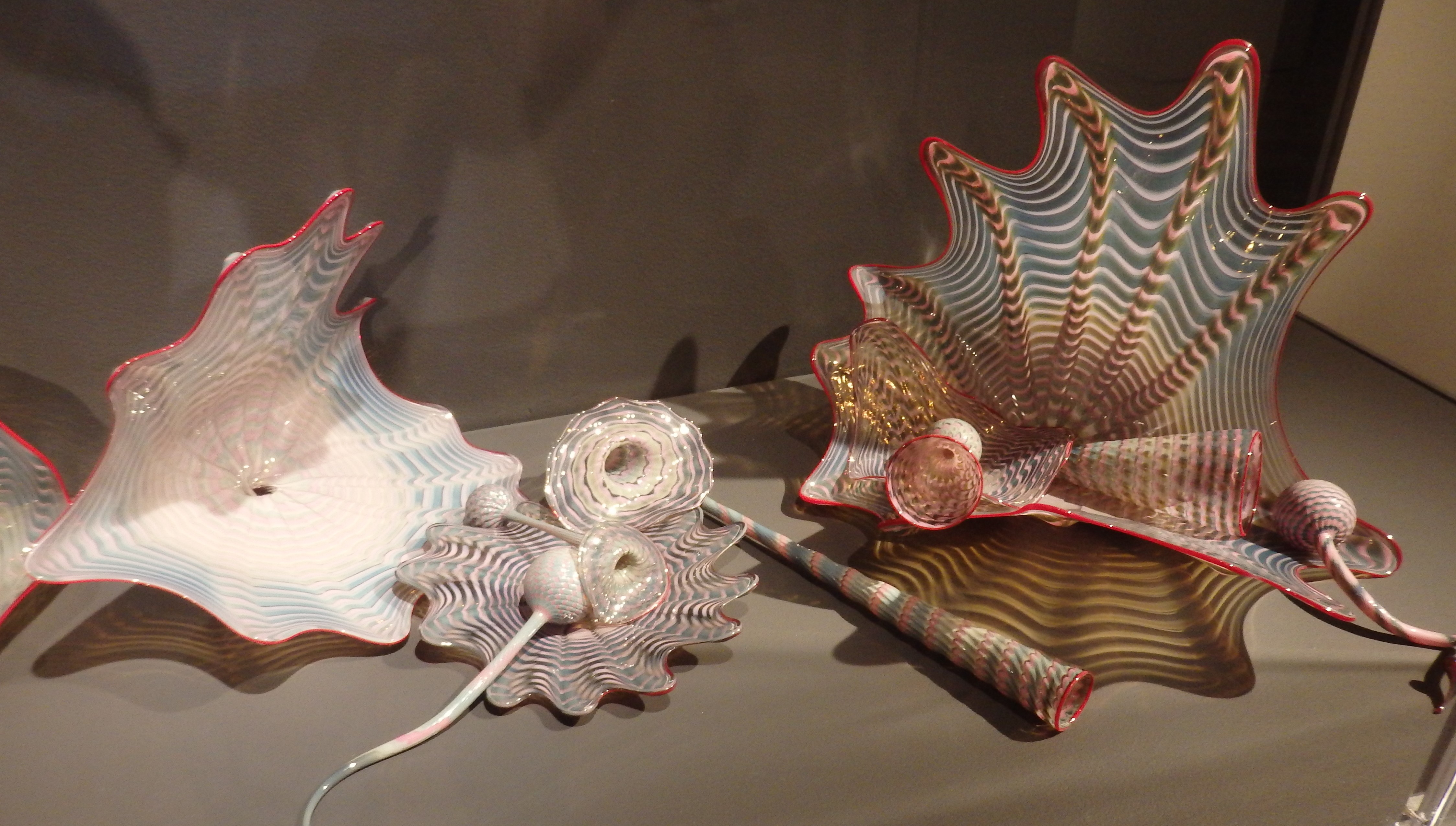
| There were many cool works of art, but I liked this one the best. Then we were off to the gallery to see professional pieces of glasswork. |


 |
| This was one of my favorites. In person, it looked like velvet. |


 |
| This one is interesting because, depending which side you looked at... |
 |
| it could almost completely disappear. |
 |
| This one has some intricate little pieces. |
 |
| Check out the cellphone, glasses and computer. |


 |
| Check out all the small pieces of this work of art. |
 |
| The glass spider is an interesting detail. |
 |
| We stopped by the Hot Shop where they were making a large elbow.... yah, an elbow. Don't know if it was going to be part of a larger work of art or a standalone. |
 |
| After the museum, we went outside to check out the bridge of glass. The bridge isn't made of glass but there's a bunch of artwork by Dale Chihuly displayed. |


 |
| There are actually two glass displays, one in the cubbyholes in the side and one with the display overhead. |

 |
| Across the highway is the Old Union Station Train Station. It how houses a U.S. District Court and an event center. |
 |
| I-705 runs between The Musuem of Glass and Union Station. We got on it when we left. |
 |
| This is Wild Horse Monument by Vantage, WA. We were here in June of 2009 and hiked up the hill to check out the sculptures. |
 |
| The view from the parking lot shows the Vantage Bridge upon which I-90 crosses the Columbia River. Actually, at this point, it is Wanapum Lake formed by the Wanapum Dam just downstream. |
 |
| Just off I-90 at Ritzville you can see this stagecoach and team of horses all made out of horseshoes. |
 |
| Next stop was Coeur d'Alene, Idaho to visit with friends and check out the town. We stopped at McEuen Park. Tried to see the floating boardwalk but we had parked on the wrong side of the resort to be able to access it. The sculptures along the north side of McEuen Park were interesting and informative. |

 |
| The North Idaho Inn in Couer d'Alene sports an Idaho shaped chimney. |
 |
| Another roadsideamerica.com stop. Kellogg, ID |
 |
| Roadside memorial describing a mine disaster that happened in 1972. |
 |
| The memorial consisted of a statue with a listing of the victims. Around this were small commemorative markers listing men that had been killed in any of the state's mine disasters. |

 |
| Next stop was the Oasis Bordello Museum in Wallace. From the Wallace, ID website, "The Oasis Bordello Museum is a former operating bordello in the historic mining town of Wallace Idaho. It is preserved exactly as it was left when it had to close its doors in 1988. The Oasis was hardly a unique establishment, being one of five such brothels along the town’s main street. Each business sported a neon sign advertising “rooms”—one wonders how many unwary travelers had to be told that these particular rooms were hardly places to rest! " |
 |
| We signed up for the tour in the gift shop/history museum. I thought this shirt was interesting and wondered who would buy such an item. We learned a lot about the madam of this establishment and how businesses like this were allowed by the town due to the amount of money they gave for community organizations like the schools. |
 |
| Each "girl" had a small room, and each room was assigned a color code name, i.e., Gold Room, Green Room, etc. Caretakers kept track of "customers" and assigned them to girls. The customers would select which "service" and the length of time of each service based on a price list on the wall. The girl would start a timer and take the customer back to her room. I'll leave the rest of the details up to your imagination. Very interesting and definitely worth the stop. |
 |
| Wallace is full of interesting items, including this spaceship. I wonder when it landed... |
 |
| Ok now here's a claim that can't be verified. |
 |
| There was a sign at each corner of this intersection, so I suppose the intersection is "The Center of the Universe". |

 |
| We've lived within 100 miles of the Missouri River for most of our lives, so we made a point of stopping at the Missouri Headwaters State Park. You can click on the photo to enlarge it for reading. |


 |
| From the ground it was really hard to see the confluence. There's a diagram further down in this post. |


 |
| The Gallatin River joins the Missouri about a mile from where the Jefferson and Madison merge. The Jefferson starts by Twin Bridges, MT and the Madison starts in Yellowstone National Park. |
 | ||
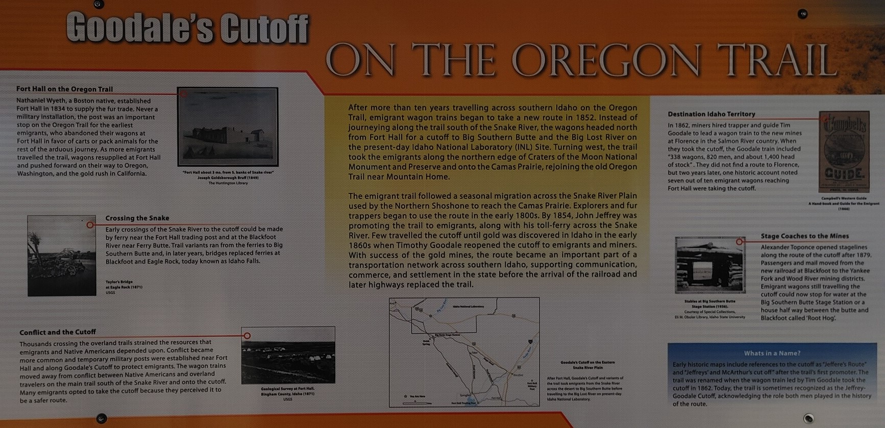
| In 1912, a group of small-town businessmen in South Dakota undertook an ambitious project to create a useful automobile route, the Yellowstone Trail, across America. This was at a time when roads weren't marked, there were few maps and slippery mud was the usual road surface. The Yellowstone Trail Association located a route, motivated road improvements, produced maps and folders to guide the traveler, and promoted tourism along its length. It became a leader in stimulating tourist travel to the Northwest and motivating good roads across America. |
 |
| Click to enlarge for reading. |

 |
| One thing I did notice about Montana rest areas was the addition of a toddler restrain seat in the restrooms. I'm sure this is quite a nice addition for those parents trying to keep a child corralled while they use the facilities. |
 |
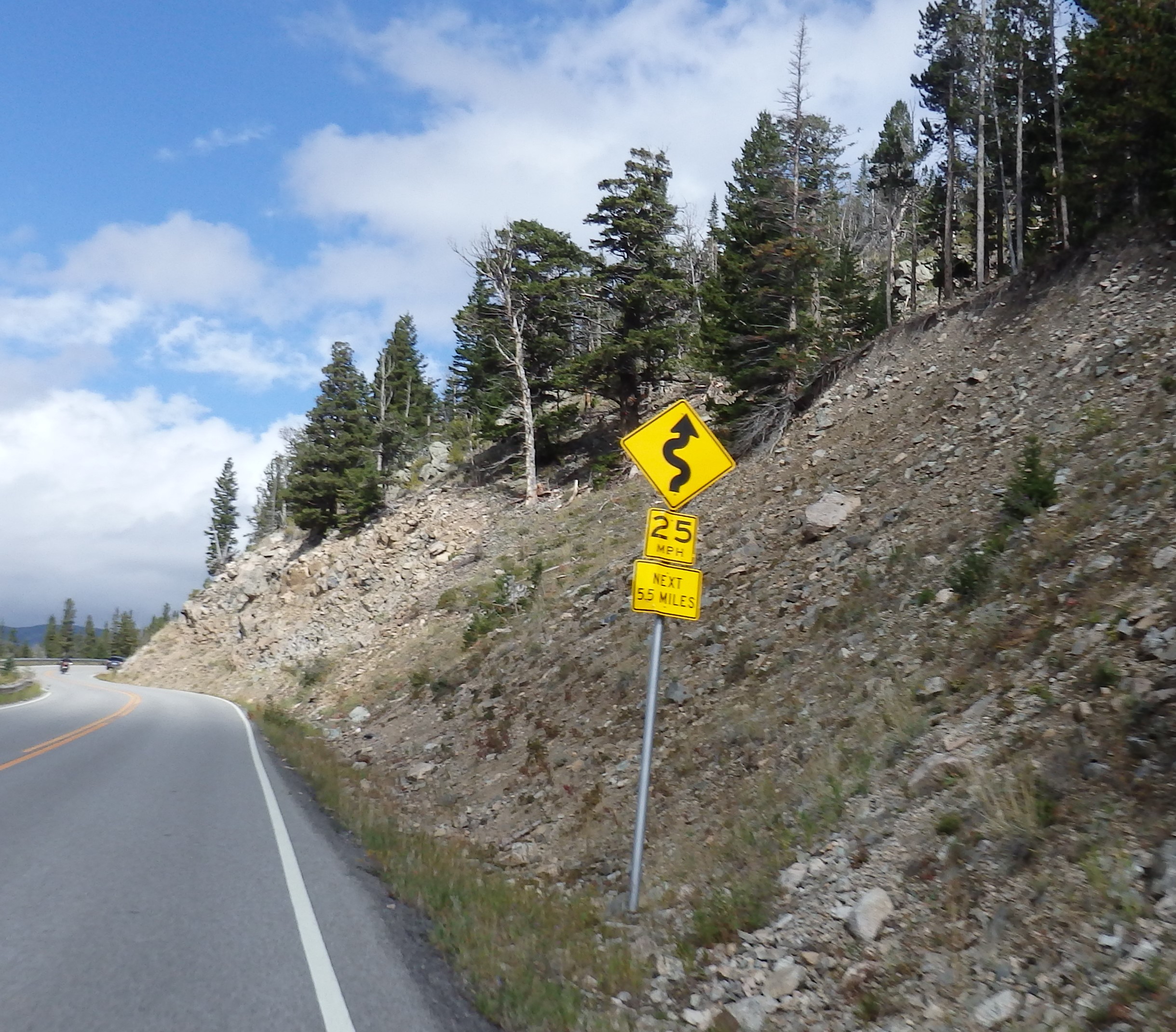
| Just south of Red Lodge, MT we started into the Beartooth Range. |
 |
| The Beartooth Highway climbs to an elevation of 10,947' above sea level and was completed in 1936. The Highway winds its way through a range of ecosystems - from lodge pole pine forest to Alpine tundra. |

 |
| We started climbing. |
 |
| First the road started making tighter turns until we came to the switchbacks. |
 |
| We could see two layers of the road across the side canyon. |
 |
| We even spotted some snow on the far side of the valley. |
 |
| Looking down on a couple meanders of the road. |

 |
| This isn't the top of the pass but it's the most developed vista point. |
 |
| The stop has a short walk to the vista point. |
 |
| Love how this tree grew out of the rock. I wonder how old it is. |

 |
| Looking up Rock Creek toward Wyoming. |
 |
| Looking back the way we came. |
 |
| Continuing up the mountain we gathered information as we stopped at viewpoints. |


 |
| With 20 peaks over 12,000' in elevation, the Beartooth Mountains lie within the 943,377-acre Absaroka-Beartooth Wilderness. |
 |
| The temperature dropped as we climbed. Somewhere along the way we passed the 45th Parallel, halfway between the equator and the North Pole. |
 |
| We reached the clouds as we neared the top. I think this is the Hellroaring Plateau. |
 |
| We were definitely in the alpine zone as there weren't any trees. The stop at the top of the pass was full so we didn't stop. It was pretty cloudy so I doubt we could have seen anything anyway. |

 |
| The top of the pass is the world of glacial cirques and alpine lakes. There are over 950 alpine lakes. |
 |
| Lowest temperature we saw during our trip over the pass. A week after this trip, this area had a snowstorm, so we went at the right time. |
 |
| The road had gotten really skinny at the top. Posted signs along the highway recommend that vehicles over 40' in length not be taken on the road but I wouldn't want to drive anything much bigger than a pickup. |
 |
| We saw what looked like the top of a cableway for skiing. Sure, enough they have a ski area called Beartooth Basin that is open to the public, dependent on snow, of course. |
 |
| The clouds obscured any sight of The Bear's Tooth, a pyramidal shaped spire that was carved by glaciation. It is the namesake of the Beartooth Mountains. |
 |
| Heading back down we start to see trees again. |
 |
| We encountered a few raindrops along the way. |


 |
| We left Beartooth Pass highway and headed toward Cody on Hwy 296, the Chief Joseph Scenic Byway. At this point, I had downloaded some stories about the area we could listen to as we drove. |

 |
| Pilot and Index Peaks are volcanic remnants more than 11,000 feet high. |


 |
| We turned off the Beartooth Highway onto the Chief Joseph Scenic Byway. It was named for the last chief of the Nez Perce Indians. The overlook is named for the Clarks Fork of the Yellowstone River. This area is home to a variety of species, including grizzly bears, wolves, moose, elk and deer. It is prime moose habitat. There are several dude ranches in this area and The Dude Ranch Association, located in Cody, was established in 1926 when several ranch owners developed hospitality standards to accommodate the growing number of travelers whose trek to the West had become increasingly easier with railroad expansions. |


 |
| Statues at Dead Indian Pass. There are varying accounts of how the pass received its name. One account occurred in 1877 when the Bez Perce tribe lost member while attempting to flee to Canada. The incident is part of a larger story often referred to as the flight of the Nez Perce. For more than 11,000 years, the Nez Perce inhabited the Columbia River Plateau in the Pacific Northwest. In the mid-1800's the U.S. government attempted to relocate the Nez Perce from its homelands onto a reservation. In 1877 the Nez Perce split into two factions. one faction agreed to live on a reservation in Idaho while the other resisted relocation and attempted to flee to Canada to join Lakota Chief Sitting Bull. For much of the summer of 1877, some 700 members of the Nez Perce traveled east almost 1,200 miles. They were led by multiple chiefs, including Chief Joseph, the namesake of the byway. As they fled, the U.S. Cavalry pursued. The fascinating story captured the interest of the country. news reports chronicled the Nez Peerce members' attempt to join Sitting Bull, with much of the public rooting for the Nez Perce to succeed. After traveling through Yellowstone National Park, the group reached the area to the northwest of this summit in early September. Chief Joseph and his people looked to move out of the Absaroka Mountains and make a final dash across the Great Plains and into Canada. The Calvary anticipated this move and stationed 600 soldiers near the easiest and most likely route. The Nez Perce outwitted the Cavalry by creating a diversion and taking a difficult and narrow trail through Clarks Fork Canyon down and back up 1,000 feet. The tactic was successful and allowed the Nez Perce to put 50 miles behind them before the Cavalry regrouped and continued their pursuit. But their victory was short-lived. A month later, the Nez Perce were forced to surrender just 40 miles from the border, and most of them were relocated to the reservation. A small number actually made it to Canada. During surrender negotiations, Chief Joseph uttered his famous works "Hear me, my chiefs, I am tired. My heart is sick and sad. From where the sun now stands, I will fight no more forever." |
 |
| My question was this. Why didn't the U.S. government just let them run to Canada? |


 |
| This, and other, outcroppings of sandstone were confusing until I remembered that all this area was covered by an inland sea millions of years ago. |
 |
| We arrived at Cody and was these interesting, enclosed lounging areas by the visitor center. They would have been too hot on a warm, sunny day like the day we were there, but I bet they were nice when it was cooler, or the wind was blowing. The lodgepole pine log building that houses the Cody Country Chamber of Commerce and the Visitor Center was the original site of the Buffalo Bill Museum. it first opened in 1927 and was modeled after Buffalo Bills house at his TE Ranch located on the south fork of the Shoshone River. The museum collections remained at this location until 1969 when they were relocated to the present-day Buffalo Bill Center of the West. |
 |
| From the visitor center, we started a phone-guided self-tour around downtown Cody. Our first stop was at Cody City Park. Formerly Irma Park, it was named after Buffalo Bill's youngest daughter. This horrible photo is of the Spirit of Cody statue in the park. According to the self-tour we did, "the base is a Greek pedestal with bison silhouettes on each side symbolizing past civilization. The bronze symbolizes the time of Buffalo Bil. He is holding Irma bolstering future generations on his shoulder. Irma is holding his hat in the air symbolizing the sun and looking to the future. The statue holds a time capsule that will be opened on December 31, 2049." |

 |
| Relief on a monument in front of the Park County Courthouse. |
 |
| Information on the relief. |
 |
| The Moose Creek Lodge and Suites on the other side of the hwy is designed in keeping with the "Old West" look. There's a moose on the right, a wire-work deer on the left and an eagle head at the peak of the overhang. |
 |
| This sculpture is in front of the Park County Fire District Office. |


 |
| Elk statue in Elk Plaza. Most of this city's downtown commercial district was built between 1901 and the 1930's. Many of the buildings are listed on the National Register of Historic Places. One interesting story is how Buffalo Bill, during a poker game, suggested that the winner donate the money to a church of his choice. Player George Beck won the large pot and gave the money to the Episcopalians to build their church. Therefore, the church they built became known as The Little Poker Church. |
 |
| The Irma Hotel was built by William F "Buffalo Bill" Cody and named after his daughter, Irma. The grand opening was held on November 18, 1902. Two suites and an office were kept for his personal use. It is listed on the National Register of Historic Places. |
 |
| The most famous thing in the hotel is the cherry wood bar. It dates back to the original construction and was rumored to be a gift for the Queen of England. |


 |
| We turned down 12th street to take a gander at the Giant Parade Rifle... |
 |
| Then turned up 13th Street to see the old Cody Post Office that was built in 1927. Now home to the Forward Cody organization, it was home to the post office for over fifty years. The exterior remains unchanged, and the interior contains many of the original details such as brass railing and oak wainscoting. |
 |
| Novel design of logo for local pizza place. |
 |
| I saw this free attraction listed as something to do in Cody and we had a few hours to fill, so we headed to this museum located in an LDS church. Having not read up on the subject of the mural, we had only the name, Cody Mural. |
 | |||||
| From the website, codymural.org, "Created to tell the story of the Church of Jesus Christ of Latter-day Saints, including the westward expansion of the Mormon pioneers, the Cody Mural is rich in color, content and history. It is a mid-century masterpiece created by the talented and prolific artist Edward T. Grigware, and it took nearly two years to complete. Grigware’s technical expertise in Western realistic painting, as well as the mural’s one-of-a-kind medium and location create a fascinating work of art and an intricate storytelling device." |
 |
| Seems the architect who designed the church wasn't aware that a dome wasn't a normal feature of a Mormon church, so the church members weren't quite sure what to do with it once it was built. They decided on a mural and had to find an artist. The artist said he would only do it if they could find enough Irish linen to cover the wall surface. |
 |
| This was a guided tour with someone with us the whole time. |
 |
| Then we entered the museum portion of the tour. They guide was still telling us about the stuff we were seeing but there was much to read and a short film to watch. We learned about the early settlement of the Bighorn Basin, including the construction of the Sidon Canal, which provided water to approximately 20,000 acres of farmland. |


 |
| Loved these wood relief wall hangings. |

 |
| Next we decided to head out to the Cody Dam. Along the way, we stopped to read this billboard and take in the sight. |
 |
| This is the Shoshone River west of Cody, at the Colter's Hell stop. |
 |
| The highway follows the Shoshone River as it cuts into the Absaroka Mountain range. |
 |
| There's not room for both the road and the river so the road requires a tunnel. |
 |
| But there are three tunnels. Going into the first we could see the start and end of the second tunnel. |
 |
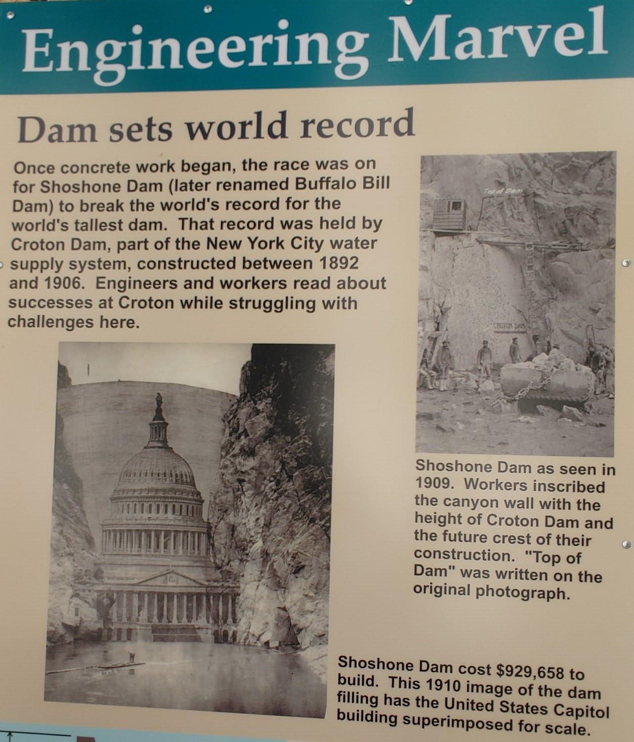
| Just after the third tunnel was a parking lot on the left for the Buffalo Bill Dam and Visitor Center. The river side of the parking lot had a bunch of information panels and some artifacts. |
 |
| You will have to click on this photo, and many of the following, in order to read them. |

 |
| Next photo is an enlargement of the narrative. |


 |
| The front side of the dam. |
 |
| The Buffalo Bill Reservoir widens once it gets past the narrow valley. |
 |
| Visitor Center and dam as we walked toward it. There is a golf cart shuttle between the parking lot and the visitor center. |
 |
| Looking down the face of the dam we noticed a platform hanging out over the far cliff face. |
 |
| It's a cableway landing platform. More on that later. |
 |
| Looking further downstream. |


 |
| There was another section of the visitor center that wasn't dam related. |


 |
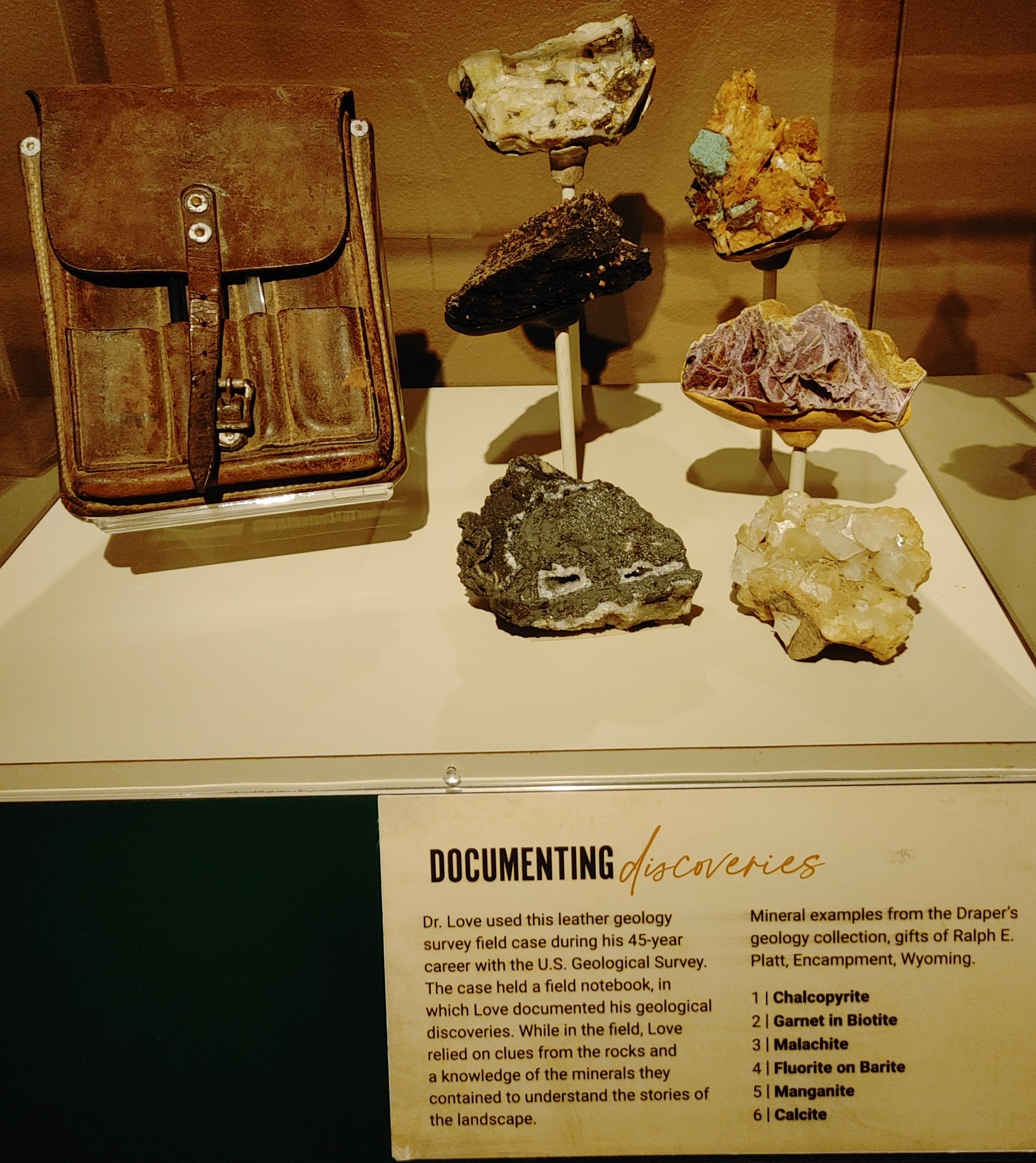
| Now for the reason we took this trip. The Buffalo Bill Center of the West in Cody, WY is actually five museums. The Buffalo Bill Museum, The Plains Indian Museum, The Cody Firearms Museum, The Draper Natural History Museum and the Whitney Western Art Museum. There's a lot to see in this building so plan to spend a couple days. We spent four hours the first day and two hours the second day. The following photos are just a small sampling of what's on display. |
 |
| We headed to the left once we got inside, which meant we visited the Draper Natural History Museum first. |


 |
| Not natural history but something interesting about Heart Mountain, is that a Japanese American confinement site was once located east of the mountain. We've been to one of these internment camps in California called Manzanar. See that post to this blog under September of 2017. During World War II, Heart Mountain was one of many camps that were quicky built after President Franklin D. Roosevelt signed an executive order resulting in the forced removal of Japanese Americans from their homes. These U.S. citizens were given just a few days to sell what they could, pack a suitcase and leave their homes for the unknown. Can you imagine that? Say you own a business. Do you imagine you can find a buyer? These people lost their businesses and homes. Nearly 14,000 Japanese Americans were held at Heart Mountain. The entire town of Cody, just a few miles away, had a population that was smaller than that. The camps were hastily constructed. There were 467 barracks buildings situated in 20 blocks. Each tarpaper covered building was 120 feet long by 20 feet wide. Barracks were divided into six rooms of various sizes. Families of six were housed in 480 square foot rooms. Each room had a stove for heat and a light fixture in the center of the room. The camp operated for more than three years until it finally closed in November 1945 after the war was over. The government gave each resident of the camp $25 and a train ticket to anywhere they wanted to go. The camp was quickly disassembled. The government sold the barracks to the ranchers and other locals for just one dollar. many were used for storage on farms and ranches. |


 |
| We looked over a railing to see the mosaic on the floor below us. |
 |
| Wow I never thought about something like this. |
 |
| This would sure help fund the upkeep of the park. |
 |
| It's very interesting how this museum is arranged. This area spirals downward with the top representing the alpine regions and the bottom the plains. From the museum website, "Winding through a 90-foot-tall grand rotunda topped with a changing Yellowstone sky, you will descend along a gently sloping path through Alpine, Mountain Forest, Mountain Meadow, and Plains/Basin environment exhibits. Each environment includes the sights, sounds, and smells you might encounter in a hike through the same environment in the Greater Yellowstone Ecosystem." |


 |
| We looked through glass to see what was happening in the Greater Yellowstone Ecosystem Specimen Preparation Laboratory. This is where they prepare specimens for research, exhibits, and educational programs. Looks like fun work, huh? Not! |


 |
| After a lunch break at the museum's dining room, we visited the Plains Indian Museum. |


 |
| Due to the wide variety of Native American skin tones, all sculptures are left in their natural clay color. This also helps highlight the items on display. |


 |
| I can't imagine how many hours it would take to do the beadwork on this saddle blanket. |


 |
| Wow, a beaded ballcap. |


 |
| Shields |

 |
| Elk Teeth |
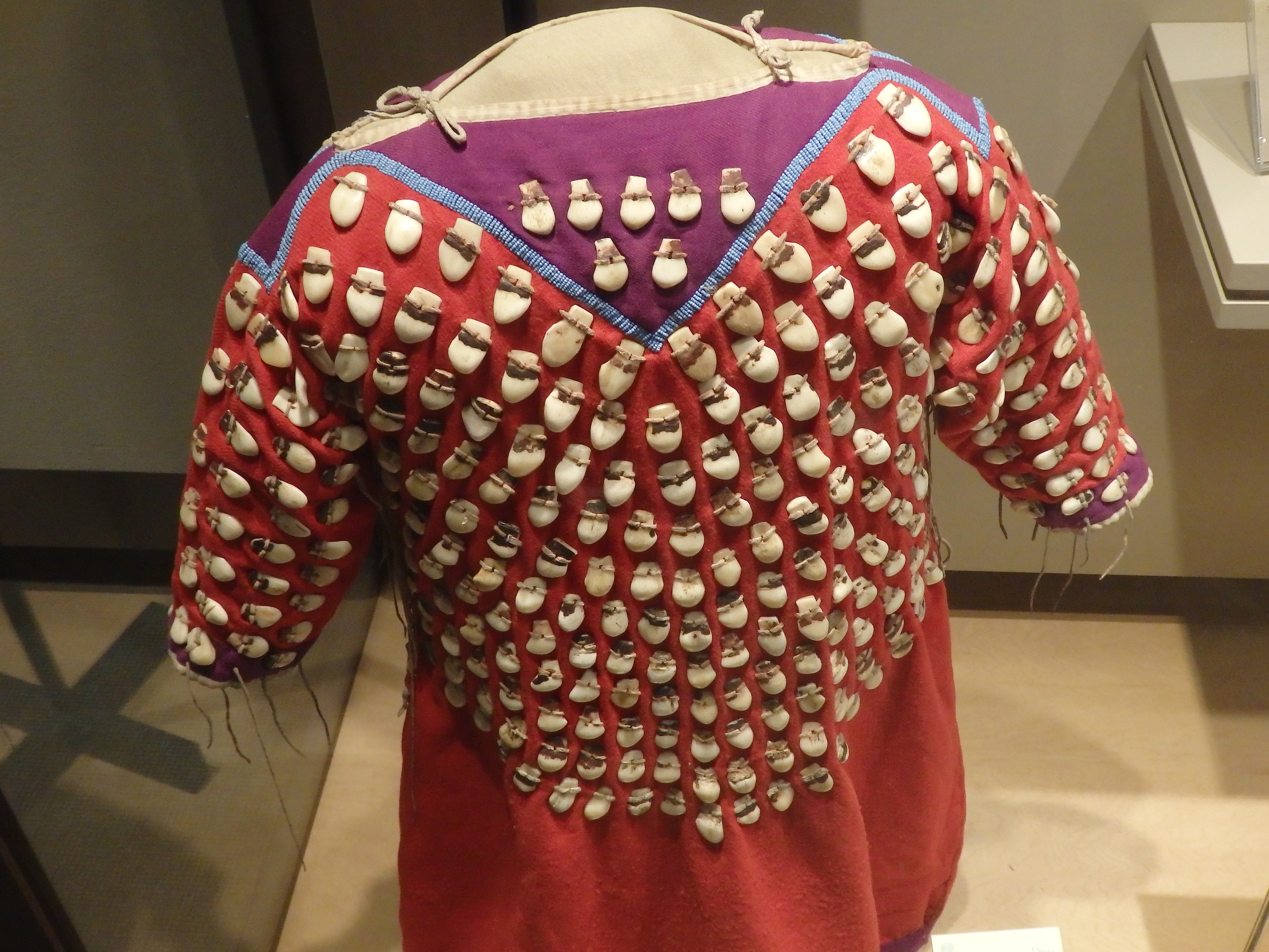 |
| I wonder how heavy this shirt is.... |

 |
| Moccasins decorated with dyed porcupine quills. |

 |
| Moccasins decorated with glass beads. |


 |
| I love inlay work and this horn has a lot of it. |
 |
| A true work of art. |
 |
| We ended our first day at the Whitney Western Art Museum. |


 |
| I don't know what it weighs but there's only six hooves touching the ground. |

 |
| Even I have see this one before. |

 |
| Another famous sculpture |


 |
| Plaster cast of Rough Rider sculpture. |


 |
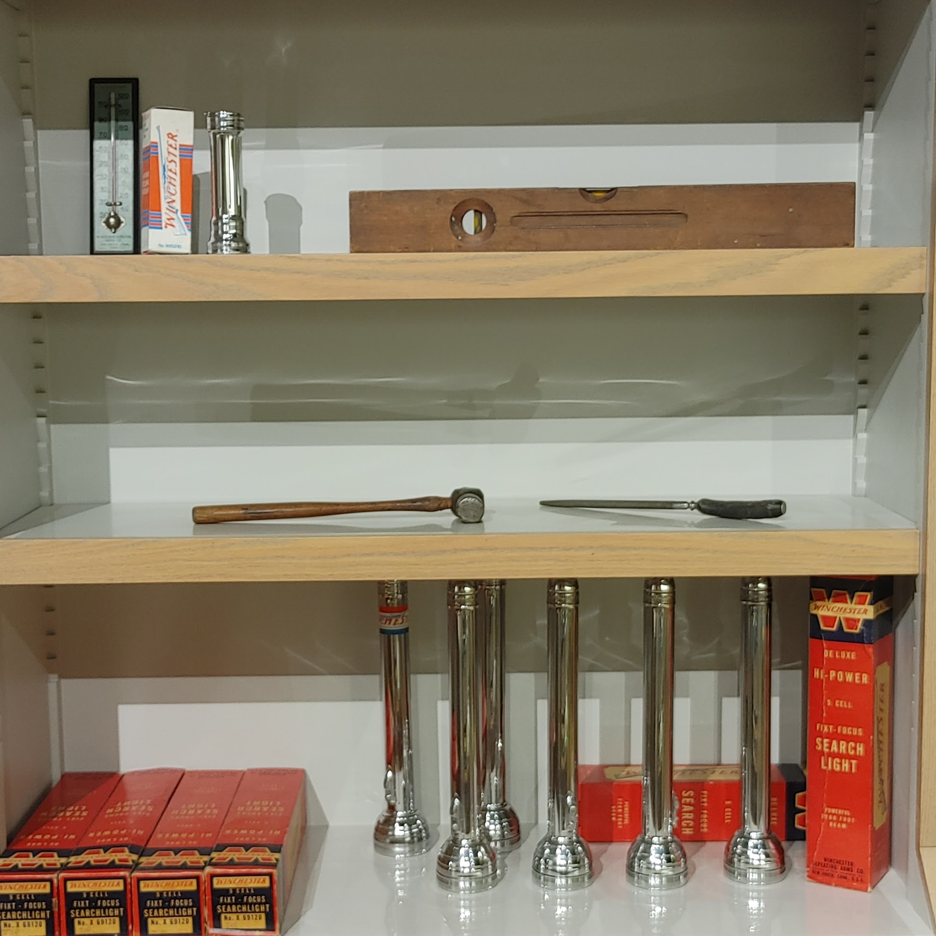
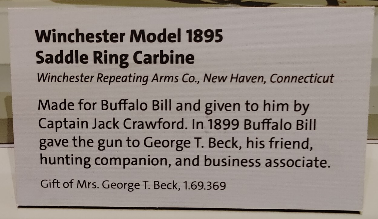
| We started day two of our visit at the Cody Firearms Museum. |


 |
| For someone like me, who doesn't know much about guns, there was a gun 101 section. |


 |
| Now this is a tiny pistol. It's in the middle of the display below. |
 |
| Can you see it? |


 |
| Gees, let's have a weapon that does everything. |


 |
| I've never seen anything quite like this gun. |


 |
| I think the middle gun is over 6' long. |


 |
| They had a small mock-up of a factory in the museum |


 |
| Last museum was the Buffalo Bill Museum. I was surprised when the first few displays weren't even about Buffalo Bill but about other famous people of the time. |


 |
| Annie Oakley's suit. |


 |
| With out visit to Cody completed, we started making our way west which took us through Yellowstone National Park, the world's largest group of hydrothermal features, including hot springs, geysers, travertine terraces, fumaroles and mud pots. At this point we are going over Sylvan Pass at 8,530' |
 |
| We say a lot of areas that forest fires had burned in the past. I tried looking into when the fire had occurred. It was possibly 2003. I saw a map of the area burned by the 1988 fires. They covered a large percentage of the park. Such fires are common in the West. While you many hear about the large wildfires that consume hundreds of thousands of acres, many more smaller blazes occur regularly. Many of us may think that the best way to deal with a wildfire is to put it out immediately. But fire ecologists often recommend letting fires burn in the wilderness while at the same time protecting homes and structures in their path. That's because they've learned that fires can clear out a dangerous buildup of old and dead trees, which can become highly flammable fuel for out-of-control fires. That kind of buildup of fuel is what happened in Yellowstone and the surrounding forests in the summer of 1988. An exceptionally dry spring created extremely dangerous conditions. late that summer, some 42 natural and nine human-caused fires occurred, and close to 800,000 acres burned inside park borders. that's more than one-third of the entire park. |
 |
| Yellowstone Lake, at 286 square miles, is the largest high-elevation lake (above 7,000') in North America. The only outlet, the Yellowstone River, is at Fishing Bridge. The lake is covered by ice from December to May or June. It is 410' deep at its deepest, |
 |
| Steam fumaroles are common. |
 |
| Looking across the lake, we could see more fumaroles. |


 |
| Remember, you can click on the photo to enlarge it for reading. |
 |
| Cliff geyser was just steaming. |
 |
| Ragged Spring. |
 |
| Rainbow pool |
 |
| What are those black dots? |
 |
| Buffalo of course. Or are they bison? Well, they are both. In North America, both bison and buffalo refer to the American bison. Generally, buffalo is used informally, while bison is preferred for formal or scientific purposes. Early European explorers called this animal by many names. Historians believe that the term buffalo grew from the French work for beef, boeuf. |
 |
| We came upon a bit of a traffic jam as we neared Grand Prismatic Spring. The parking lot was jammed so we didn't even try to get in. One past the parking lot, the oncoming traffic was backed up for miles. |
 |
| We stopped to eat lunch along the Firehole River. |
 |
| The scenery was different across the road. |
 |
| Once at Madison junction, we turned left and followed the Madison River out of the park. The Madison is one of the rivers that combine to form the Missouri. |
 |
| I think this is Mount Haynes. At West Yellowstone, back in Montana, we followed Hwy 20 for the rest of the day. |
 |
| Hwy 20 quickly lead us out of Monana and into Idaho. We crossed over the Henry's Fork River at least three times before the day was over. |


 |
| Henry's Fork River. |
 |
| Looks like the caterpillars I always saw as a child. They are commonly called Woolly bear caterpillars or woolly worms and have a reputation for being able to forecast the coming winter weather. If their rusty band is wide, it will be a mild winter. The more black there is, the more severe the winter. |
 |
| This sounded interesting and we had the time so we decided to investigate. |
 |
| A sign said the road was rough, and it was right at the beginning, but they it smoothed out... for about a mile anyway. Then it got really rough so we turned around. |
 |
| The last sightseeing we did that day was a trip to Mesa Falls. This is a map of the Upper Mesa Falls area. We walked trails, descended stairs and walked on a boardwalk to get to the falls. |

 |
| Yep, that's the Henry's Fork again. |


 |
| We had descended some steps but it looks like we had more to go before we could follow the boardwalk to the falls. |


 |
| Upper Mesa Falls |


 |
| Mist rising through the air at the top of the falls. |


 |
| Time to climb back to the upper boardwalk. |
 |
| Next stop, Lower Mesa Falls. These were quite a distance from the viewpoint. |

 |
| Heading on down the road, we stopped to read this information panel. |

 |
| The next day we continued our journey on Hwy 20 to Idaho Falls where we stopped to see this sculpture in the middle of a roundabout. |


 |
| Continuing west on Hwy 20, we entered a pretty desolate area. |

 |
| East Butte |
 |
| Middle Butte |
 |
| Southern Butte |
 |
| The Big Lost River Rest Area had a bunch of information panels. Below you will find photos taken of each section of this panel |


 |
| It was very hard to get a photo of some of the panels because they were covered in plexiglass. There was an environmental monitoring station with readouts on wind (speed and direction), temperature, etc. but it was hard to read because it reflected my image and everything behind me. |
 |
| We wanted to visit EBR-1, the world's first nuclear power plant but it had just closed for the season. |


 |
| Continuing on down the road, we stopped at an overlook for Craters of the Moon National Monument. The plan was to stop at the Visitor Center since we hadn't done that back in 2001 when we were through here. But we were ready to go home, and just stopped for a look. |


 |
| Continuing west, we took a break at the Castle Rock pull-off. |

 |
| Further west we stopped a pull-off and read this interesting sign. |

 |
| We made it back into Oregon and stopped north of Bend. |
 |
| The only problem is that there are some large fires in eastern Oregon so the view of the Sisters was obscured. |


 |
| We continued on Hwy 20 to Sisters, Oregon where we turned onto the McKenzie Hwy which is closed from November to July. |
 |
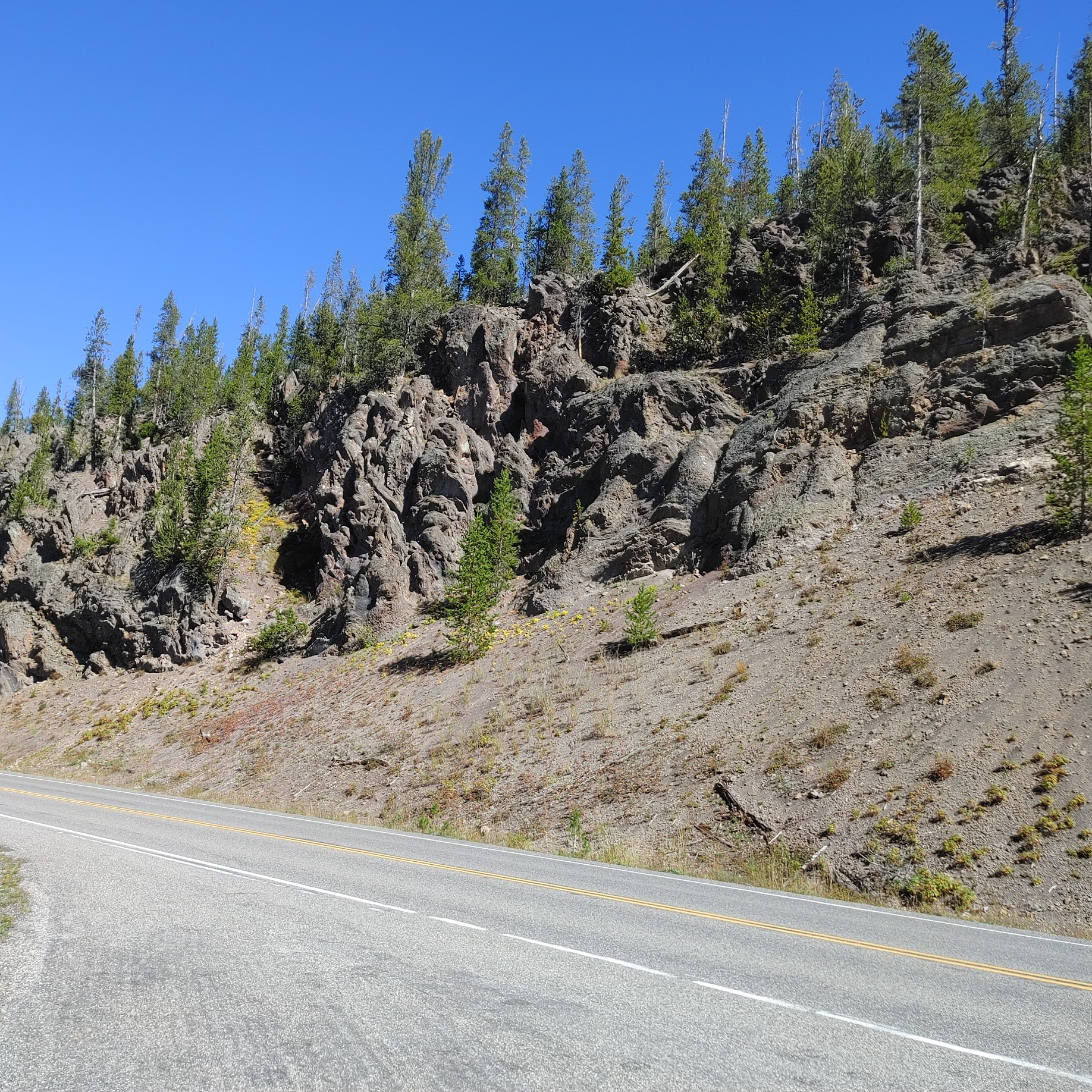
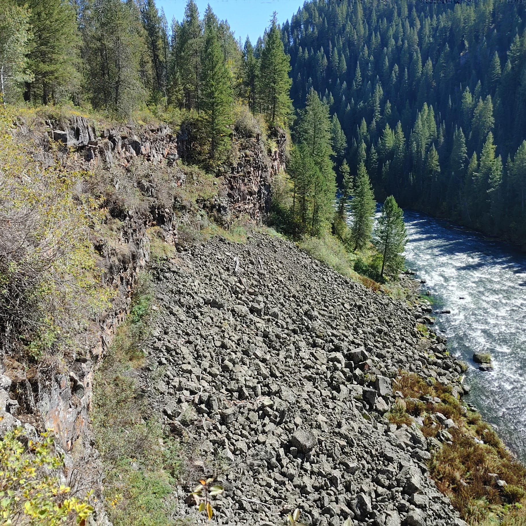
| The road got narrower as we climbed and we ran into a large area that had burned in years past. |
 |
| Then we were winding through lava fields. The road was terrible in places but there were plenty of motorcyclists enjoying the curves. |
 |
| The Dee Wright Observatory is at the top of the pass. |

 |
| There was information posted about the fires in the area with QR codes you could scan with your phone for more current information. The only problem with that is that there's no cell phone reception on the pass. Gees! |
 |
| Located in the Cascade Range at 5,187 feet, this mountain observatory offers panoramic views across 65 square miles of black lava rock that looks so much like a moonscape that in 1964, NASA conducted drills with astronauts as they prepared to travel to the moon. Completed in 1935 by the Civilian Conservation Corps (CCC), the observatory was named in memory of Dee Wright, the crew’s foreman who passed away the year before. |


 |
| Time to climb to the top. |
 |
| You definitely had to watch where you stepped. |


 |
| Looking toward North Sister, South Sister and Broken Top |
 |
| The interior portion of the structure had viewpoint, so you know what you were looking at. Belknap Crater is 2.7 miles away. |
 |
| Belknap Crater |

 |
| Little Belknap Crater is 2 miles away. |

 |
| Mt Washington is 5.2 miles away. There were more viewports, but their inscriptions were too hard to read. |
 |
| Next, we climbed to the top of the observatory where this pillar heap a bronze cap that was inscribed with the names of various features with arrows indicating which direction to look. |

 |
| On a clear day, you can view Mt. Washington, Mt. Jefferson, the South, North, and Middle Sister, and even see Mt. Hood, 78.5 miles to the north. Supposedly we could see Collier glacier on the North Sister if we looked hard enough. It is the largest glacier in Oregon. |

 |
| There was a trail leading off into the lava field. One viewpoint had information panels. |


 |
| We continued west down the pass and closer to the fires. |


 |
| We saw a fire service encampment once we passed west of the fire area. We missed getting a photo of the large helicopters and equipment. |

No comments:
Post a Comment