2 On The Road Blog

After 12 years of full-time rving, we've sold our truck and trailer but we're still traveling. Email us at wowpegasus@hotmail.com if you would like to contact us.


Wednesday, May 01, 2013

Valley of Fire State Park

The Valley of Fire State Park is a Nevada State Park NE of Las Vegas.
From the park brochure, "The Valley of Fire derives its name from red sandstone formations, formed from great shifting sand dunes during the age of dinosaurs, 150 million years ago."


"Complex uplifting and faulting of the region, followed by extensive erosion have created the present landscape."

Our first stop was the Beehives.  I thought I would lounge on the rock to give some size perspective.

Nolan thought this was a good place to take a photo of the car.


"The area plant community is dominated by widely spaced creosote bush burro brush and brittlebush."


The Visitor Center.

Double-click to enlarge for reading.

Heading North of the Visitor Center


Time for a walk.

I believe this is a datura plant with one flower bloomed and several ready to bloom.

Some of the interesting shapes caused by erosion.

Some of the petroglyphs along this trail.

You'll probably have to enlarge this photo to see the small bird.  It was slightly larger than a humming bird.

A side view of the bird that is slightly harder to see.

Mouse's Tank is named for a renegade who used the area as a hideout in the 1890's.  The sun is shining on the left wall so it looks like the basin has an outlet but it doesn't.  This natural basin is where water collect after rainfalls, sometimes remaining for months.  It was dry when we were there. 

A small flower has grown on the side of the rocks.

Arches and other interesting features are common in the sandstone.


This is the view from Rainbow Vista.  There are many colors in the rock.


We stopped at the Seven Sisters picnic area for our sandwich lunch.   I picked out four of the rocks to represent the four sisters in my immediate family.

Nolan got this great photo of a Chuckwalla lizard.  It's probably a foot long.  The biggest lizard we saw in the park.

Zion National Park - Day 2

We got up early to beat the heat.  First walk was to the Emerald Pools.  The path to the Lower Pools is all paved.


I believe this is the Beehives that we saw the top of the first day.
Another great view along the way.


We came around a corner and scared two deer out of the path.
Oh if only this photo was as good as the real thing!   Nolan called this the Western Movie View.
We made it to the Lower Pools.  Water is falling in two places here but I'm sure it's quite the roaring falls during spring run off.

A little info on the pools.


The Lower Pool isn't much of a pool.  The path runs to the left and follows the wall under the falls.
You would have to double-click to enlarge this to see the second falls here at the Lower Pool.

View from under the wall.  You can see some of the water dripping down.

Then we continued up to the Middle and Upper Pools.  These paths were rock and sand and much steeper than the Lower Pool path.  The cliff to the south of the Upper Pool.

The Upper Pool was a good sized pool.  The picture Nolan took didn't come out because of the way the sun was shining into it.  Nolan did see this frog playing in the pool.
We walked back to the Lodge and took the shuttle to the next trail on our list.  The Weeping Rock Trail.  This is a short but steep trail.
The water runs down the cliff.  There's a view point under this overhang.  
A view from the viewpoint.   Lots of dripping going on so everyone that came up got a little wet.


An explanation of why the water drips out of the cliff side.


The last thing we did in Zion was driving west on Hwy 9 through the Zion-Mt. Carmel tunnel.

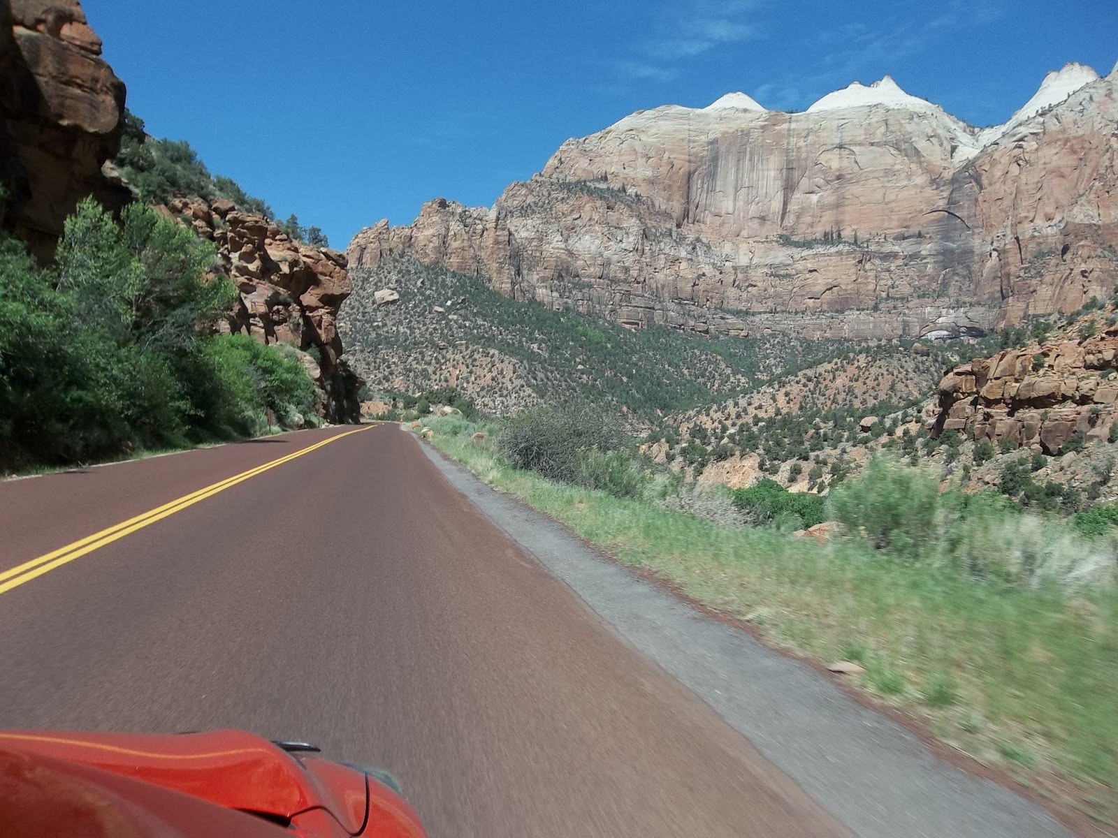
Lots of good views on the way up the curvy roads.

Info on the tunnel.  It's over a mile long.  It was opened in 1930. 


Yeap it was dark in there.

What's real interesting is that they carved viewpoints into the side.  You can't stop in the tunnel any more they must have been really interesting for the first visitors.
Amazingly, the tunnel isn't straight.  There are several slight turns throughout it.  The proverbial light at the end of the tunnel.

RV's and tour buses are allowed through but only if the tunnel is closed for one way traffic.  They also have to pay for the privilege.  Our truck and trailer exceed the length maximum to go through the tunnel.

The landscape on the other side is much different.   There's a lot of slickrock.

There's also another small tunnel.

Just another view of the different topography.