 |
| This viewpoint is just as the river turns. |
 |
| This truck navigating the one-lane portion of the highway shows how the rock overhangs the road. |
 |
| We weren't at this stop long when along comes another truck. Something tells me a lot of trucks use this road. |
 |
| As we continued along the road, we saw this interesting piece of artwork and hurriedly pulled over for a photo. |
 |
| The artwork was by Berlins Cafe, Bar and campground but the business had a for sale sign on it. |
 |
| View across the road from Berlins |
 |
| Next stop, the Kawatiri Picnic Area and Historic Railway Walk |
 |
| There was a small pavilion covering some displays about the railway. |
 |
| We saw this sign and didn't know what it meant so I looked it up. It means: “Speed Limit Derestriction (no posted speed limit, maximum of 100 km/h applies but drive to conditions)”. I didn't know there was an international treaty to standardize road signs. Read all about it. I've seen a lot of different variations of road signs in the countries I have visited but most have been recognizable. I still remember the "Stud Fitting" sign in Ireland and I still don't know what it meant. |
 |
| We saw a few hop farms but later, just south of Nelson, vineyards were everywhere. |
 |
| We saw a lot of logging trucks, but they looked a bit different than what I was used to seeing. |
 |
| We stopped in Nelson for lunch before continuing to Pelorus Bridge Scenic Reserve. |
 |
| From the parking lot, we made our way back to the bridge and took these steps down to the water. |
 |
| The water was a beautiful color |
 |
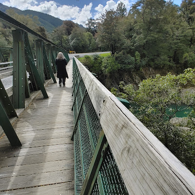
| We climbed back up the steps and headed across the bridge. We had to see what was on the other side. |
 |
| Found this information panel on the other side. |
 |
| Click on the photo to get it to enlarge so you can read it. |


No comments:
Post a Comment