
 |
| December 31, 2022, at 11:28 p.m. I flew out of Phoenix to Dulles Airport in Washington, D.C. Then I took a flight to Miami. This trip was the second attempt for my sister and I to do a Norwegian cruise to the Panama Canal. The previous year's attempt had gone wrong when my sister's flight was cancelled and she had to reroute, which made her arrive too late at Fort Lauderdale to get on the ship. But even those people that made it to the ship had their trip cancelled when ports closed due to another wave of Covid-19. We were given credit for everything but the trip insurance. |
 |
| This time we decided to come a day early so we spent the night at the Miami Hilton. |
 |
| View from our 15th floor room. The next day our bus from the hotel to the port was delayed because another cruise line had six buses going out before us. So instead of getting on our bus at noon, it started boarding at 1 pm. We were hoping to have lunch on the ship. When we got to the pier, there was another delay in boarding. I felt sorry for the people that had arrived at the pier at 9 am, the first time available for check-in. We had to wait another 45 minutes on the pier before our group was called but our rooms were ready when we boarded. |
 |
| Our balcony room aboard the Norwegian Pearl. I usually find beds too hard for me but this one was just right. |
 |
| This mirror had a lit circle that could be pressed so the light around the mirror would illuminate. Below was a refrigerator and then there were two closet doors. Notice the hair dryer and the little stool below the counter. |
 |
| The closet had two spaces with a shelf above, but life vests were stored on the right shelf. The left space contained two drawers and a safe. I brought more hangers, plastic ones so we could hang wet clothes in the shower. Except for a couple of items, both of us had brought more clothes that we needed. |
 |
| The bathroom was the worst I had encountered on a cruise ship as there was hardly room in front of the toilet to maneuver on and off the toilet. Notice the small slot on the sink front? It was supposed to hold facial tissues, but it took about half the cruise for some to appear. I had brought a whole, square box of Kleenex which was softer than the tissues which were provided. We were also missing a bathmat which showed up in about three days or so. |
 |
| Our balcony had two chairs and a small table. |
 |
| View from the balcony. From the room we headed off to the buffet. We had breakfast that morning at the hotel, but it was about 2:30 pm before we got lunch aboard the ship. The buffet closed at 3 so we just made it. |
 |
| After our meal, we decided to explore. We found a bridge viewing room on deck 11 but the curtains on the windows into the bridge were closed. The little room included a model of the ship. |


 |
| This frame enclosing two socks and an explanation was hung on the wall in the Bridge Viewing Lounge. CAPTAIN'S SOCKS AN ESSENTIAL AID TO DETERMINING VITAL NAVIGATIONAL INTELLEGENCE Instructions for use Attach the PORT (red) sock to the left foot and the STARBOARD (green) sock to the right foot * Should a know-it-all member of your crew make reference to one of the technical positioning terms (often accompanied by other esoteric jargon such as "....tack" and "large sandbank to ...", there's no need to panic. Simply glance surreptitiously at your color-coded ankles to ascertain where to look. By casual use of this help, you will both reassure the crew of your competence and win their undying respect. Long trousers might hide the Captain's Socks, so it is wise to take the precaution of sewing strings to the turn ups and attaching them (inside your trouser legs) to the pockets, so that you an artfully pull the trouser bottoms up to reveal your helpful socks. * On standard models this is attached to the right leg. Fits size 6 - 11 Guarantee: The Manufacturer warrants that following the above instructions will reduce the incidence of grounding/collisions/ disputes/ humiliation/ friction/ demotion/ divorce, etc. The guarantee is invalid if the product is interfered with by unqualified operators or is improperly used in conjunction with other socks, of similar appearance or worn on the wrong foot. |
 |
| Leaving Miami Cruise Port. The road is the MacArthur Causeway. |
 |
| Car ferry at the Fisher Island Ferry Terminal. |

 |
| Very interesting house over the water. |
 |
| Opposite side of a car ferry. |
 |
| Miami Beach US Coast Guard Base. |
 |
| Portofino Towers condominium |
 |
| South Pointe Beach |
 |
| We went to the show the first night on the ship. Loved the stage curtain. Show was good too. |
 |
| Every evening we got a flyer listing important information and an itinerary of the next day's events. |
 |
| I didn't find much to do on the first At Sea day. Went to trivia once. Took advantage of the bar package and drank some mud slides. |
 |
| Our first port, George Town, Grand Cayman, Cayman Islands. |
 |
| This port isn't big enough for ships to dock so we were tendered to the pier. |
 |
| We gathered in a group for our first excursion. Wrist bands were placed on one of our wrists and we had to sign a waiver for the excursion company. Looking at the locations marked on the sign, we exited the tender by #6, bused to #7, then headed to #20, reboarded then stopped at #5 for a swim before heading back to the tender. |
 |
| Excursion companies were swarming us trying to get the attention of people who hadn't already booked an excursion. I like to go with the excursions set up by the cruise company because these have been vetted and, should your excursion get back to the dock late, the ship will wait for it to return. I had that happen to me in Dominica in 2020 so I think it is worth the extra money. |

 | |||
| We walked a short distance to our bus. Lorna, our wonderful guide/bus driver told us about the sites and the country as we made our way along the south coast of the island. The island is 22 miles long and has 17,000 residents. Two other islands are included in the country, one 89 miles away and the other 90 miles. You can fly or take a ferry between islands. Grand Cayman is the most populated of this British Overseas territory. The Governor is appointed by the head of the royal family, currently King George III. They hold the position for 5 years. Other officials are elected by the citizens and hold office for 4 years. There are two political parties, the Peoples Progressive Movement (PPM) and the Cayman Democratic Party (CDP) but 90% of the people register as independent. These are tax-free island, no income or sales tax. This makes them a haven for people trying to evade income tax. Our guide told us there are 300 banks on Grand Cayman Island but a quick internet search gives results from 158 to 600. The south side of the island is where you find the expensive properties, all over a million in value. This is also where The Grand Old House, built in the 1800's, is located. Main industries are tourism and banking. There's no unemployment. Workers are brought in during the high tourist season. Agricultural crops include coconuts, cabbage and peppers. Pigs, lobster, turtle and goats are raised. Main sports are cricket and soccer. In 1503, Christopher Columbus was making his fourth and final voyage to the New World when winds blew his ship off-course. It was then that Columbus first happened upon two islands that he would name “Las Tortugas” for the many turtles residing there. This pair would become the Sister Islands of Cayman. Unlike other locations that Christopher Columbus claimed to have "discovered", the Cayman Islands were not occupied. Years later, a map was drawn showing all three islands in the area with the name “Lagartos,” meaning alligators or large lizards. By 1530, the trio was called the “Caimanas”— derived from the native word for the crocodiles that used to dwell here. The name “Caimanas” evolved into Cayman. The Spanish Crown made no efforts to settle the region, and the islands were not thoroughly explored until 1585, when English sea captain Sir Francis Drake arrived. In 1670, the Treaty of Madrid officially transferred possession of the Cayman Islands to Great Britain, and for nearly three centuries the Islands were administered as a dependency of Jamaica, the largest British colony in the West Indies. Around 1700, George Town became the first permanent settlement on Grand Cayman. |
 |
| Our first stop was Pedro St James, a private home built in 1870. It was the largest home on the island, much larger than the wattle and daub homes found in the area at the time of its construction. |
 |
| The bottom level was a dining and storage area. The second a living area, while the bedroom was on the top level. |
 |
| Ground floor |

 |
| Storage area on the ground level. |


 |
| Separate cook house. |


 |
| Time to head up to the second floor. |
 |
| Meetings were held at Pedro St James to negotiate the islands separation from Jamacia in 1962. |


 |
| Click on the photo if the print is too small to read. |


 |
| We reboarded our bus and headed back the way we came. Saw this gas station so I thought I would try to figure out how much in US dollars a gallon of gas costs. They use the imperial gallon which is 160 ounces or 1.2 US gallons. The Cayman Island dollar is worth about US$1.20. So Cayman $5.37 divided by 160 oz is .0335625/oz. Times 128 oz is Cayman$4.296 x 1.2 is US$5.156 per US gallon. The guide also told us that the electricity is diesel powered so it is expensive. We went past the airport which is serviced by many of the large airlines including, Jet Blue, American and United. We also went past the dump, the highest point on the island, where trash has been dumped since the 1960's. |
 |
| Next we stopped in Camana Bay, a whole community developed by Dart Realty, ran by Kenneth Dart, heir to the producer of the Dart foam cup. Dart has spent more than US$800 million in developing the Camana Bay Town Centre, which presently consists of some 700,000 square feet of office, residential, retail and other commercial space. |
 |
| We climbed up the five-story tower for a look around the area. We could see the ocean on either side. |


 |
| Looking west. |
 |
| Looking east. |
 |
| The pedestrian walkway between the stores. |
 |
| To me the coolest thing about the tower was the tile work on the walls as we went down the stairs. |
 |
| We went into a couple stores. My sister thought all the sand timers needed to be turned over at this store. |
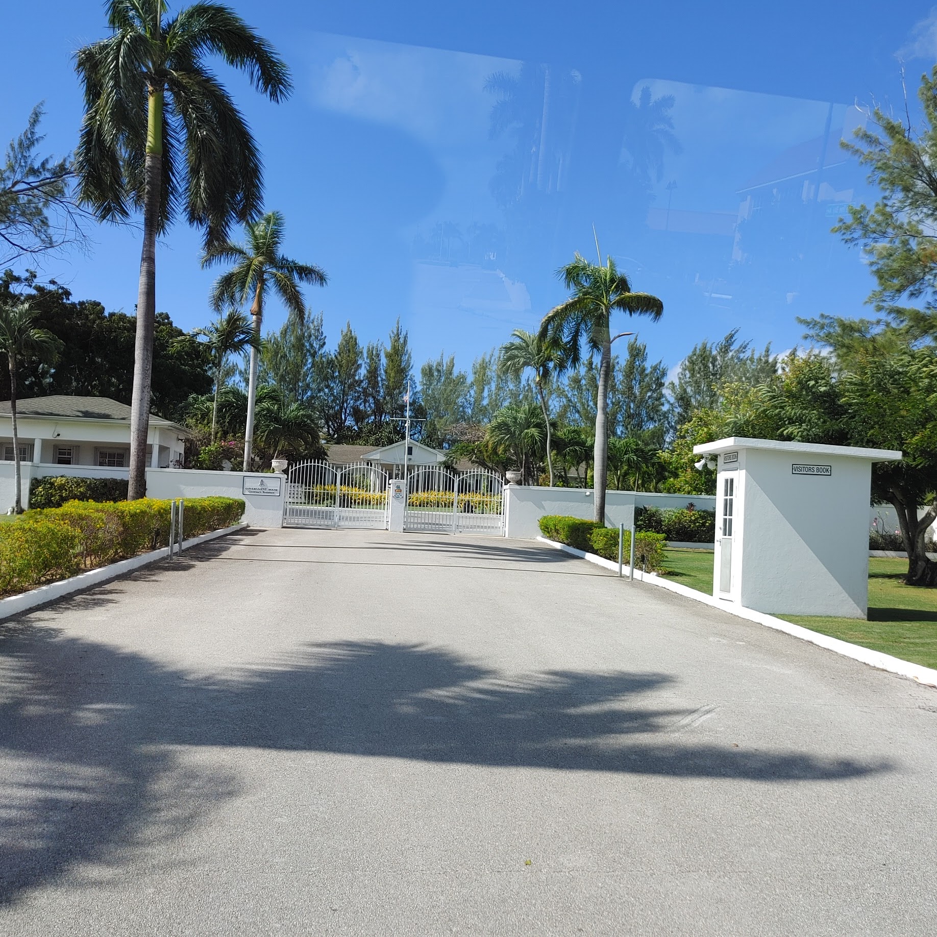 |
| Official residence of His Excellency the Governor of the Cayman Islands. Officially named ‘Government House’, it is not open to the public. |
 |
| We can officially say we've been to Hell and back. We stopped here for a quick look. |
 |
| Although not part of the geological site, I thought this palm tree I could see from the parking lot was very interesting. Looks like it got knocked over but just kept growing. |
 |
| There were quite a few chickens running around the parking lot. Figure they are domestic animals that got loose at some point. Probably during a hurricane, as is the case in Hawaii. |
 |
| The geology is a little strange with its surrounding vegetation. |
 |
| Would the punishment be a trip to hell? |


 |
| Interesting how this tree was growing up in the formation. |


 |
| This rooster was more colorful. |
 |
| Of course they had a post office so you could send a postcard from Hell. From here we reboarded the bus and headed back south. We stopped at Seven Mile Beach so everyone that wanted could get in the ocean. It was nice but crowded. Then the bus took us back to the pier where we caught a tender back to the ship. |
 |
| There were three other cruise ships in port while we were there. |

 |
| Another day at seas without much to do. Well, we did go to shows almost every night and we attempted to complete a puzzle. The ship had a few but all were missing pieces and they didn't have a good place to do puzzles. We used the buffet dining table during off hours. This puzzle had a notation on the box that a piece was missing. We found out it probably had 50 pieces missing. |
 |
| My sister's cell phone takes amazing photos. |

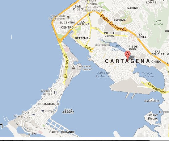 |
| This map will help me explain where I went in Cartegena. In the middle of the map there are two long projections out the bottom of the area that is gray. This is where the cruise ship docked. Between the De of Pedro De Heredia and Pie Del Cerro, is the location of the old fortress called Castle San Felipe de Barajas. Where it says El Centro is the old walled city. |
 |
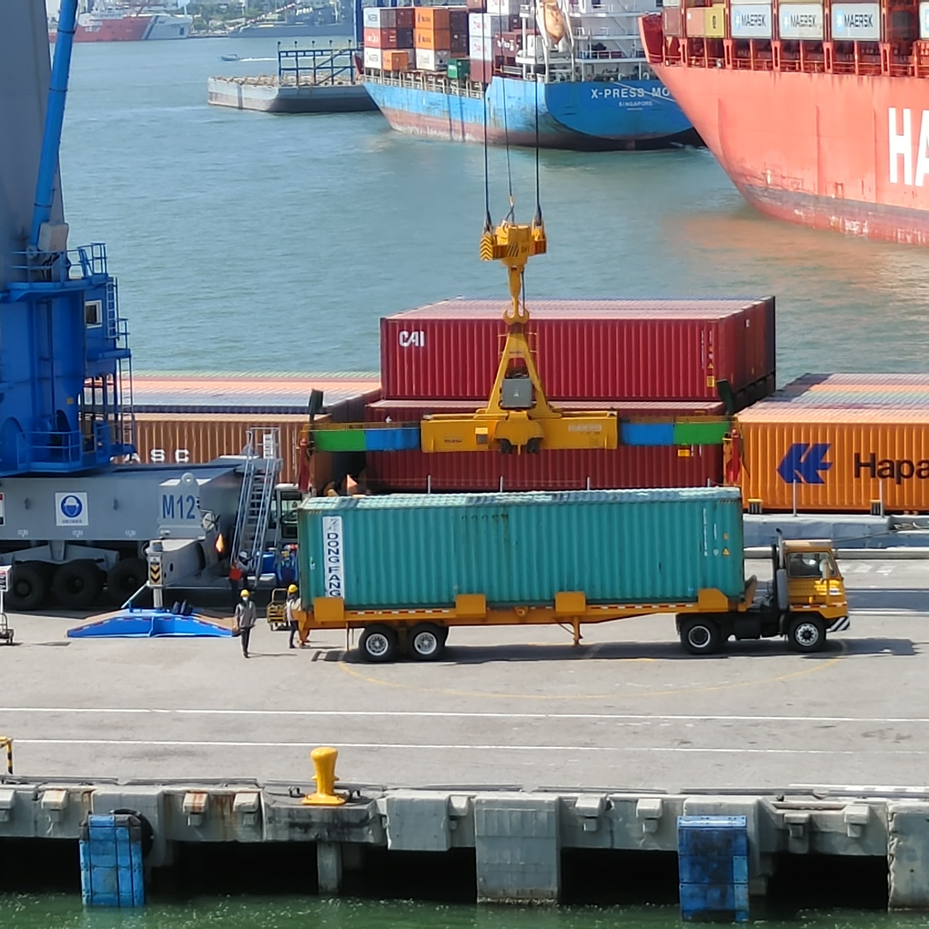
| We were docked by the container port. There was a large container ship at the dock. Cartegena has a population of 1.2 million. Its real name is Cartegena de Indias. This was to differentiate it from Cartegena, Spain, after which it is named. |
 |
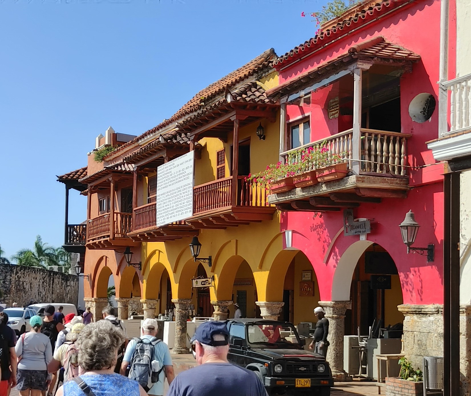
| Lots of skyscrapers in the Bocagrande area where most tourists stay. Our guide later told us about the six different social classes of Columbian society and how this area was Level six. Housing characteristics, such as a garage, a front yard, and quality of the neighborhood, are the main criteria used to determine the level. Depending on the diversity and quality of housing, there could be six strata: level one is lower-low, two is low, three is upper-low, four is medium, five is medium-high, and six is high. Most cities, like Cartegena, have all six, but there are towns that have only three. Level one and two are in the hills. Interesting that, in the U.S., homes in the hills are usually the most expensive. |
 |
| My group boarded a bus for our tour. There was a lot of traffic, and I didn't see many lane markings when I caught glimpses of the road. |
 |
| So it looks like regular fuel is 10,250 pesos per liter. If I figured this right, that's about US$8.5361/gallon. No wonder the cars are small, and I saw a lot of motorcycles. Of course, that could also be because of the congested roads. |
 |
| Parking did look a little tight. 😉 |
 |
| Looks like motorcycles could maneuver however they wanted to get through traffic. This one had come down the side of the road then cut in between these two cars to get to the front of the line. |
 |
| This place looked pretty nice... |
 |
| Until you zoomed in a little closer. |
 |
| Looks like street cleaners have a hazardous job. |
 |
| The bus drove along the SE edge of the Getsemani district just inside the bastion walls. There are 11 kilometers of wall. Columbia was known for its emeralds. In the colonial days, emeralds, silver from Mexico and gold from Peru were gathered and stored in Cartegena to be shipped to Spain. This expensive cache needed to be protected from the pirates and other European empires which is the reason for much of the early fortifications. |
 |
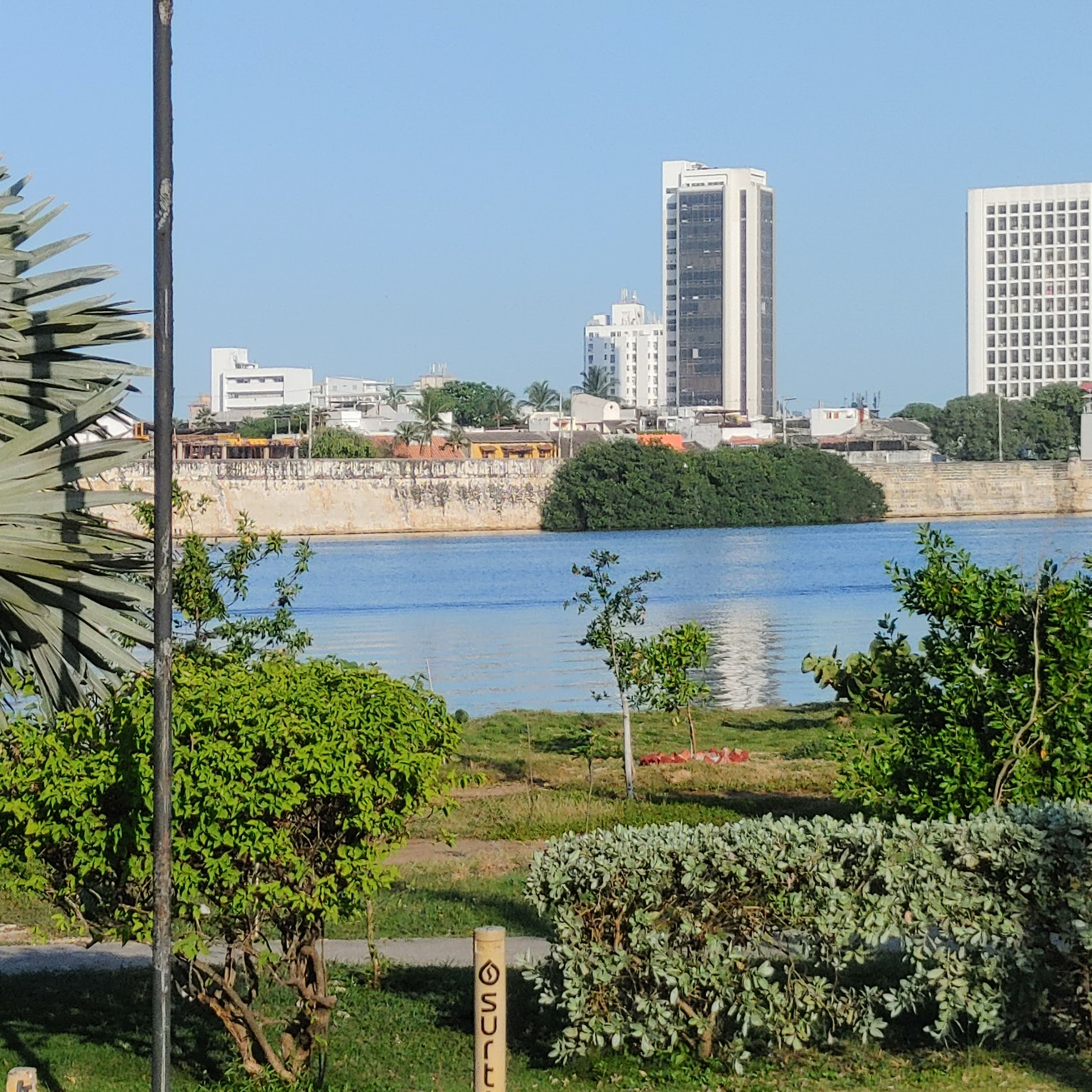
| View of Castillo San Felipe de Barajas across the lagoon. Cartagena has the most extensive fortifications in South America. A system of zones divides the city into three neighborhoods: San Pedro, with the cathedral and many Andalusian-style palaces; San Diego, where merchants and the middle class lived; and Gethsemani, the 'popular quarter'. |
 |
| I'm assuming this guy was out collecting plastic to make money. |
 |
| We stopped at a section of the bastion called Baluarte (bastion in English) de Santa Barbara |
 |
| View of the fortress from the top of the bastion. |
 |
| ‘Las Tres Guerreras’ is one of the many colorful murals in the Getsemani district. This tour was supposed to include a walking tour around the neighborhood to see the murals, but it didn't. This is the only one we got to see while the bus was stopped. |
 |
| Our open-air bus. |
 |
| More workers were cleaning around the bastion. |
 |
| Looks like these humps were used to separate the bike lane from the roadway. |
 |
| As we passed back over the lagoon, we could see a homeless encampment below the bridge. |
 |
| Gas station brand of this area. |
 |
| Arriving at the fortress, Castle San Felipe de Barajas. |
 |
| Vendors started heading toward the bus as soon as they saw it approach. We were surrounded as soon as we got off the bus. A polite "No gracias" was enough to make most of them leave you alone but there were so many that you found yourself saying it over and over. |
 |
| It's quite a steep climb to the top so we did it in stages. |
 |
| The description of the excursion mentioned we would stop at Commander Blas de Lezo y Olavarrieta Plaza, where the famous Spanish admiral and defender of the city overseas the fortress, with his one leg, one eye and one arm. Well, the bus didn't stop by the statue and no mention was made of it. This photo from the ramp leading up to the fortress shows the only time I saw it. |
 |
| Gran Colombia, formal name Republic of Colombia, was a short-lived republic (1819–30), that including roughly the modern nations of Colombia, Panama, Venezuela, and Ecuador along with parts of northern Peru, northwestern Brazil and Guyana. Gran Colombia was dissolved in 1831 due to the political differences that existed between supporters of federalism and centralism, as well as regional tensions among the peoples that made up the republic. It broke into the successor states of Colombia, Ecuador, and Venezuela; Panama was separated from Colombia in 1903. |
 |
| The fortress was actually built in stages between 1536 and 1767. |
 |
| The colors of the Colombian flag are ascribed many meanings, the most common being: Yellow – the golden sun and fertile lands of Colombia. Blue – the waters of the oceans that wash the nation’s shores. Red – the blood spilled on the battlefield for the independence of the homeland. Columbia is the only place in South America which borders both the Pacific and Atlantic Oceans. |
 |
| Everything I read says the fortress was constructed using limestone, clay, mud and bricks. This looks like a fossilized coral that was contained within the limestone. |

 |
| Here are the bricks. |


 |
| Looking toward Bocagrande. |
 |
| The black building was the old Circo Teatro bull ring that has been converted into a shopping center. |


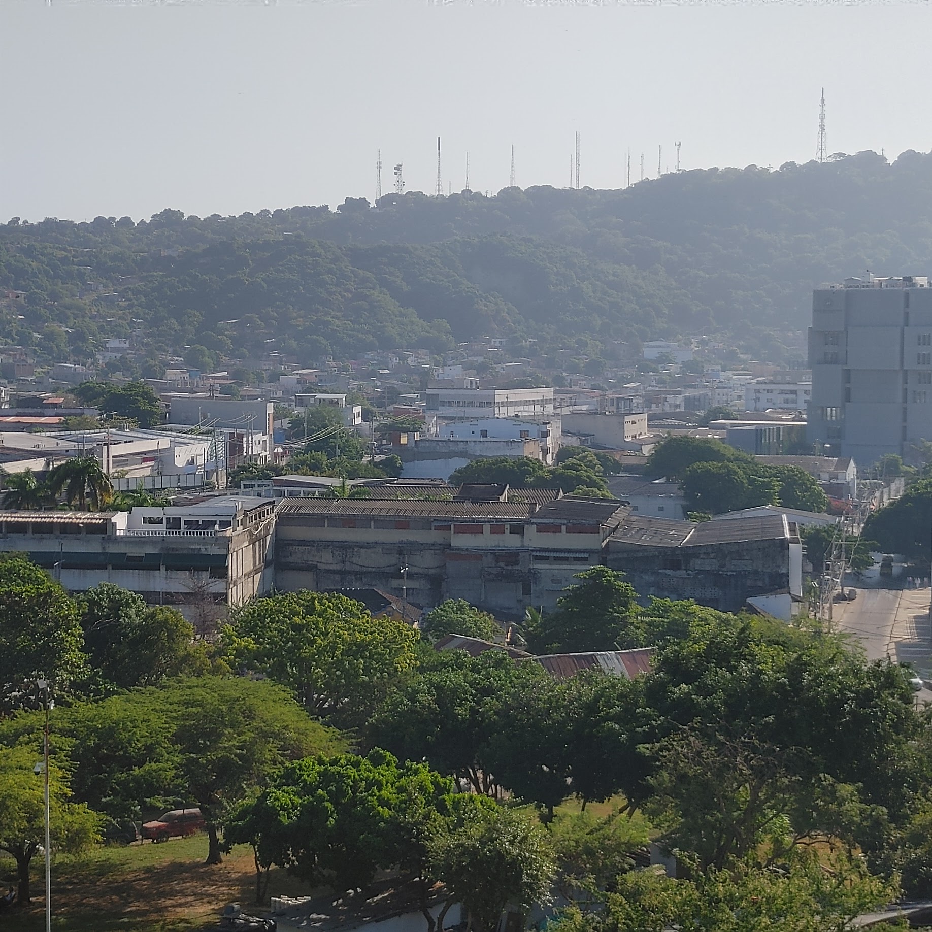 |
| Looking towards the hills where most of the poorest people live. |
 |
| We finally make it to the oldest part of the fortress. Built in response to the war with England, the Spanish commissioned the engineer Pedro Zapata to build a new fort on the hill in 1657. Zapata named his fort Castillo San Felipe de Barajas after the Spanish King Philip IV. This fort is just a small part of the massive structure visible today. It consisted roughly of the central part of the fort at the highest point of the hill and was designed to garrison only 20 men operating 4-6 cannons. |
 |
| This tunnel is our entrance to the top of the fortress. The guide faced it and yelled to demonstrate how it amplified his voice. This was one of the defensive traits of the fort. There are over 2,000 meters of tunnels throughout the fort. |
 |
| We headed up the tunnel. |
 |
| View at the top of the tunnel. |
 |
| Behind the tunnel mouth. |
 |
| Looking at where the tunnel emerges from below. |

 |
| Entrance to the well. |
 |
| Looking down on later parts of the fortress. |
 |
| Bell tower. |
 |
| In 1739, Britain declared war on Spain to begin the War of Jenkins’s Ear (seriously, the war started because Spanish coast guards cut the ear off a British merchant, a chap named Jenkins, albeit it 8 years earlier!). Fearing attack, San Felipe Fort was fully repaired, and a new battery was added. |
 |
| On March 13, 1741, a fleet led by Edward Vernon arrived off the coast of Cartagena. Vernon had at his command over 120 ships and more than 20,000 men, including 12,000 foot soldiers. Four hundred of which were North American troops led by Lawrence Washington, George's half-brother. Meanwhile, Cartagena’s defenders numbered no more than 6,000, much of them militia. Vernon's troops quickly took 78% of the city. But they didn't count on the invisible troops of the area, better known as mosquitos. Malaria sickened 10,000 of the British and North American faction and they withdrew on May 20th. |
 |
| In 1984 UNESCO listed the castle, along with the Old City of Cartagena, as a World Heritage Site |
 |
| For a more complete description of the fortress and is history, check out this website - https://www.cartagenaexplorer.com/history-castillo-san-felipe-fortress-cartagena-colombia/ |
 |
| Our guide told us we could see our cruise ship from the top of the fort. Well, I see the cranes at the container dock. |
 |
| Maybe if I had a better camera, I could have gotten a photo of the ship, but I think it might be there in the break between the buildings. |
 |
| Panoramic view of the west side of the city from the top of the fort. In 1811, Cartagena was the first city to declare independence from Spain. However, the attempt failed, and the city was taken back by Spanish under general Pablo Morillo. A decade later, during the War of Independence, the city was once again the first to declare independence from Spain. The city recovered well and remained an important trade port. |
 |
| Street scene as we headed back to the center of the old walled city. The average humidity is 74 to 80% although January and February are less humid. The US dollar was approximately 4841 pesos at the time of our visit. When purchasing items, bargaining is part of the culture. |
 |
| Salsa is the most popular music for dancing in this city where the music and dance scene is very popular with tourists and locals alike. Bars here are known for their fantastic atmosphere and live music choices, and the variety of drinks they offer. |
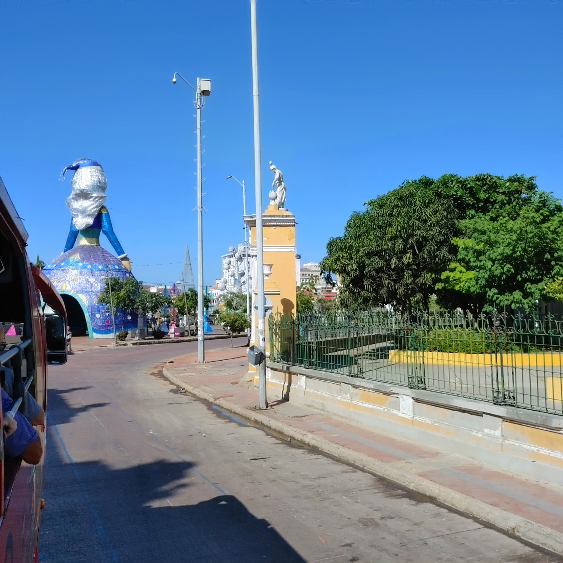 |
| Approaching the Camellon de los Martires, Median of the Martyrs, a piece of land between two streets just outside the walled center of the old city. The "doll" figure in front of the bus is part of the Christmas decorations that were still up. |
 |
| On the other side is the Parque Centenario, created to celebrate one hundred years of independence from Spanish rule. |
 |
| Once again the vendors gathered as the bus came to a stop. |
 |
| The clock tower at the entrance to the walled city. |
 |
| Turning to look at the Camellon de los Martires as we headed toward the walled city. |
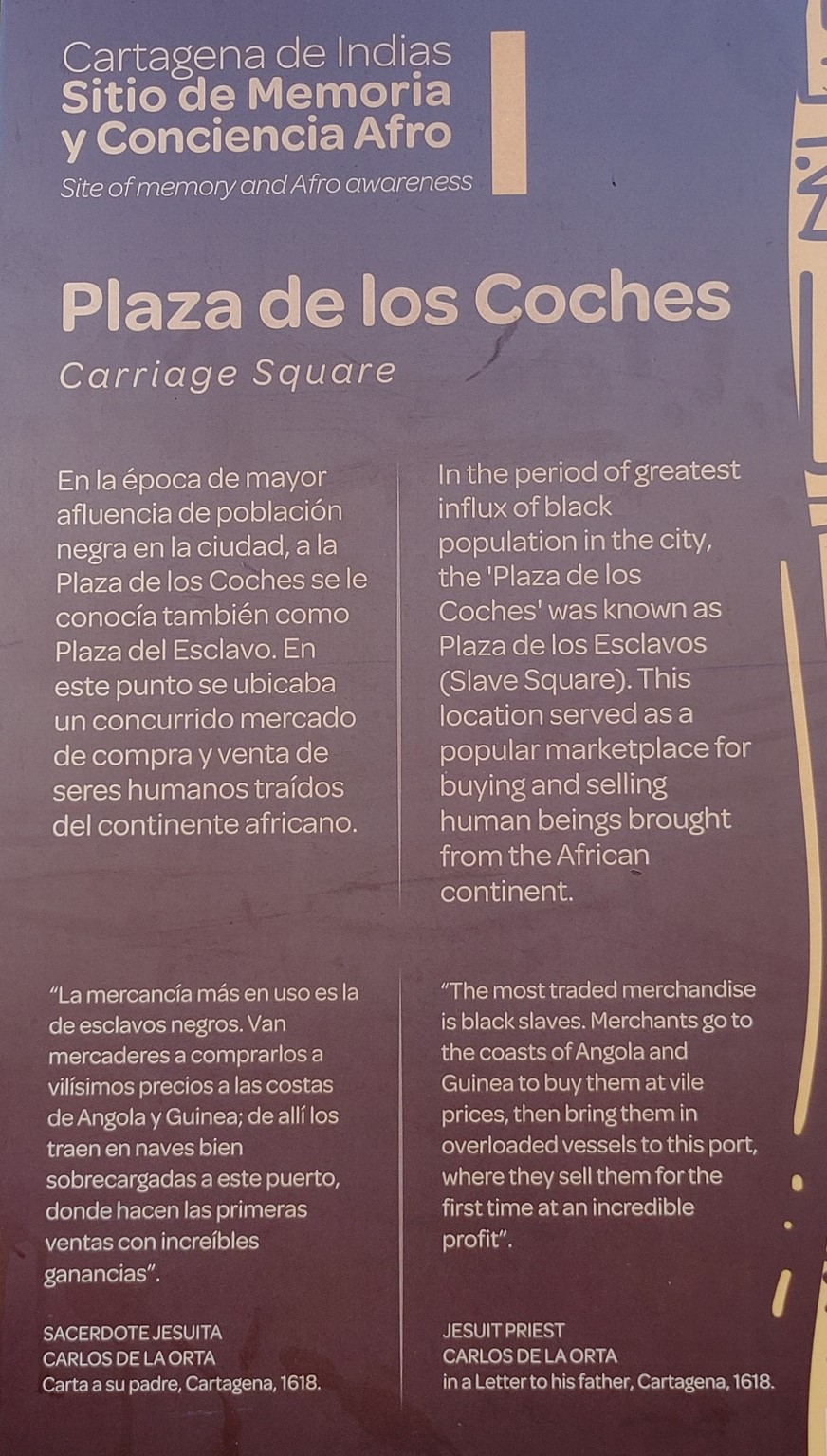 |
| Once we entered the walled city, I took photos of some plaques on the wall. The guide said we were in Carriage Square where the 1501 expedition landed. |


 |
| Founder of the city, Pedro de Heredia. He was a Spanish conquistador who explored the northern coast and the interior of present-day Colombia. His interpreter was an indigenous princess who had been kidnapped in 1509 and sent to Santo Domingo, where she learned the Spanish language and adopted the Catholic Christian faith. Although I never saw it, a monument to this woman is located somewhere in the middle of the walled city. |
 |
| Within the walls is an impressive collection of colonial and republican-era buildings. The colonial style buildings are characterized by their red roofs. |
 |
| I didn't see a lot of them, but pigeons are everywhere you go. |
 |
| Christopher Columbus Monument in Plaza de la Aduana |
 |
| Slotted concrete storm drains |
 |
| The home of the Major of Cartagena, or Alcaldia Mayor de Cartegena. |
 |
| I wonder how many people per day trip over those stone borders. |
 | |||
| Headed down Calle 32 (32nd street) toward Plaza de San Pedro Claver. San Pedro Claver (AKA Saint Peter Claver) was a priest who is thought to have baptized 300,000 slaves. He often went to slave ships as they arrived, treating the sick and wounded in addition to ministering to them. He also argued for owners and slave traders to treat slaves better, although there’s no evidence that he called for abolition. He grew sick for several years before dying in 1654, but his work and the compassion he showed towards slaves had earned him the nickname of the “slave to the slaves.” He was canonized as a Catholic Saint in 1888 and is considered the patron saint of human rights. |
 |
| Church built was built between 1580 and 1654 and named after the saint. |


 |
| Looking toward the Cathedral of Santa Catalina de Alejandría. |
 |
| On our way to the cathedral, we stopped here. They had a small, fake cave with oversized fake crystals on display, a 3D presentation about the indigenous creation story (couldn't see because my headset was fogged up), and, of course, you had to walk through their jewelry exhibit. Next we watched a performance by a street dance group arranged by our guide. |
 |
| The dance took place in this narrow street while our guide held up the traffic. |
 |
| Next stop was Plaza de la Proclamación. |

 |
| On the other side of the plaza, we entered the Catedral de Santa Catalina de Alejandría. This is a side entrance. |
 |
| This is what the front of the church looked like. |


 |
| One of many of reliefs on the walls. |
 |
| Loved the multicolored tile on this roof. |
 |
| There were many food carts selling sliced fruit. |
 |
| We ended up back at the clocktower. |
 |
| From the clocktower, we headed straight out, crossed the street and walked down the Camellon de los Martires. In 1816 Pablo Morillo landed in Cartagena de Indias with the firm intention of reconquering Colombia for the Spanish crown. He wanted to teach the rebels a lesson: he tried the nine most renowned leaders of the city, without a legitimate defense, and sentenced them to death in a public square. On February 24, 1816, the martyrs were taken to the place of execution, on the outskirts of the walled center, near the Ciénaga de la Matuna. Their bodies were buried in a mass grave in the Manga Cemetery. |
 |
| Monumento Noli Me Tangere. Carved from white Carrara marble by Felipe Moratilla, it was erected in 1911 on the centennial of Cartagena de Indias declaration of independence. The name translates to the warning, “Touch Me Not.” This means Cartagenans always stand ready to defend their freedom. |

 |
| Front view of the large "doll" Christmas decoration |
 |
| Inside the "doll's skirt". |
 |
| Notice how it was lit with string lights. |

 |
| On the other side of Avenida Calla 24 Real were two large statues of pegasi. We walked past the Convention Center and stopped for a rum and chocolate tasting. |
 |
| I took this photo of a statue as the bus drove by but I never found any information on it. It is by the Convention Center parking lot. Google maps didn't show it there so maybe it is new. |
 |
| Interesting electrical / phone wires. |
 |
| If you want to know more of the history of Cartagena, I found the following website to be very informative. https://www.cartagenaexplorer.com/history-of-cartagena-comprehensive/ |
 |
| There were buses to take people to the ship, but it was close enough that I just walked. |
 |
| Back in the cabin, I stepped out onto the balcony to watch containers being placed onto flatbeds. |

 |
| My sister and I both cancelled our excursions for this day for two reasons: #1. We would have to spend 3 hours in the shopping area after our excursion because the ship was moving through the canal and couldn't be boarded before docking at Colon. #2. There was a Panama Canal Authority guy on board that was imparting information while the ship was in the canal. He also hosted a Q&A session that was informative. |
 | ||
| The canal welcomes around 13,000-14,000 ships each year, 35-40 each day. Due to increasing demand and high competition throughout the years, it has undergone constant improvements and expansion projects. In 1934, the maximum capacity of the canal was 80 million tons, and by 2015, its traffic reached 340.8 million tons. |
 |
| This map just shows the Atlantic entrance of the Panama Canal, not the whole canal. The cruise ship entered from the Altantic (Caribbean Sea) which means it was heading south in order to enter the canal. First, we went through the entrance of the sea wall, transversed Limon Bay and sailed under the Atlantic Bridge. Notice there are two canals at Gutan. The ones on the right are the Agua Clara Locks which are part of the Panama Canal expansion project, also called the Third Set of Locks Project. This project doubled the capacity of the Panama Canal by adding a new lane of traffic allowing for a larger number of ships and increased the width and depth of the lanes and locks allowing larger ships to pass. The new ships, called New Panamax, are about one and a half times the previous Panamax size and can carry over twice as much cargo. The expanded canal began commercial operation on 26 June 2016. The new lock chambers are 427 m (1,400.92 ft) long, 55 m (180.45 ft) wide, and 18.3 m (60.04 ft) deep. |
 |
| The Atlantic Bridge was completed in 2019 and is the third bridge over the canal after the Bridge of the Americas and the Centennial Bridge, both on the Pacific side of the canal. |
 |
| By the time I was taking note of our surroundings, we were passing under the bridge. |
 |
| The Panama Canal locks are a lock system that lifts ships up 85 feet (26 metres) to the main elevation of the Panama Canal and down again. The original canal had a total of six steps (three up, three down) for a ship's passage. |
 |
| Heading into the Gutan Locks, one of the original series of locks. The Panama Canal Authority regulates the Panama Canal. Its revenue is generated chiefly (roughly 80%) by the transit toll paid by the vessels. Tolls are based on the vessel type, size, and type of cargo. The average transit toll is around $54000. Payment is based on cargo space. Military ship rates are based on weight. The largest vessel in dimension and container cargo capacity ever to pass through the Panama Canal transited on May 30, 2019. The Neopanamax container ship Triton, built in 2015, had a TEU capacity of 14,424, a 20-row beam of 51.2 meters (168 feet), and was 369 meters (1,211 feet) in length. Its toll? 1.1 million dollars! The smallest toll ever paid was 36 cents, plunked down in 1928 by American adventurer Richard Halliburton, who swam the canal. It cost $400,000 for our cruise ship to go in and out of Lake Gutan. The price would have been the same if it had crossed the entire isthmus. |
 |
| All the rails were crowded with people and the crowd was five people deep at the bow. Some of the decks had plexiglass barriers that were hard to see through due to condensation. |
 |
| A Panama Canal Authority pilot came aboard to maneuver the ship through the locks so the Authority was responsible for any damage to the ships or locks. It takes years of training to become a pilot, with most pilots receiving their training in the US. Four locomotives, as seen in the above photo, hooked up to each side of the ship to keep it centered in the canal. The movement of the ship was done with the ship's engines. |
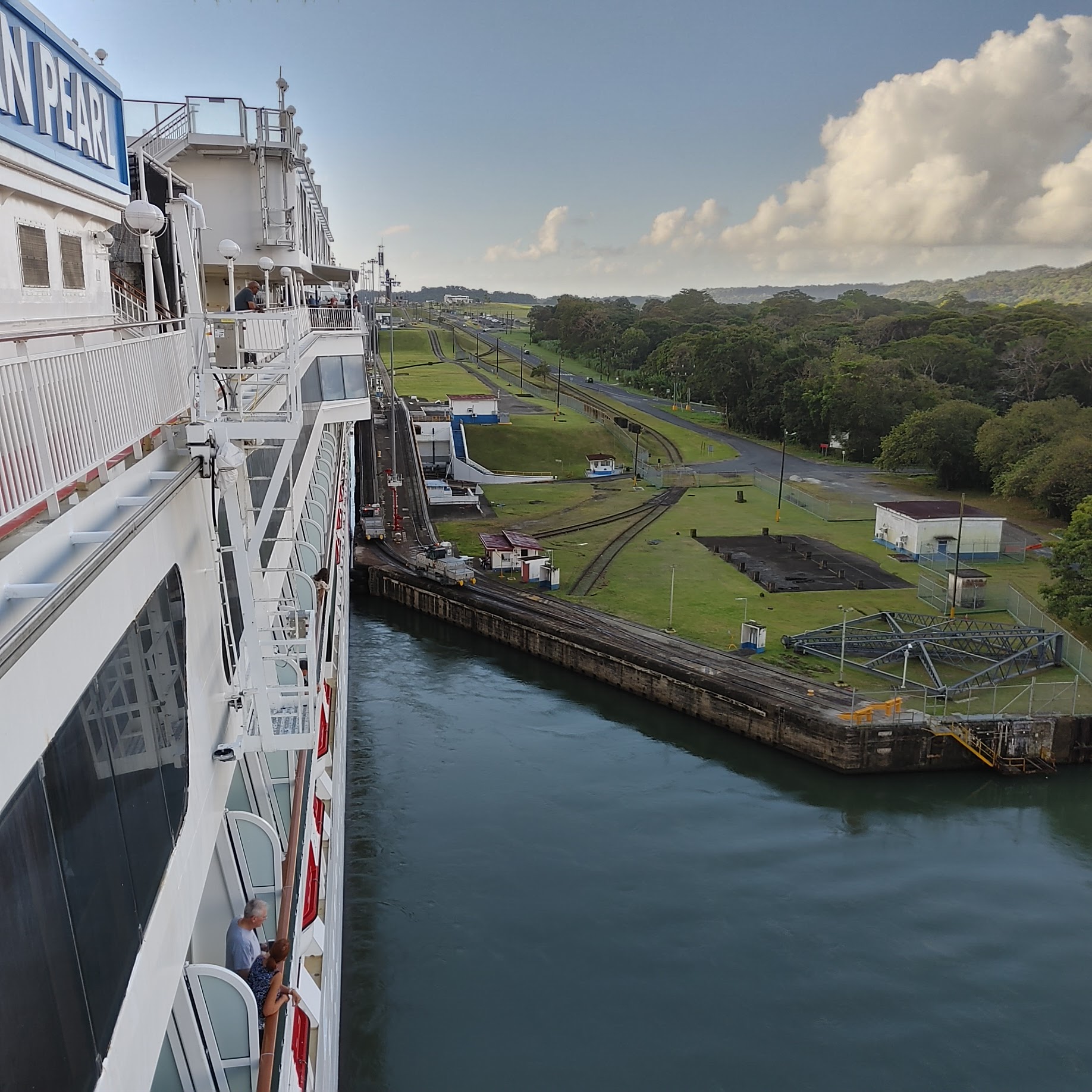 |
| The original locomotives were GE and the current ones are Mitsubishi. Each has two motors, one for forward movement and one for backing. |
 |
| See how the land rises with each set of locks? There are two independent transit lanes, since each lock is built double. The size of the original locks limits the maximum size of ships that can transit the canal; this size is known as Panamax. The lock chambers are 110 ft (33.53 m) wide by 1,050 ft (320 m) long, with a usable length of 1,000 ft (305 m). |
 |
| Looking back we can see a tug escorting the next ship in line. |
 |
| As we enter the first lock chamber, a ship is exiting in the opposite direction. The Panama Canal Authority estimates that each transit through the canal uses 52 million gallons of water. |
 |
| For centuries the idea of a canal through Isthmus of Panama as discussed, researched and even attempted but the difficulty of the task and the inhospitable conditions caused the failure of all of them. The first attempt to construct a canal through what was then Colombia's province of Panama began on January 1, 1881 by the French. They worked on it for 18 years before conceding to the terrain and the animals. The US was interested in obtaining the rights to continue the construction of the canal. The Isthmus was part of Columbia at this time so, on January 22, 1903, the Hay–Herrán Treaty was signed by United States Secretary of State John M. Hay and Colombian Chargé Dr. Tomás Herrán. For $10 million and an annual payment, it would have granted the United States a renewable lease in perpetuity from Colombia on the land proposed for the canal. The treaty was ratified by the US Senate on March 14, 1903, but the Senate of Colombia did not ratify it. Bunau-Varilla told President Theodore Roosevelt and Hay of a possible revolt by Panamanian rebels who aimed to separate from Colombia and hoped that the United States would support Colombia with US troops and money. Instead, the US actively supported the separation of Panama from Colombia. Shortly after recognizing Panama as a separate country, the US signed a treaty with the new Panamanian government under terms similar to the Hay–Herrán Treaty. The US also paid the French $40 million to purchase the Right of Way concession. The cost of the original construction was $375 million. Equivalent to $8 billion today. At the time of its construction, Lake Gutan was the largest in the world. There are hundreds of islands with tropical research being done on the largest. |
 |
| The lock chambers are massive concrete structures. The side walls are from 45 to 55 ft (14 to 17 m) thick at the bases. At the top less strength is required so they taper down in steps to 8 ft (2.4 m). The center wall between the chambers is 60 ft (18 m) thick and houses three galleries that run its full length. The lowest of these is a drainage tunnel; above this is a gallery for electrical cabling; and toward the top is a passageway that allows operators to gain access to the lock machinery. |

 |
| There are twelve locks in total. A two-step flight at Miraflores, and a single flight at Pedro Miguel, lift ships from the Pacific up to Gatun Lake; then a triple flight at Gatun lowers them to the Atlantic side. All three sets of locks are paired; that is, there are two parallel flights of locks at each of the three lock sites. The chambers are lined with wood. The Atlantic only has about a 12-inch difference between high and low tides but the Pacific has a 13-foot difference. |
 |
| The Agua Clara Locks is on the other side of the trees. That's where the New Panamax sized ships go through locks. There is only one lane on the Atlantic side and one on the Pacific side. These were completed in 2016 after 10 years of construction. They are 1400 feet long and 140 feet wide. Since there are already ships too large to go through the new locks, there are plans for even larger locks in the future. |
 |
| See the next northbound ship in the lock ahead of us? |
 |
| We could see the view from the bow camera on the TV in our cabin. |
 |
| There wasn't much room on each side between the ship and the canal walls. |
 |
| The next ship down to our level and the gates open |

 |
| Gate holding back the waters. The gates are removed and reconditioned every 20 years. That closes a channel for 2 to 6 months. The Canal has 100 gates with 4 to 5 being reconditioned each year. |
 |
| The canal employes 9,500 people out of a total Panamanian population of 24 million. No ships have even been stuck in the locks. Submarines have gone through. There is an annual canoe race through the canal which takes 5 days because they stop every night. The canal is open to all countries but US and Panamanian ships have priority. The US monitors passage of all foreign military ships. Private smaller boats are scheduled when there are several. Their fee is between $1,500 to $5,000 each. |

 |
| Once out on Guton Lake, those people going on excursions were tendered off the ship. |
 |
| We saw all kinds of ships and boats as we waited for the transit back through Guton Locks. |
 |
| The Panama Canal Authority is designing the next set of locks to accommodate even larger ships. Each chamber of the 2016 expansion has three lateral water-saving basins, for a total of nine basins per lock and 18 basins in total. Just like the original locks, the new locks and their basins will be filled and emptied by gravity, without the use of pumps. More locks would require more water, so these water saving basins are essential. |
 |
| The Canal is always open and services 1,920 ports in 170 countries. |
 |
| The canal generates about $3 billion a year, and approximately 40% goes to Panama’s General Treasury. The proceeds contribute to around 3% of Panama’s annual GDP. |
 |
| Turning around and heading back to the locks. |
 |
| Looking over the locks to Limon Bay and the Atlantic Bridge. |
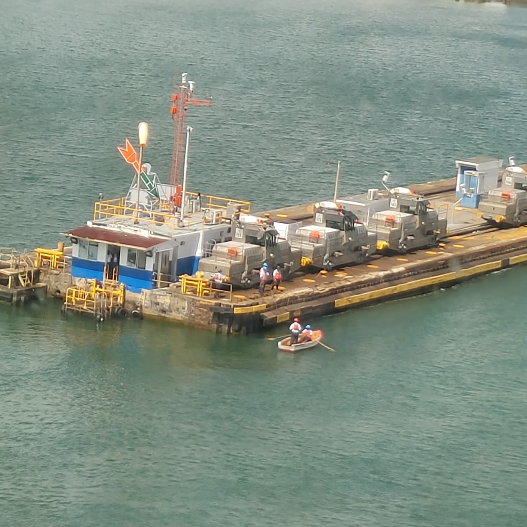 |
| What?!! A rowboat? |
 |
| Oh my, that is how they are going to get the ropes from the ship to the side of the canal. |
 |
| Can you imagine being out in a rowboat with a ship approaching? But notice how the ship is approaching. It looks like it will run into the side of the canal where the locomotives are waiting. |
 |
| The ship proceeded in this sideways fashion until the starboard side ropes were slung. |
 |
| Starboard side locomotives waiting. |
 |
| If you look closely, you can see the lines that run from the ship to the locomotives. It takes twenty-four line handlers to attach the lines from the ship to the locomotives. |
 |
| There was a tug in the lock with the Florida Highway. That was to make sure it didn't hit the sides of the lock as it exited because it had been released from the locomotives. |

 |
| The first lock of each channel always has two sets of doors in case one is damaged. |
 |
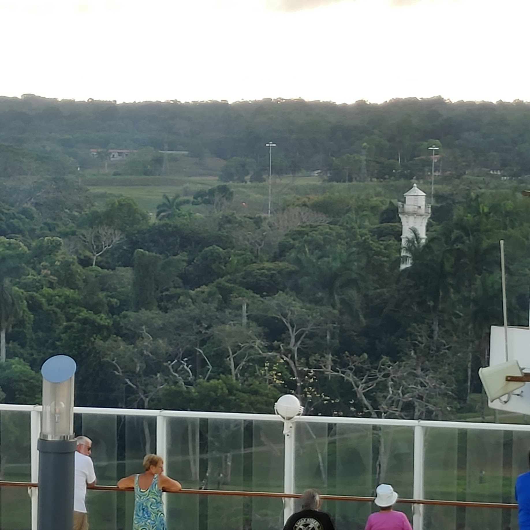
| This old lighthouse cannot be removed because it is an historical landmark. It is painted black because it was confused with a navigational marker. |
 |
| A normal transit of the whole canal takes 8 to 10 hours. The fastest time ever recorded was 2 hours and 41 minutes by a US Navy hydrofoil in 1979. |

 |
| As this ship lines up for the first chamber, there's no locomotives on one side so these tug boats keep the ship from hitting the side of the canal. |

 |
| Every ship had personnel waving as the ships passed. |
 |
| This guy was playing a trumpet, although not skillfully. |
 |
| The cruise ship passed back by Colon. |


 |
| But it kept going clear back out the sea wall... |
 |
| Only to enter the smaller seawall entrance to head into Colon harbor. |
 |
| Looking back at the small seawall break the ship had just come through. |
 |
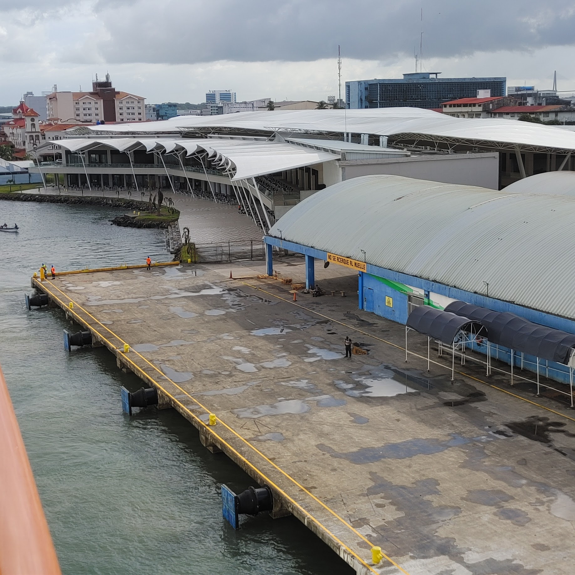
| Approaching the cruise ship dock at Colon. |
 |
| Oh, oh. Bad news. There's an ambulance waiting on the dock. |
 |
| Looking forward I can see a small motorboat. |
 |
| Looking aft. |
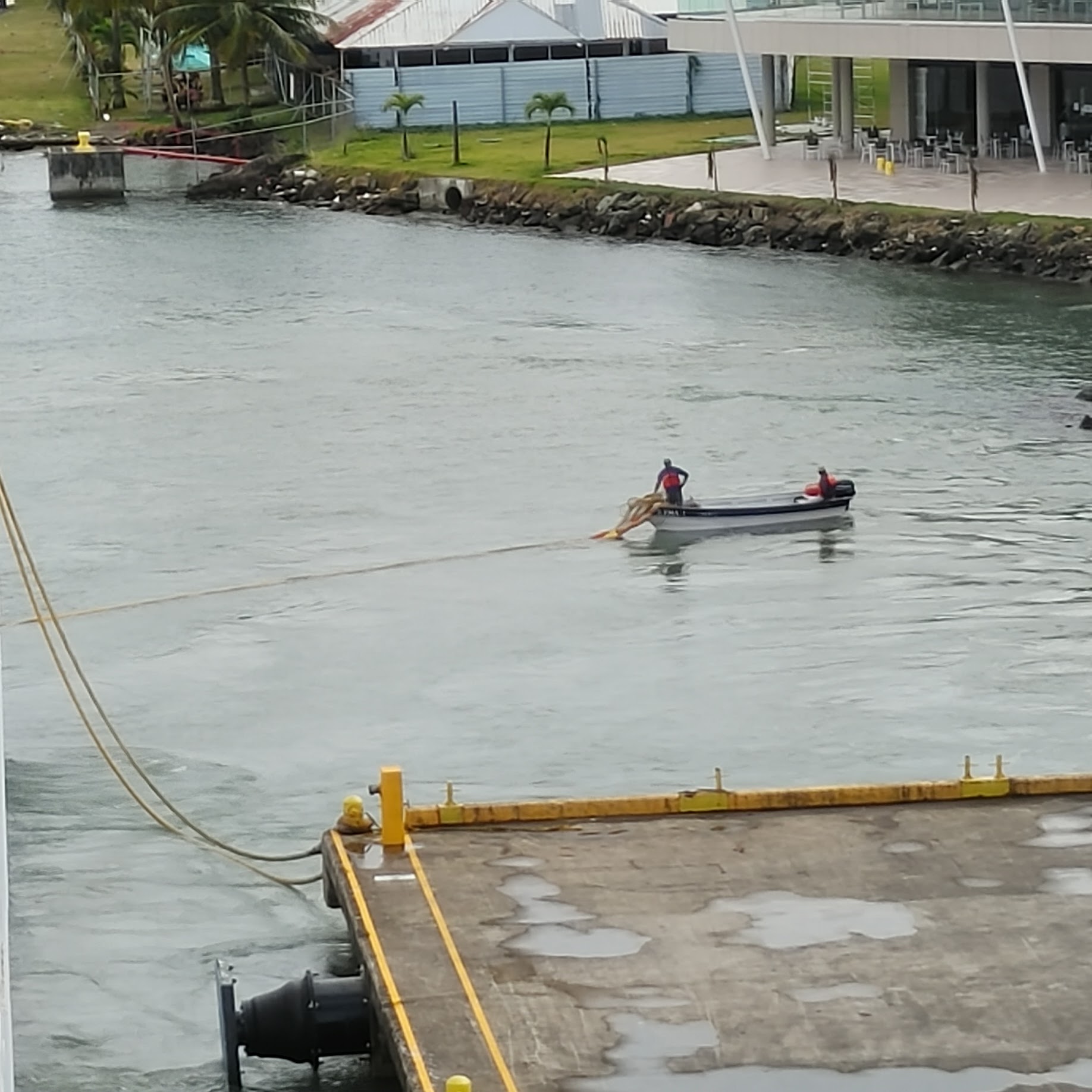 |
| Yep, the motorboat is towing the lines to shore. |
 |
| As soon as the ship docks, ship personnel swarm out to set up for passengers to both board and exit the ship. |
 |
| Three sets of lines at the rear of the ship. |
 |
| Two sets of lines at the front with a truck waiting to give the ship supplies. |
 |
| Whatever that is that they are taking off the ship, it must really be heavy. |
 |
| We got off the ship to be able to say we went to Panama. We had to walk through a mostly deserted shopping center where we saw this tilework. |
 |
| Other passengers were kind enough to take our photo at the Colon sign. |

 |
| Docking at Puerto Limon, Costa Rico |
 |
| Tugboat alongside to make sure ship gets docked. |
 |
| Pier was on the starboard side so all we could see from out window was another pier and Uvita Island |
 |
| Wow that's a colorful pier. |
 |
| This satellite view really shows how the pier was painted. The Costa Ricans do not list recognize Central America as separate from North and South American. They just say they are from the center of America so therefore, they are Americans. Islands off the cost are Insular Americans. Costa Rica claims 20,000 square miles of which 30% is protected forest land. There are four mountain ranges which run NW to SE. They are volcanic. |
 |
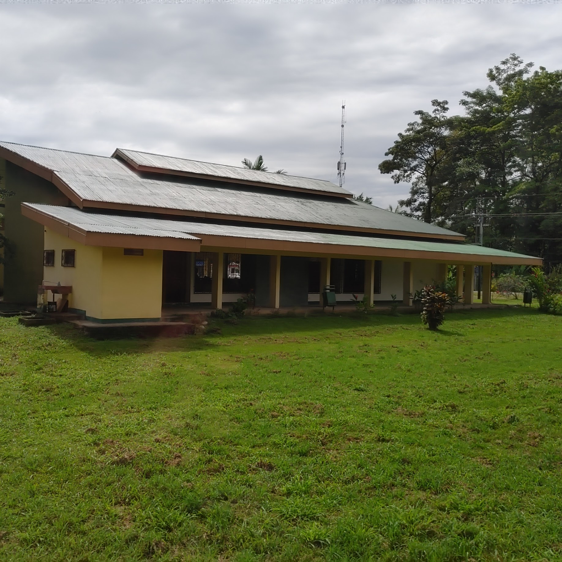
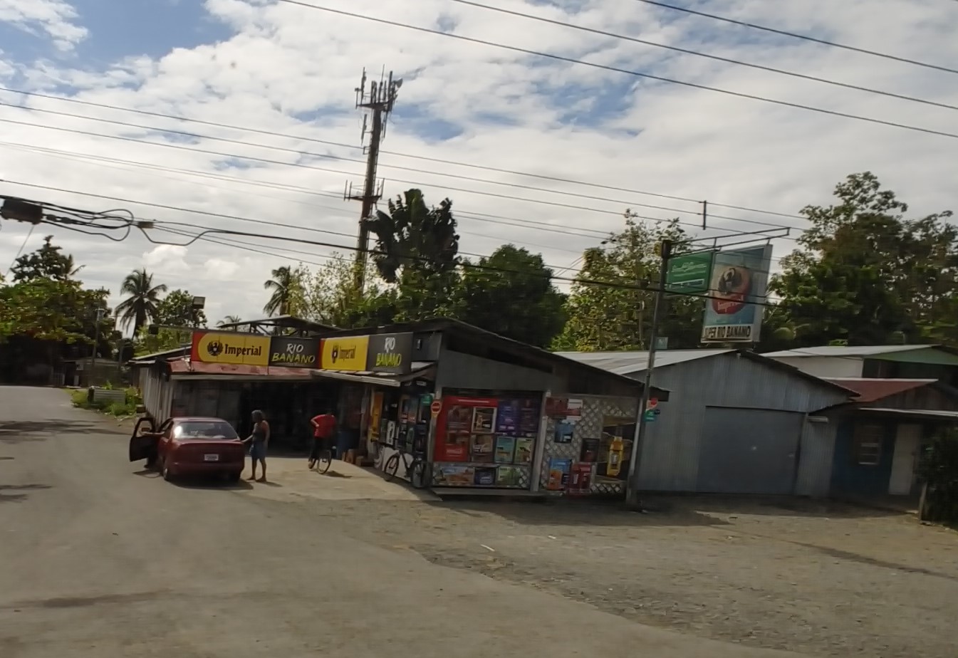
| Typical housing along the road. The bus had previously passed a McDonald's and our guide told us that, in 1970, Costa Rica was the 2nd country in the world to get a McDonald's. The population of Limon, where we docked, is approximately 62,000. |
 |
| Our guide told us this area was the red zone and not a safe place to be. The metal around the homes serve as burglary deterrents. He also said that Costa Rica had less crime than other Latin America countries. But since this is where drugs that have been jettisoned from smuggling boats often washes ashore, the murder rate was high in this district. Having marijuana in small quantities is ok but crack caused the most problems. Cocaine is usually shipped out of the country. |
 |
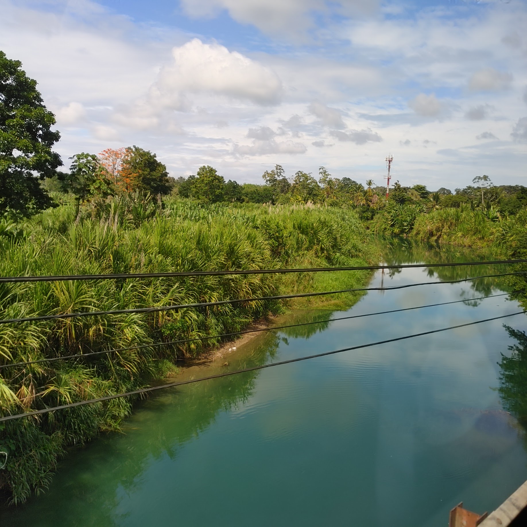
| We crossed a one-lane bridge over this small river. River crocodiles and caiman do occupy the water ways. This country is world-renowned for its abundant and exotic wildlife. There are over 500,000 species of wild animals, many rare, endangered and endemic. Besides the crocodiles and caiman, you can also see monkeys, exotic frogs, sloths, colorful birds, and a large rodent called an agouti. |
 |
| The river continued out to the ocean. The Capital of San Jose was 125 miles away and took 2.5 to 3 hours to get to by highway. The dry period lasts from December to April, but it is always rainy on the Caribbean side which gets 13' of rain annually. The Pacific side gets dry for six months. |
 |
| One of the best-looking homes I saw. Bananas and pineapple grow year around and make up 6% of Costa Ricas GDP. They also grow arabica coffee, mangos, cashews, sugar cane, rice, vegetables, tropical fruits, ornamental plants, corn, potatoes and palm oil. The Pacific side of the country grows cocoa. Mangoes and citrus fruits are not native but come from Asia. |
 |
| We stopped alongside a banana plantation. Banana bunches are encased in blue bags. The blue bags protect the bananas from larger animals down to small ones like wasps, flies and spiders. It also protects the fruit when the trees are sprayed with fungicide and helps prevent bruises and cuts. The bags are blue because they are also a solar filter. A fungus that harmed the fruit appeared about 4 years ago. They were able to eradicate it, but they found that people touring the plantations were the carriers. Therefore, there are no longer tours in the plantations. The plastic is recycled. The trees are also tied together with plastic rope. The plants do not need to be pollinated. 90% of the water in the plant is in the trunk. |
 |
| This crane supported a cable used in the transportation of banana bunches. One bunch of bananas grow on each tree and the tree dies after producing bananas. Each tree is allowed two new shoots to start at the bottom in different stages of growth. As one plant is harvested, a new one can grow and produce bananas three months later. Each shoot will take 9 months from first appearance to harvesting. If more shoots were allowed to grow, the fruit would be smaller. Actually, it's not a banana tree, it's the world's largest herb. When harvested, one worker can carry two bunches, but these can weigh 60 pounds each. |
 |
| Our next stop was at a community where workers who grew, packed and shipped bananas for Dole lived. Workers get a room or home with electricity and water. This community had a soccer field, medical clinic, park and school. Some of the communities have high school. Children are required to go to school starting at the age of 4. This is mainly a social thing at that age. Kindergarten and elementary school is mandatory. High school is free but not mandatory. Food is provided during school hours. During the pandemic, beans and other uncooked food was provided. |
 |
| Trash service is rare in these communities, so the residents burn their trash. |
 |
| There are 5 million people in Costa Rica, a million of whom are Nicaraguans escaping poverty and repression under an increasingly authoritarian Nicaraguan government. The children of immigrants are still required to go to school. |

 |
| The bus traveled down a road that ended at a gate. Usually the gate attendant would open the gate so the bus could turn around. But this one refused so the bus driver had to back up about a 1/2 mile. Did a great job of it too. |
 |
| Since it was Sunday, the mules were getting the day off from pulling cables full of bananas to the processing facility. |
 |
| Banana start that the guide showed us. |

 |
| It was Sunday so families were gathered in the shade at many homes. |

 |
| Community Building. |
 |
| Church. 60% of the country identifies as Catholic. |
 |
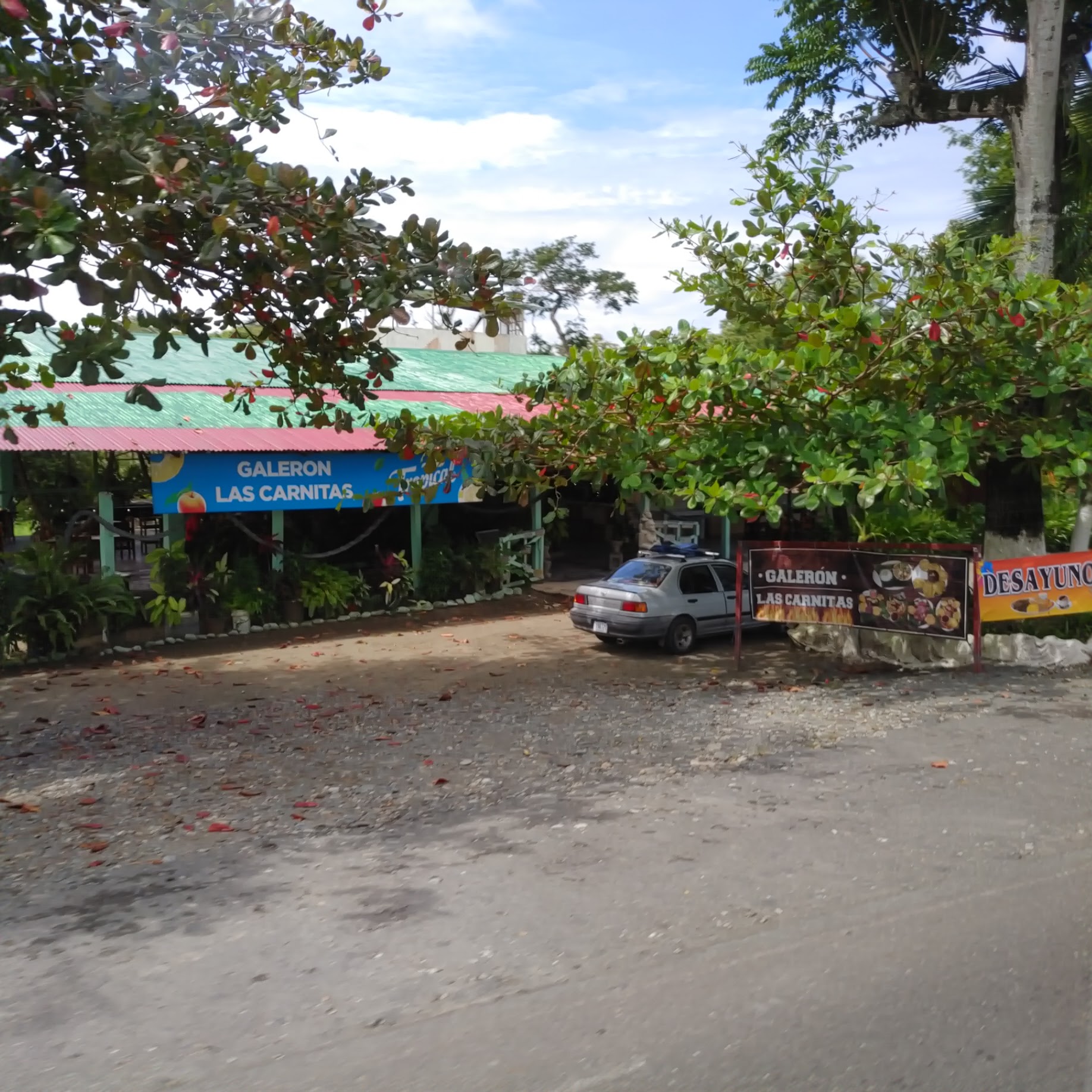
| There were little stores everywhere. |
 |
| Immature bunch of bananas. |
 |
| Dole sign as we entered a community. Notice all the roads are unpaved. |
 |
| Another small store but in this photo you can see the old railroad tracks that used to be used to transport bananas. |
 |
| Basketball court. |

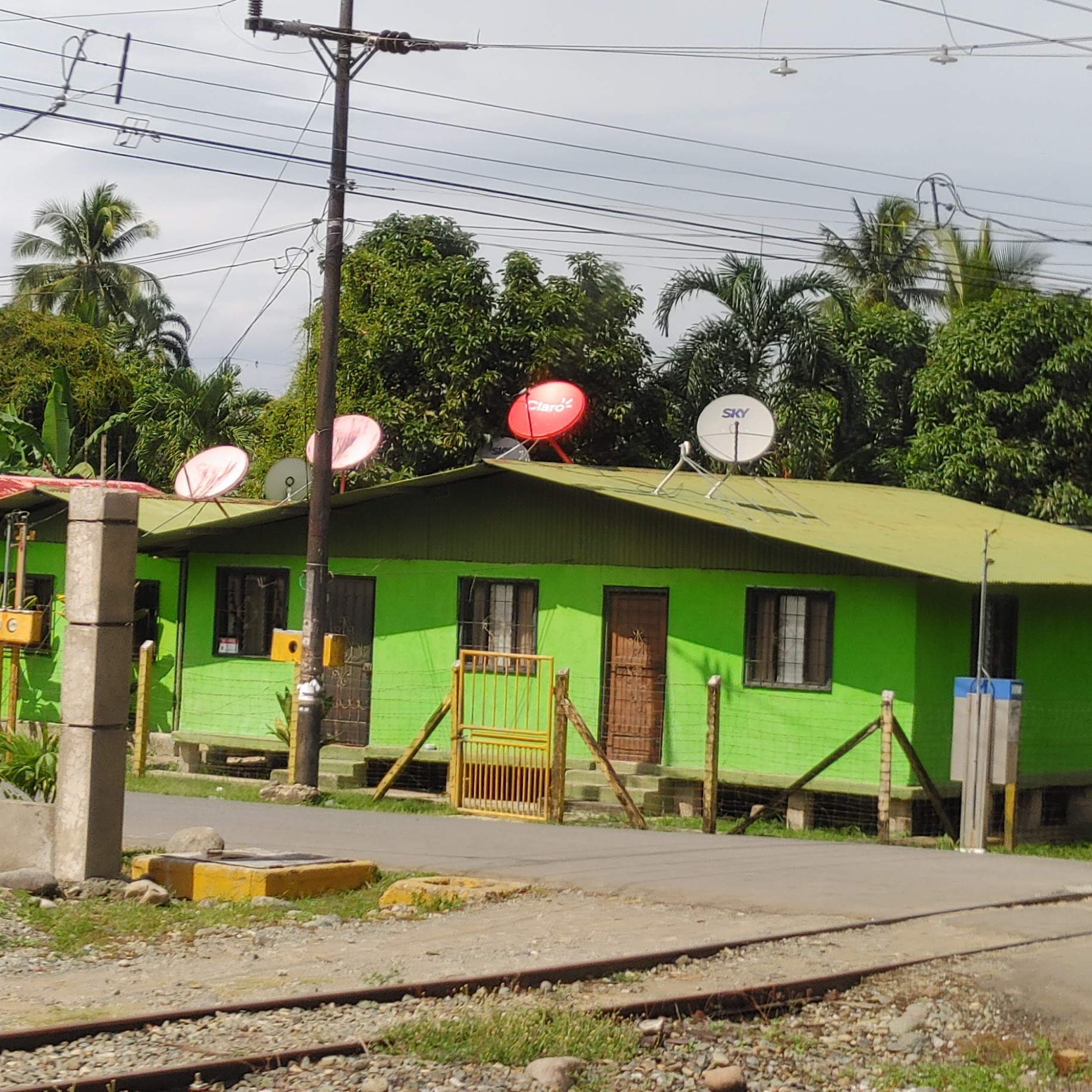 |
| I wonder if the satellite dishes are for different services or just generations of dishes as they changed technology. |
 |
| Many homes were on stilts. |
 |
| Bananas grow from the female flower while the male flower hangs from the bottom of the bunch. |


 |
| Red Ginger is grown as an ornamental plant. |
 |
| The bus driver spotted a troop of howler monkeys in this tree but the angle was wrong for me at the back of the bus. |
 |
| The driver moved the bus and I could finally see monkeys moving in the branches. |
 |
| Spider monkeys and white face Capuchin monkeys can also be found in Costa Rica. |
 |
| This is a cocao pod. There are 6 or 7 varieties of cocao, the start of that delicious treat called chocolate. |
 |
| My sister got this photo of an opened pod during her tour. Not very appetizing, is it? |
 |
| Another river crossing on a one-way bridge. Actually, this is a canal that was made to carry wood when it was a major crop. |
 |
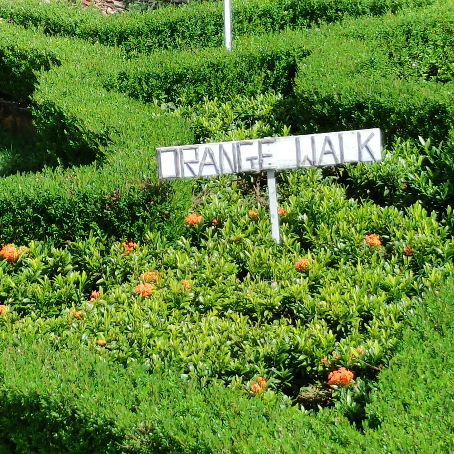
| Orange Poro tree in bloom |
 |
| Some fruits are toxic and have to be processed correctly in order to be eaten. These include tomatoes, passion fruit, mangos and cashews. |
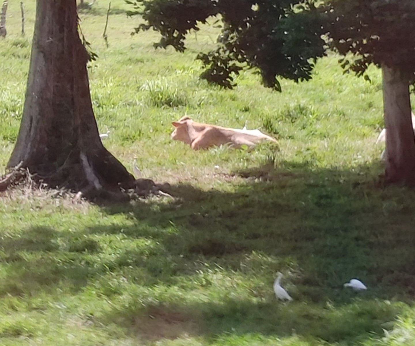 |
| Brahma cattle is raised because it can stand the heat and insects of Costa Rica. Their hide is tough to penetrate so this discourages ticks and flies. They are not grain fed so the meat is lean. |
 |
| We stopped at a fruit market. I didn't go inside but there were plants outside that had signs indicating what they were. |
 |
| Jackfruit is a tropical tree fruit grown in Asia, Africa and South America. Under its thick, bumpy rind is a stringy flesh that you can eat raw or cooked in a variety of dishes. Jackfruit is the largest tree-borne fruit in the world, weighing up to 40 pounds or more. |
 |
| Achiote, is a shrub native to Central America, and its parts have a variety of different uses. The seed covering is the source of annatto, a natural orange-red condiment. The ground seeds are used in traditional dishes in Central and South America, Mexico, and the Caribbean. Annatto and its extracts are also used as an industrial food coloring to add yellow or orange color to many products such as butter, cheese, margarine, ice creams, meats, and condiments. Some of the indigenous peoples of the Americas originally used the seeds to make red body paint and lipstick, as well as a spice. |


 |
| This tree is native to West Africa but widely cultivated throughout tropical and subtropical regions for its edible fruit. It was taken to the Caribbean area with enslaved people from Africa, |
 |
| The soft fruit is eaten as a vegetable, though it is toxic, even fatal, if eaten unripe. |

 |
| Noni fruit. I figured out that this was the same fruit that we were shown in Australia by an aboriginal man who called it cheese fruit. His claim was that it could cure high cholesterol. It is also called vomit fruit because it really smells bad when you crush it. |
 |
| You can see that the one on the bottom right has several flowers on it. That is because each cluster is made up of many fruits fused together. Pineapple is the same. |
 |
| The print is small on this so you might have to click on the photo to enlarge it for reading. |


 |
| What I really wanted was a photo of the red dragonflies. I'm used to blue dragonflies. But my camera and I weren't up to the task. |
 |
| Here's what one would look like if you got it to sit still. |
 |
| Loved these little ornamental pineapples that the guide showed us. |
 |
| Dole banana processing raceway that went over the road. |

 |
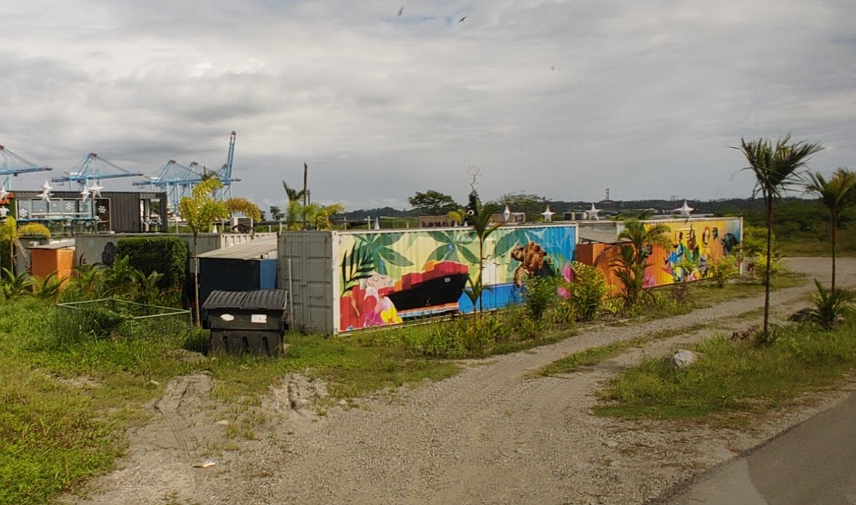
| Old containers made into a cafe. |
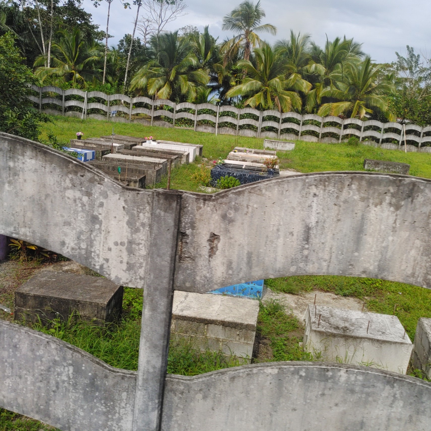 |
| We passed a cemetery, so our guide told us about the procedure after a person dies. Burials happen quickly because there's no embalming process. Families often have communal family burial box. Some have four boxes so as one person dies, the remains that have been in a box the longest is taken out, put in a bag and then put back in the box with the latest body. Some families only have one box, so if grandma died last month and grandpa dies the following year, they take her remains out, put them in a bag, and put them back in with grandpa's body. Usually just the body is placed in these slots without the coffin. This was very common in the past. |
 |
| Tour buses waiting in line to go over a one-lane bridge. All electric in Costa Rica is clean energy. It is mostly generated by hydro and geothermal. Costa Rica has six volcanoes that are currently active so that's where the geothermal power comes from |
 |
| This bridge also had a separate pedestrian bridge. Our guide gave everyone a Cacao sweetie. These are cocao beans fermented and then roasted with caramel. I wasn't a fan. |
 |
| Costa Rican license plate. |
 |
| Sloths in the trees |

 |
| My sister saw one on the move during her excursion. Sloths have no natural predators. |
 | |||
| In 1991 the largest earthquake to ever occur in Costa Rica happened near Limon. It was a 7.8 on the Richter scale and was felt throughout the country as well as in western Panama. Roads all over the country were destroyed by the quake. Several bridges were completely destroyed and much of the railroad system was so badly damaged that it was never repaired. Six feet of uplift raised the coral beds at the coast, and this is what you see in the photo. We also caught some glimpses of white sand beaches. Some of the sand is just Parrot Fish poop in this area. Yeah, the Parrot Fish eat algae off the coral but sometimes they get a bit of the coral also. |
 |
| My sister saw this large spider during her excursion. I'm not sure but I think it might be a golden orb. |
 |
| Interesting barrel chairs on the dock. |
 |
| Back end of our cruise ship. |

 |
| Workers were busy painting the ship while it was docked. |
 |
| I ate my first ever Rueben on the ship. I've had one since that wasn't as good. |
 |
| January 9th was a day at sea so we did a puzzle. This one only had 13 pieces missing. |
 |
| Day 8 we were at Harvest Cay, Belize. Owned in partnership by NCL and the Belizean government, all restaurants, bars and shops on Harvest Caye are entirely Belizean-operated, making it an authentic Central American destination. Harvest Caye is the only destination in the country of Belize with a pier able to accommodate cruise ship berths. This was a long pier so golf carts were waiting to take people ashore. |
 |
| Traveler Palms we saw as we walked ashore. |
 |
| Looks like the shoreline here is encased in mangroves. |

 |
| We just walked through the island, bypassing shops on our way to the boat that was transporting us to the mainland for our tour. |
 |
| There are many activities offered on and around the island, including jet skiing, fishing and ziplining. |
 |
| There was a lighthouse on the island and many different types of boats to take people off on different excursions. |
 |
| As we left the harbor, we sailed past the ship. |
 |
| On the boat ride to the mainland, we were told that proper response to the question, "How was your visit to Belize?" was supposed to be "Unbelizeable". |
 |
| Someone's private island. Might be Little Harvest Caye. |
 |
| We docked at the Harvest Caye Marina near the dual town of Mungo Creek/Independance which was started in 1981, the year Belize got its independence from England. Belize is the only official English-speaking country in Central America due to its status as a former British colony rather than a Spanish one. Many Belizeans identify much more as a Caribbean nation, alongside the likes of Jamaica and Barbados than a Central American nation. There are three dialects of creole and broken English in the country. The Belize dollar is worth about US 50¢. Fuel is sold by the US gallon and can be paid for in Belize or US dollars. So, this fuel is approximately US $6.08/gallon. All oil pumped in the country is exported because they don't have any oil refineries. Gas is expensive so the guide's acronym of BMW stood for Better Me Walk. Yaman is broken English for yes. |
 |
| We boarded buses that traveled at least five minutes on very rough unpaved roads. The bus terminal had buses every hour to Belize City. It is a five-to-six-hour ride. Our guide passed around placards with a lot of information about Belize. The national bird is the Keel Billed Toucan due to its strength, beauty and diversity. The national animal is the Tapir, also called the mountain cow although it is not a cow. It is closely related to the horse and is also kin to the rhinoceros. The tapir is a vegetarian. At maturity they can weight 500 to 600 pounds and are strong swimmers. There are five species of cats including jaguars, pumas, jaguarundi and ocelots. The national flower is the Black orchid, an air plant with a tiny flower. There are two political parties. The national dish is rice and beans which is usually served with stewed chicken, beef or pork, and a fried plantain. |
 |
| Belize Coat of Arms displays their national motto: “Sub Umbra Floreo”. These Latin words mean, “Under The Shade I Flourish”. It is displayed in the middle of the Belize flag on a blue background with red strips at the top and bottom of the flag. The coat of arms recalls the logging industry that first led to British settlement there. The figures, tools, and mahogany trees represent this industry. British Honduras became Belize on September 21st, 1981. The struggle for independence started in 1950. Logging mahogany was the mainstay of the economy at that time, as the lumber was shipped to England. Since it takes 80 to 90 years for a mahogany tree to mature, that industry quickly languished. Mahogany is now the national tree. |
 |
| We had an hour-long ride to our first stop so the guide told us a lot about Belize. School is mandatory for primary and secondary students. At age four, they start kindergarten. Primary school for 8 years then High school for 4 years. Most Mayans live in the south of Belize. There are many different ethnicities including, Mexican, Guatemalan, Muslim, and Nicaraguan. We passed through a town of Guatemalan immigrants. There are over 6,000 species of birds in the country. There are four highways of which, the Southern Highway is part of the Pan American Hwy that connects Alaska to South America. It runs for over 19,000 miles. I didn't get a good picture of the road but I saw flat, concrete ribbons alongside the paved road. Belize has a population of just over 400,000 over its 8867 sq miles of land. This is approximately the size of the U.S. state of Massachusetts or Wales in the U.K. It is divided into six districts and is 30% rainforest. There are 200 offshore keys and three atolls. Belize is famous for the Great Blue Hole, a giant marine sinkhole off the coast. The hole is circular in shape, 318 m (1,043 ft) across and 124 m (407 ft) deep. The Great Blue Hole is a popular spot among recreational scuba divers. The country has 21 banana farms. You can buy 16 bananas with US$1. Same with oranges, which are only exported as a concentrate. Coconuts, mangoes, papaya, cashews and sugar cane are also grown in the country. There are tilapia and shrimp farms while fisherman harvest conch and lobster from the sea. But the backbone of the economy is tourism. There are two seasons, rainy, between June and December, in which they get 170 inches of rain in the south; and the dry, hotter season. March, April and May are the hottest with temperatures between 100° to 110°. |
 |
| The money used in Belize is called the Belize dollar, often abbreviated as BZD. The official exchange rate is permanently set at 2 BZD to 1 US dollar, although some banks provide a slightly different rate. Belizean bank notes are world renowned for their beauty and colorful designs. All bank notes are printed by the British firm De La Rue, Limited. As a former British colony and current member of the Commonwealth, Belize has the British King or queen as its head of state. Currently all bank notes in Belize depict the official portrait of the queen on one side. The obverse of Belizean bank notes depicts indigenous wildlife species as well as notable architectural landmarks such as bridges, buildings, or ancient Maya temples. I'm sure new notes with Charles the III will be printed soon. |
 |
| Our first stop was the Belize Spice Farm and Botanical Gardens. We were here to see how the spies were grown and hear how they were harvested. |
 |
| Everyone funneled through this walkway to an area that contained trinkets and food for sale. This area has been a spice farm for 15 years and has 50 employees. |
 |
| I recognized the heliconia from a trip to Hawaii. There are different varieties of heliconia and I believe this is shrimp heliconia. |
 |
| We were greeted with a cup of orange juice. |
 |
| We walked out onto the patio, which had a area where we could easily board a trolley that was pulled by a tractor. The trolleys were made at the farm. |
 |
| The tractor pulled the trolley through the farm, and we enjoyed the view and commentary as we traveled along. The farm occupies 500 acres, 20 of which are used to grow Valencia oranges. The owner of the farm is from India. He practiced medicine in the US and is now a farmer. |
 |
| I believe they called this a firecracker tree. |
 |
| The tractor operator would stop the tractor, hop off and collect parts of plants for us to feel and smell. This is a leaf off the sandpaper vine. Yes, it feels like sandpaper. |
 |
| The garlic vine naturally repels insects. |
 |
| Size of the bush and the tractor operator selecting vines for us to smell. Yes, it smells like garlic. We also were able to smell lemongrass. |
 |
| The underside of the Victoria Amazonica, a water lily from Brazil that have very large leaves, up to 3 m (10 ft) in diameter. They float on the water's surface on a submerged stalk, 7–8 m (23–26 ft) in length. The farm grows them in the pool you can see behind the tractor operator. |
 |
| A leaf off a Butterfly Pea plant. The guys said it was good for eyes and ears when made into a tea. I later read that a tea made out of the flower may help ensure skin and hair health, promote weight loss, and reduce blood sugar levels. |
 |
| This is turmeric, a yellow ginger plant root. They pointed out the teak trees from SE Asia that are hard and slow-growing and a site where they are building cabanas so people can stay on the farm. |
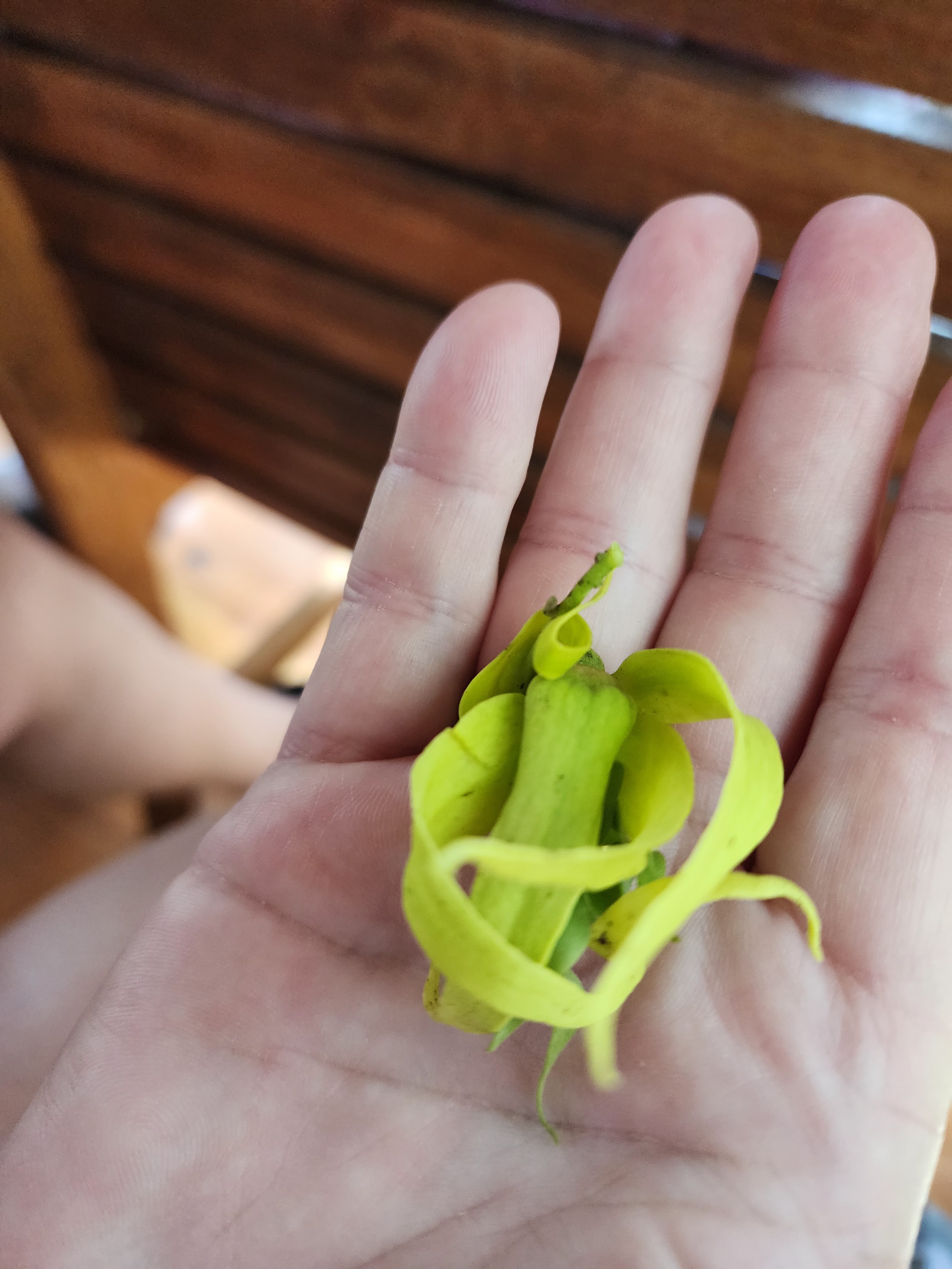 |
| Native to Southern India, Java, Malaysia, the Philippines and other Pacific islands, the Ylang-Ylang tree, Cananga odorata, is the true Chanel No.5 Perfume Tree. Its common name is Ylang-Ylang, can be pronounced (ee-lang ee-lang) and is among the most celebrated flowering trees in the world. Boy did this flower smell good! |
 |
| Looks like they gathered coconuts and left them in a pile. Some were growing. |
 |
| These are curry tree leaves. They are used in many dishes in the Indian subcontinent. |
 |
| Moringa has been used for centuries due to its medicinal properties and health benefits. It also has antifungal, antiviral, antidepressant, and anti-inflammatory properties. |
 |
| Nutmeg are grown for two spices that can be derived from its fruit: nutmeg, from its seed, and mace, from the seed covering. They split naturally on the tree. You need a male and a female tree in order to grow the fruit. But don't eat too much nutmeg, both raw nutmeg freshly ground from kernels and nutmeg oil have psychoactive effects. |
 |
| Leaf of a cinnamon tree. Notice how the veins are parallel to each other. What we know as cinnamon is a shaving of the inner bark of the tree. It rolls up naturally when dried. |
 |
| Bilimbi, commonly known as cucumber tree or tree sorrel, is a fruit bearing tree and is a close relative of carambola. The fruit is sour. |
 |
| They built a picturesque bridge over a wetland and weddings are held there. |
 |
| These are vanilla orchid plants. The vanilla orchid grows on a vine, and on vanilla farms, each vine needs its own tree to grow on. It can take up to three years for a vine to reach maturity and begin to flower. |
 |
| There goes our driver, headed out for another sample. The process for creating the vanilla we have in our cupboards is quite lengthy, which contributes to its cost. First it is pollinated with a toothpick. Each flower is only open for 6 hours so that's a rush job. It takes 6 more months before the single bean from each flower is mature and ready for harvest. They are mature when the tips turn yellow. These beans are boiled and separated out and put into airtight boxes to stop the ripening process. This fermentation step lasts for a couple months. The beans are then laid out on the drying floor for 4 to 6 months. After that they soak in brandy for six months. So overall, this is at least a 1.5-year process to produce vanilla extract. |
 |
| These are peppercorns off a black pepper vine. They are ground to make black pepper. Riper ones are soaked in water and the skin picked off to produce white pepper. All the spices are handpicked. The most expensive spices are saffron, vanilla, cardamon and nutmeg. |
 |
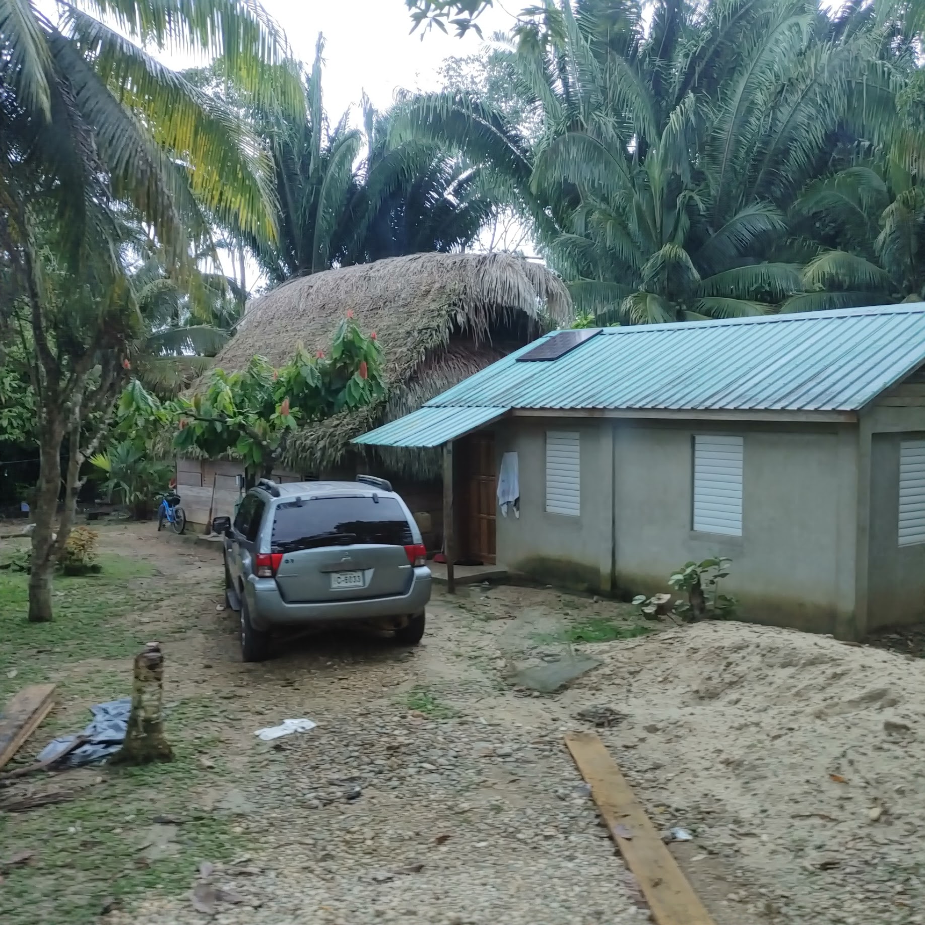
| Typical homes seen along the way to our next stop. |

 |
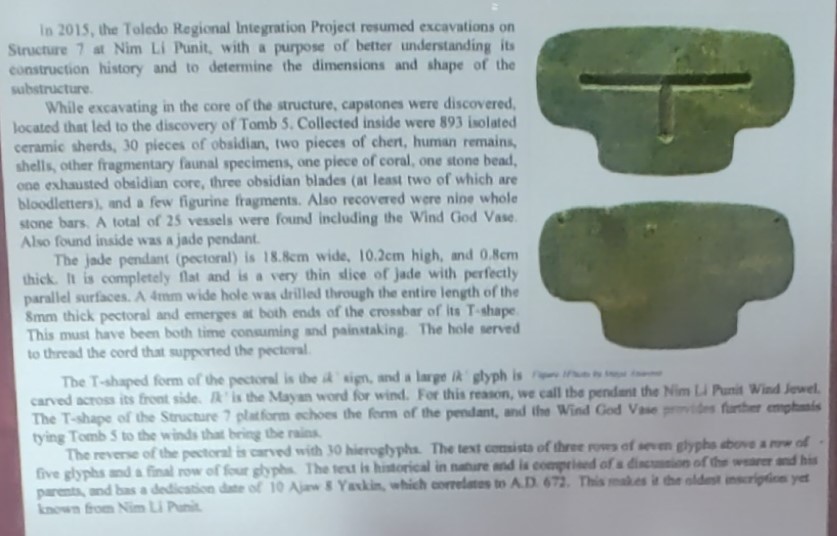
| Nim Li Punit is a small Mayan archaeological site. Its modern name means “Big Hat” in Kekchi Maya after an image of a ruler depicted on a stela recovered from the site. Its original name has yet to be deciphered. The site is located upon the leveled summits of small hills within a tropical forest situated in the foothills of the Maya Mountains. It was established to exploit the areas natural resources and to take advantage of the extensive trade network that existed in the region. It is situated 9 miles/15 kms northeast of, and was contemporaneous with, the Maya site of Lubaantun which was the main political/economic center in the region. The population has been estimated between 5,000 to 7,000 individuals. |
 |
| The bus traveled up an unpaved, bumpy road to the front of the visitor center. Once off the bus, we climbed a couple sets of stairs to get to the entrance where we were guided into a room with three stealae. You may need to click on the photo to enlarge for reading. |


 |
| Along the top of one wall was a timeline of human development. Due to extreme glare, it was hard to get a readable photo. |
 |
| Information on the timeline could be divided into events happening in the world, those for Mesoamerica and those that were happening in Belize. |


 |
| Nim Li Punit was rediscovered by oil prospectors in 1976. Conservation began in 1980. Below is a photo of each stela followed by a photo of the description of the stela. |

 |
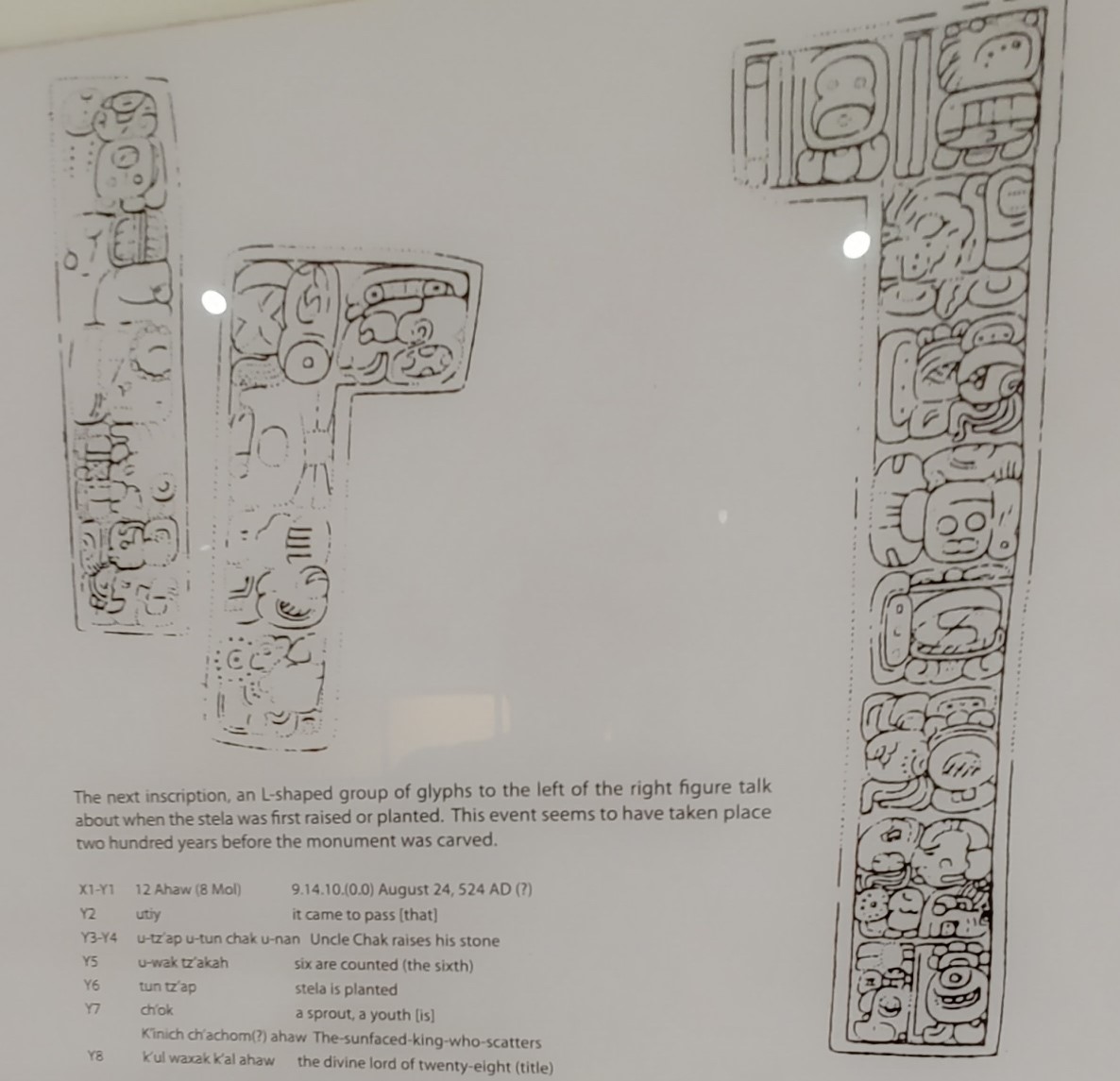
| Closeups of this description are the next two photos. Flint was used to create the stela inscriptions. |


 |
| Closeups of the words on this description follow. |


 |
| Some of the artifacts found at the site. |


 |
| Remember, click on the photo to enlarge it for reading. |
 |
| The “Wind Jewel” is a carved pectoral cut in the shape of the Maya “Ik” glyph, which is similar to a truncated “T”. The glyph itself appears on the front side. The glyph stands for “breath of the gods”, or wind. |

 |
| Our guide just waiting to show us the site. |
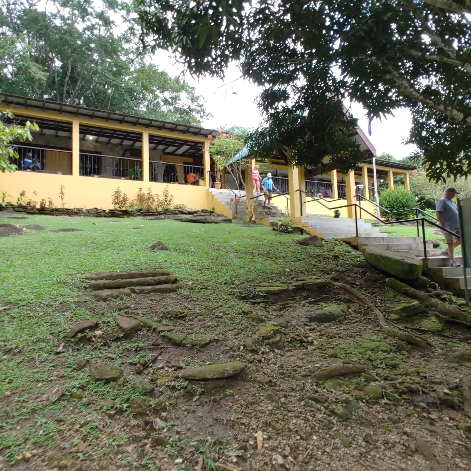 |
| The front of the museum. You can see the stairs we had to climb to get to it. |
 |
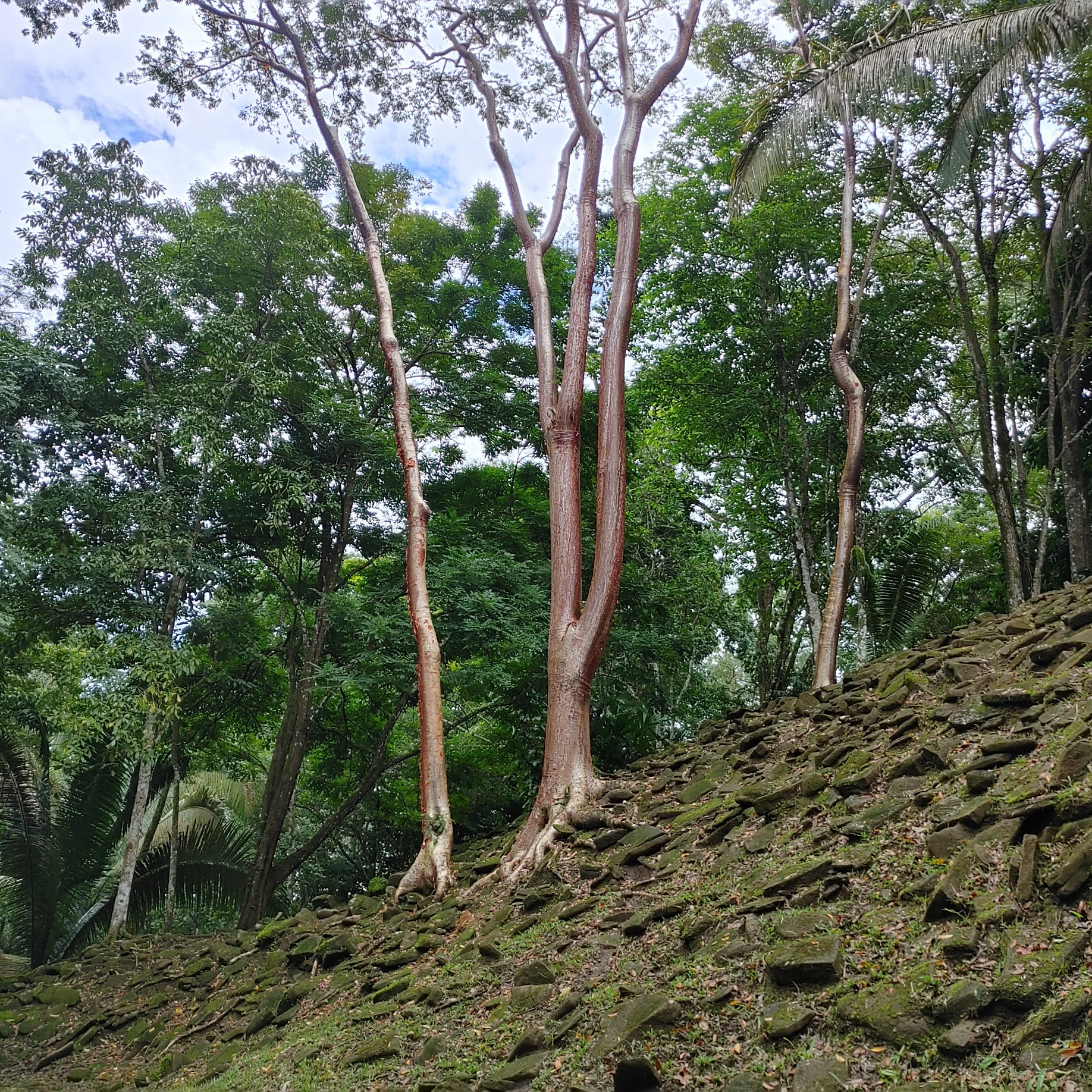
| Like any ancient site, trees and other vegetation hide the structures. |

 |
| The first part of our walk was on this gravel path but later on it was muddy due to the recent rains. I believe the tree is a Ceiba, a tree that had great symbolic importance to the ancient Maya, and its name in the Mayan language is Yax Che (“Green Tree” or “First Tree”). according to Maya mythology, it was the symbol of the universe. The tree signified a route of communication between the three levels of earth. Its roots were said to reach down into the underworld, its trunk represented the middle world where the humans live, and its canopy of branches arched high in the sky symbolized the upper world and the thirteen levels in which the Maya heaven was divided. |
 |
| 5,000 to 7,000 people live here. Mayan wrote about their culture, gods, and live in general in detailed records they created on the pages of bark-paper books called codices. In the mid-sixteenth century, Franciscan missionaries burned nearly all of the Maya’s written records in an effort to eradicate their religion. Today, only three or four Maya codices remain. |

 |
| The guide said that the game was played with a 4-to-5-pound ball which had to be put through a hoop to end the game. The loser endured bloodletting but not sacrifice. The people were short, and the ball could only be touched with the shoulders, hips and knees. |
 |
| The fronds from the Heart of Palm tree are used to thatch roofs. |

 |
| Mayan observed thirteen twenty-day months plus 5 days to form each calendar year. |
 |
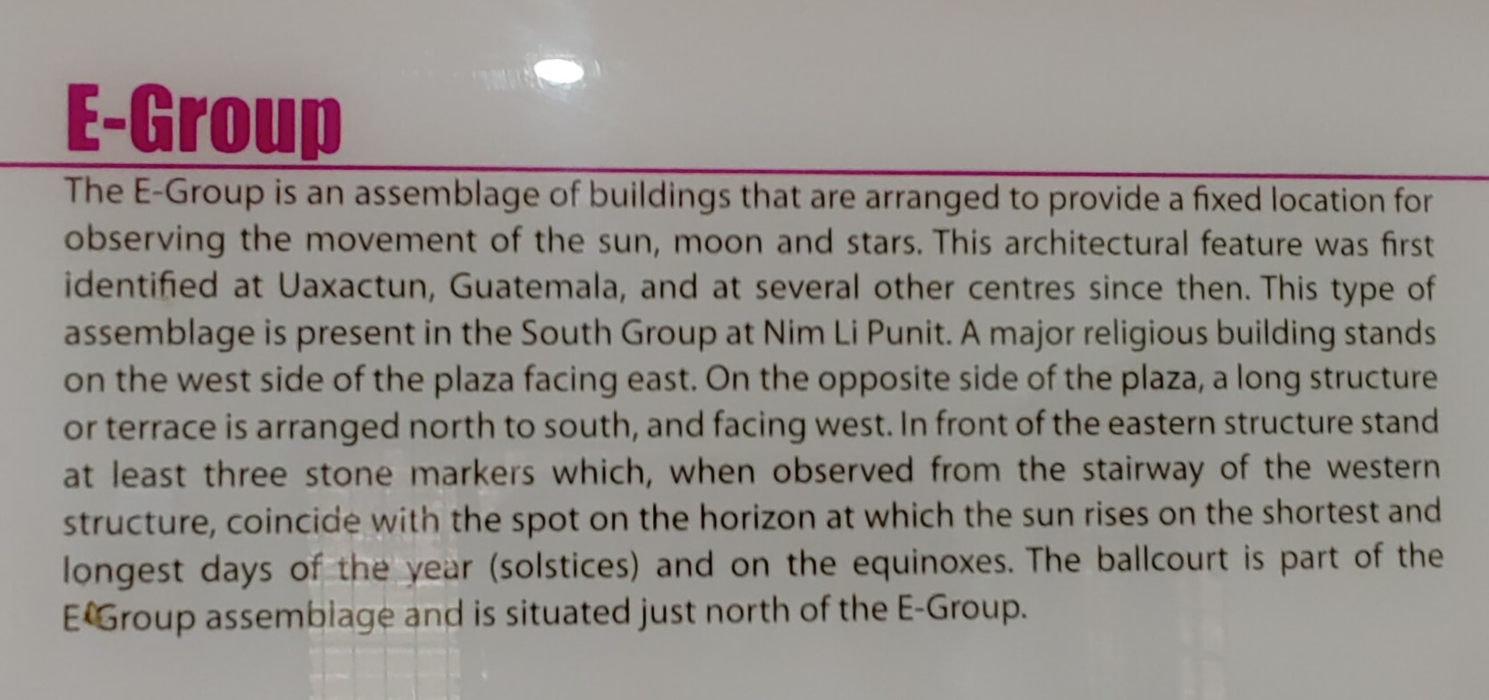
| Worn stela standing at E-Group. |
 |
| This is Stela #1 still in place at E-group. |
 |
| Stela #1 is on the Belize $2 bill. |
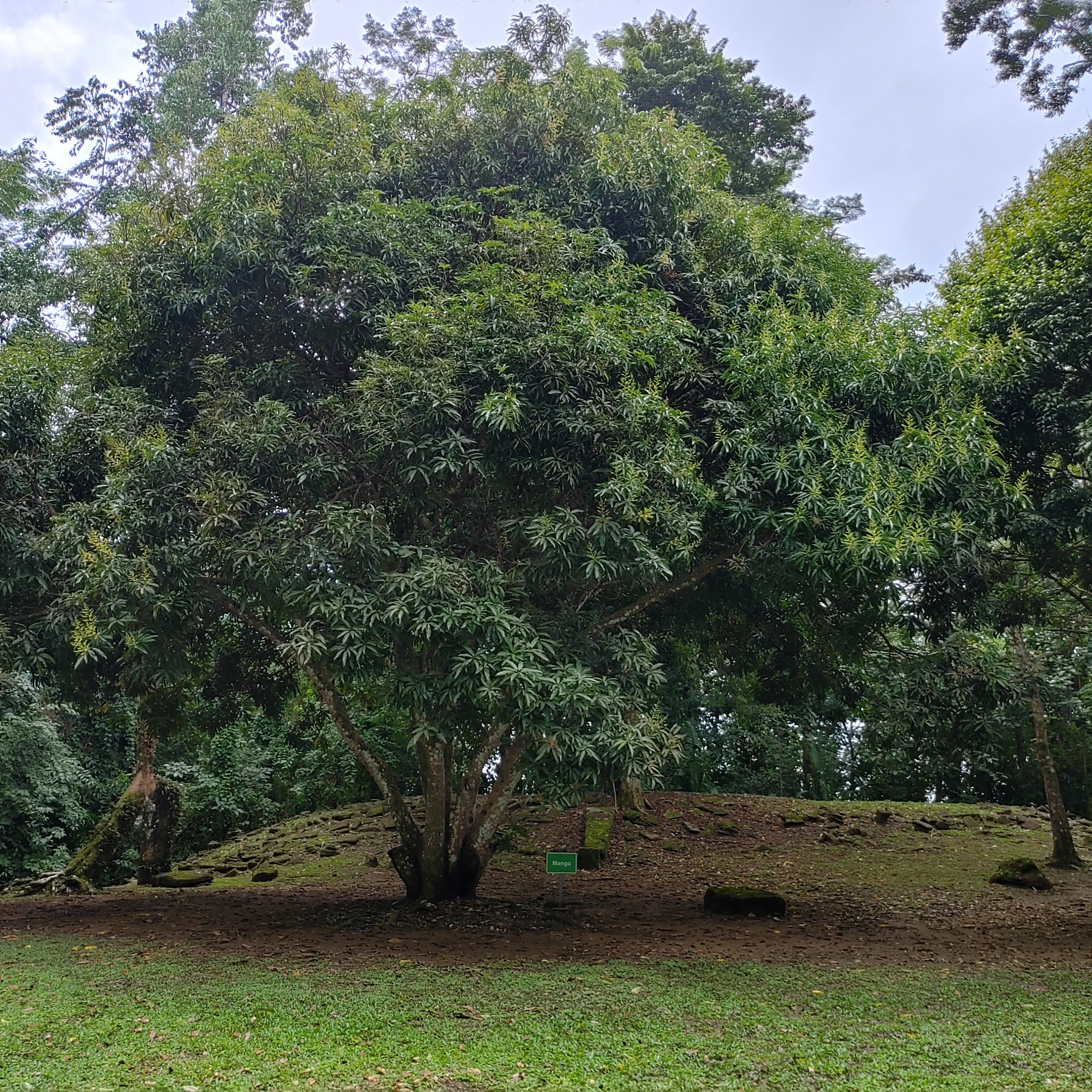 |
| Mango tree at E-group. |
 |
| We walked a short distance to the location of Tombs 2 and 3. These were made with sandstone from the riverbed without any form of mortar. |


 |
| Mahogany tree located between Tomb #1 (under roof in background) and tombs #2 and #3. |
 |
| The bones are now at the Museum of Belize long with much of the rest of the items found at this site. |
 |
| Excavations took place between 1979 and 1986. |


 |
| Not much left of the royal residence. |
 |
| Gumbo limbo trees |
 |
| Huge termite nest that fell out of the gumbo limbo tree. These trees have smooth bark so they are slippery. |
 |
| Landscaping in front of the museum. |
 |
| When leaving the site, we had to walk through, or past, a vendor shelters and down a long, flight of stairs to get to the bus parking lot. The road to and from the archeological site is steep. |
 |
| Our guides grandparents live at the bottom of the hill, so he played at the ruins as a kid. |

 |
| This and the next six photos are sights along the way back to the pier. |


 |
| We took the shuttle boat back to Harvest Caye and boarded the ship. |
 |
| Beautiful end to another enjoyable day. |

 |
| Approaching Cozumel, we saw this pyramid shaped structure on the far shore. This is greatly zoomed in as, with the eyes, I could only tell it was shaped like a pyramid. Never did figure out what it was. |
 |
| Approaching San Miguel de Cozumel |
 |
| I had read about the problem of algae bloom around Cozumel. The putrid macro algae, or sargassum, is being brought from somewhere between the Atlantic Ocean and Brazil by ocean currents. I'm assuming this is what we are seeing here. |

 |
| But no, we went around the front then backed alongside the pier. |
 |
| In place but not yet secured so the dock crew could start getting ready for passengers to depart. |

 |
| This is the pier from above so you can see how the pier take a turn before heading to shore. |
 |
| At the end of the pier, I joined the group for my excursion. Many other excursions were meeting in the area pictured. |
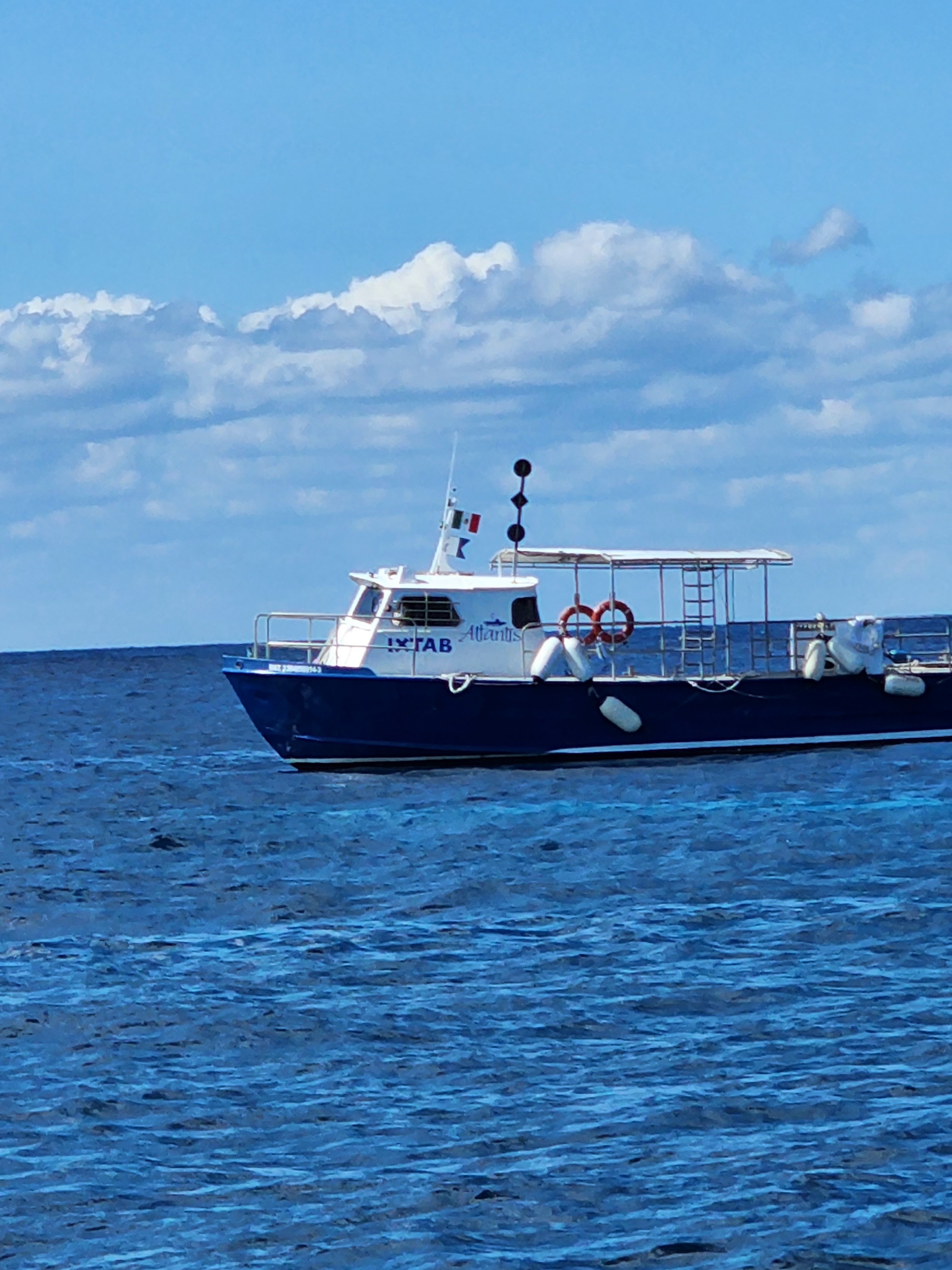 |
| While I got on a bus, my sister got on this boat to go to her submarine trip. |
 |
| Map of the island. The port we landed at is on the left side of the island where you can see three crooked and one straight pier. Ours was the top crooked one. My excursion went down the left coast, around the bottom of the island before heading north on the right coast and across the island. |
 |
| On August 24th, 1821, Mexico gained its independence from Spain. It came by its name thru the Mayans. They considered Cozumel to be a sacred sanctuary and called it “Cuzaam Luumi” which means land or place of the swallows. They later shortened these two words to “Cuzamil”. When the Spanish arrived, the name adapted phonetically from “Cuzamil” to “Cozumel”. The Spanish arrived in Cozumel for the first time in 1518, before starting their conquest of the New World. Mayans and others lived on the island but by 1600 the island had been completely abandoned. In 1848, people who sought refuge from the “War of the Castes” on the Yucatan Peninsula, took refuge on the island. |
 |
| The buses exit from the parking lot included going down this narrow alley. Once the driver made the tight turn into the alley, we had to wait for the delivery truck to leave. The guide supplied us with a lot of information as we traveled. The island depends on tourism. Six to eight cruise ships stop at Cozumel each day. There are three cruise ports, and they are thinking of building a fourth. The airport sees 5 to 6 planes arrive each day and that increases to twelve on the weekends. |
 |
| There were a series of painted tree trunks in the alley. I've seen tree trunks painted white as a sunshade but never multiple colors. Eighty to ninety percent of the island is covered in vegetation. There's no factories and no agriculture. |
 |
| I was trying to get a photo of the neat mural on the side of the building, but all the trees made it difficult to see. You can see the bottom of the trees are painted white here. There were several nice murals along the way as well as a Hard Rock Cafe and a Hooters. McDonald's established a restaurant twice but was beat out by Burger King. Taco Bell has also failed to survive. It takes approximately 20 Mexican pesos to make a US dollar. |
 | ||
| There were lots of pharmacies for cheap medication, but I didn't have time while in port to look around. We passed by a street called Calle Dr Adolfo Rasado Sales after an extremely well-liked physician who often provided consultations free of charge. He was so popular that after his death in 1943 grateful residents renamed the street that he lived in his honor. |
 | |||||||
| Our first stop was for a Taquila tasting. Of course, we had the "opportunity" to purchase bottles after the demonstration. Taquila is 100% from the blue agave plant which take 8 to 10 years to mature. Blue Agave is grown in only five states in Mexico and not grown at all on Cozumel. To make tequila, first the leaves are removed from the blue agave plant. They are cooked, mashed by a stone wheel, fermented and distilled twice. There are five types of tequia: First is Tequila Blanco. Also known as silver tequila, blanco is straight from the distillation process and unaged. Next is Tequila Joven. This is a mixture of aged and unaged tequila. Third is Reposado. Tequila reposado is tequila that is aged in American or European oak barrels for at least two months and up to a year. Fourth is Anejo. Tequila añejo is tequila aged in American or European oak barrels for at least a year. And the highest grade is extra añejo which is aged for at least three years. |
 |
| After a presentation of how tequila is made, we were able to taste three different varieties - Joven, Crema de Horchata and Licor de Cafe. Only the Joven was actually tequila. Once flavor is added to tequila, it becomes a liquor instead of a tequila. I didn't care for the Joven, liked the Horchata and loved the Cafe. No, I didn't buy any. Didn't have room in the suitcase and it was $40 a bottle. Worms used to be put in the bottle to indicate that it was true tequila. Another liquor that uses agave is Mescal. It uses 24 different types of agave. |
 |
| Saw this figure in front of the tequila tasting place. Maybe a representation of a tamandua anteater? |
 |
| A little further down the road we stopped at the Myan Cacao Company. |
 |
| There were shops in the yellow buildings, but we headed straight to our tour. |
 |
| The tour ended at this shop that we had passed on our way in. |
 |
| There were several large, noisy parrots around. They first thing they wanted us to understand was the difference between Chocolate and Cocao. Cocao is the plant on which the cocao bean grows. Many ingredients are added to cocao before you have chocolate. Cocao originated in Venezuela and Columbia but is now grown in Africa and South America. |
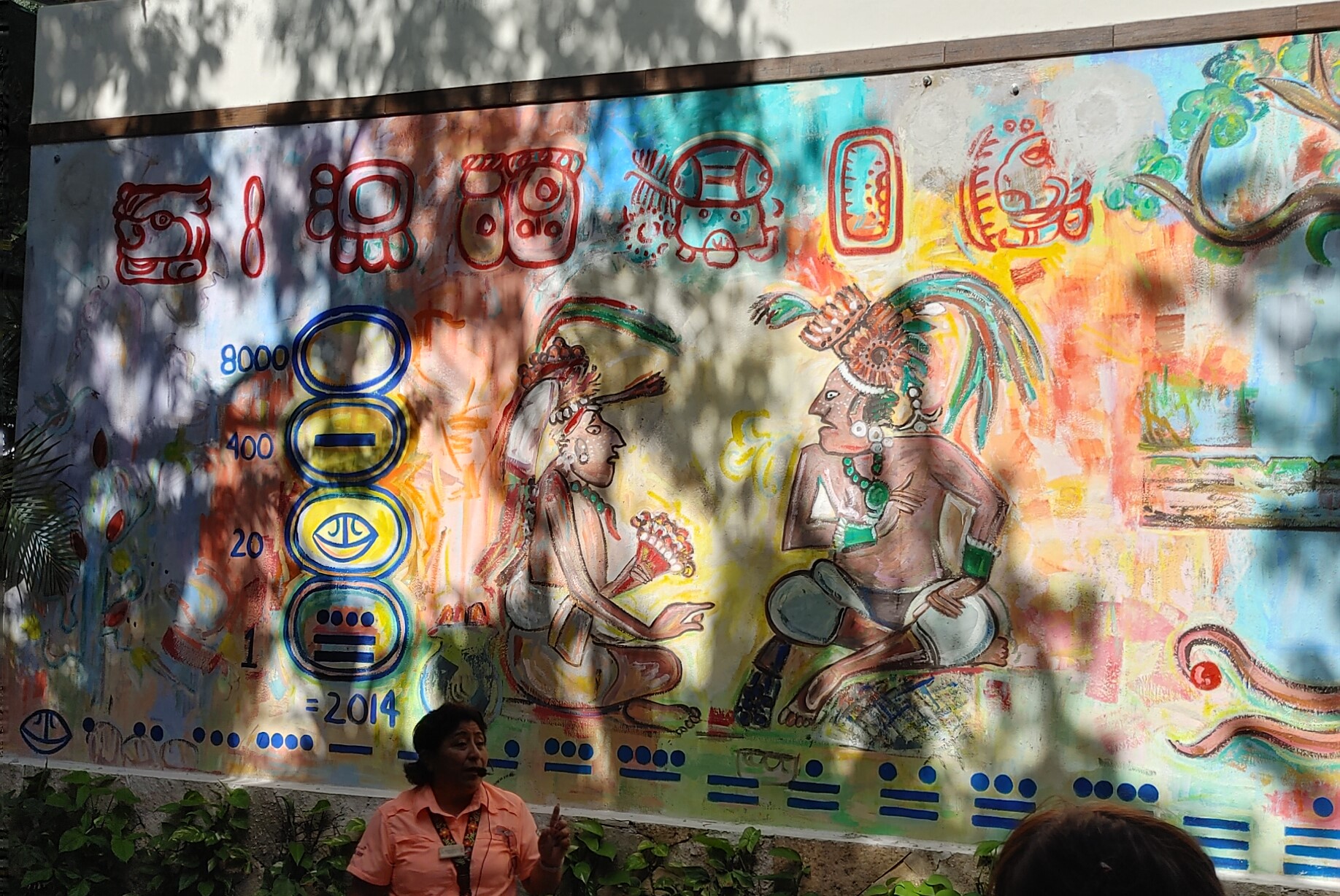 |
| Our guide stopped in front of a mural to explain the Mayan numbering system. Terrible photo, huh? That's just how the shadows were hitting it when I was there. |
 |
| Searching online, I found two photos, that when put together, show most of the mural. |

 |
| Mayan numerals are made up of three symbols; zero (a shell), one (a dot) and five (a bar). So here we see zero, one, two, three, four. five and six. |
 |
| This would be ten, eleven, twelve, thirteen and part of fourteen. |
 |
| Numbers after 19 were written vertically in powers of twenty. This set represents 2014. |

 |
| Click on the photo to enlarge for reading. Monkey helped the Mayans find cocao beans. The beans gave the monkeys energy from the caffeine. |
 |
| Only the highest classes of Mayans were allowed to have cocao. It was given to warriors. |
 |
| There are 24 to 40 beans in each pod. |


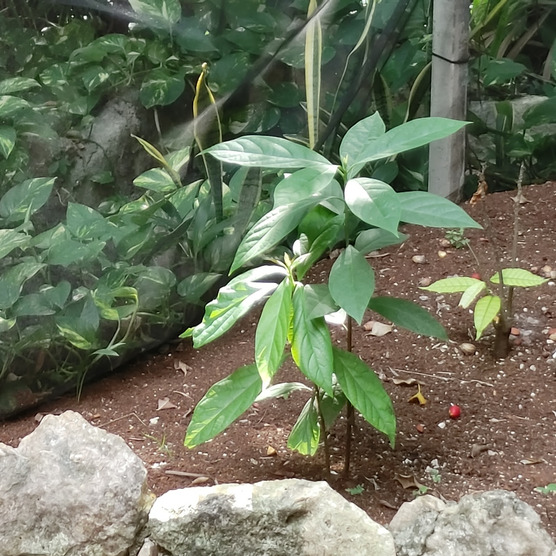 |
| A young cocao plant |
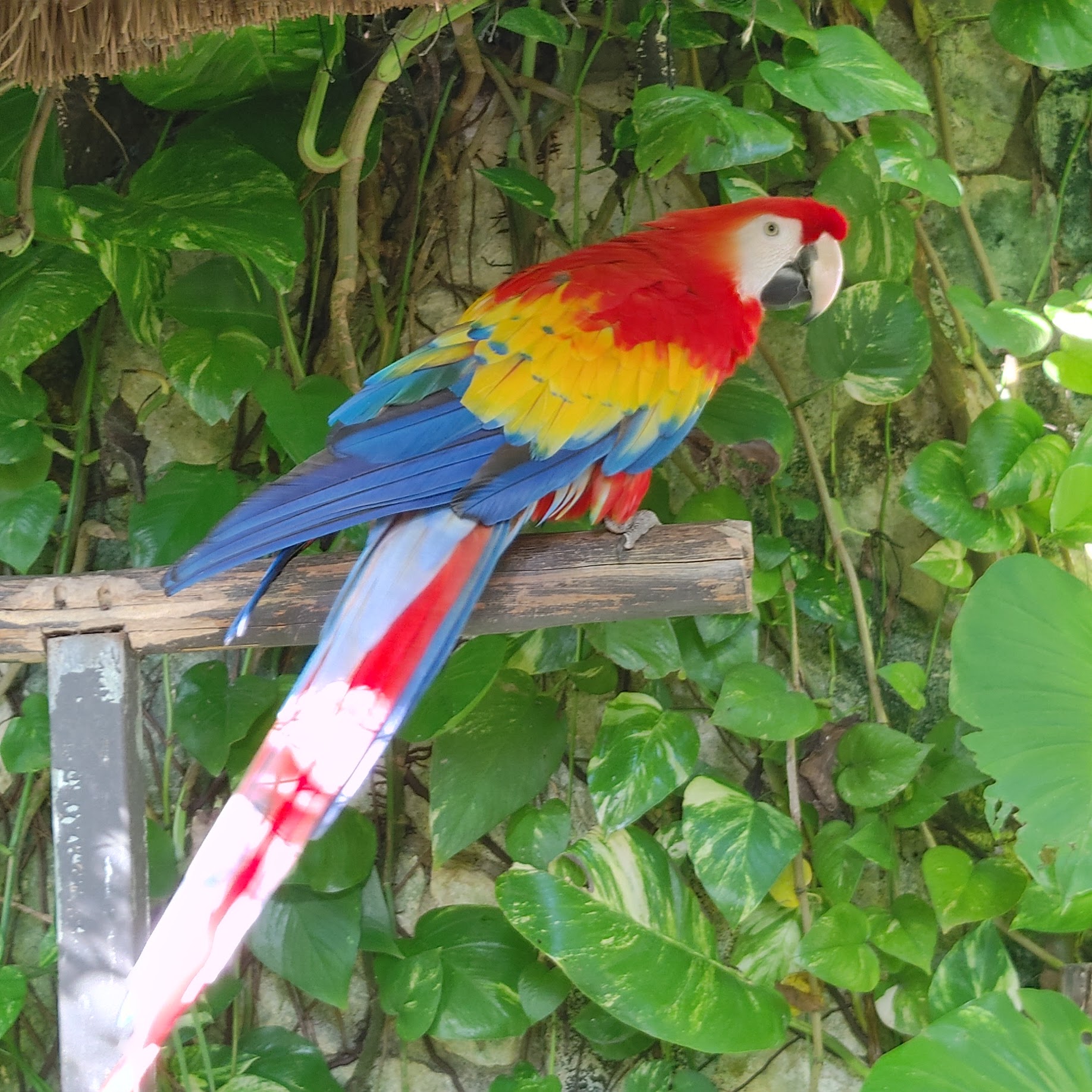 |
| This bird messed with me for a while as I tried to take a photo. It would make sure it had its back to me, but I finally caught its profile. |
 |
| Homes sometimes had two levels of hammocks. |
 |
| A Mayan home might have an Alter for the Dead. |

 |
| Well |
 |
| We were given a very small tortilla made out of a traditional recipe that included limestone. The filling is a mild tasting mole. Sometimes they have Sikil Pak or Mayan Pumpkin Seed Dip. It is made out of pumpkin seed, cilantro and tomato sauce. |
 |
| Sign with information about Melipona honey |


 |
| As we entered the exhibit hall, we were given a bite of chocolate that they had made like the Mayans original created it. It was a little crunchy. |
 |
| We took seats in the bleachers and watched this guy make chocolate. He referred to himself as the Mexican Willy Wonka but his name was Eduardo. He explained that it takes a cocao tree 7 years to grow. Seeds are fermented, dried and ground. |
 |
| He ground the seeds on this motor then proceeded to add different ingredients, including allspice, cinnamon, Small red seed paprika, hot water, sugar, honey, and vanilla. |
 |
| At the end of the tour we were led through a shop where we had the "opportunity" to buy chocolate. They gave out samples. The dark chocolate mint was very good but each bar costs $9. Ouch! |
 |
| The toilet didn't' have a seat and the flush lever was off to the side. |
 |
| Fancy cocao pod sinks. |
 |
| Our next stop was the El Mirador Lookout Point. |

 |
| The bus we traveled in. |
 |
| Shops lined up at the lookout point were just waiting for tourists to buy their goods. |
 |
| I wandered around to check everything out while most of the passengers flocked to the outdoor food vendor for a bite to eat. The restaurant served the catch of the day because they don't have electricity to store food. The catch can include mahi-mahi, barracuda and snapper. |
 |
| This poster showed where the different kinds of agave are grown and what type of liquor they produce. They gave free samples of mescal. |
 |
| Loved this artwork made out of a coconut. |
 |
| After we left the lookout point, the guide told us about the beaches and island as we rode along. The barrier reef just off the coast is the 2nd largest in the world after the Great Barrier Reef off the east coast of Australia. It is the Mesoamerican Reef and was discovered by Jacques Cousteau. This is San Martin Beach. A Corona beer commercial was once filmed here. |
 |
| There's no electricity on the east coast of the island. Turtles nest on this side. |
 |
| View of the road as the bus turned into the next spot. |
 |
| Home of the Melipona Bee, the sacred Mayan stingless bee. There are actually more than 550 different stingless bee species that can be found in most tropical and subtropical regions of the world, including Australia, Africa, Southeast Asia, and tropical America. |

 |
| Bee made out of vines hung above the entrance. |
 |
| The first stop was to watch a guy, speaking in Mayan, do a Mayan ceremony. |
 |
| We walked along a path toward the bee hives. |
 |
| The bees make their homes in dead wood. Since ants are enemies of bees, these logs were put inside a trench filled with water. |


 |
| See the little hole? That's the entrance to the hive. |
 |
| I could see the bees moving around in the hive. |
 |
| Melipona bees are more the size of a house fly, and only produce a liter of honey a year. European bees produce 30 to 40 liters. |
 |
| Melipona honey has many medicinal uses, including for allergies. |
 |
| There are over 10,000 cenotes in the Yucatan peninsula. |


 |
| Our next stop was to taste the honey. |

 |
| We were given a taste of melipona honey then a taste of apis (European honey bee) honey. They were very different from each other. The Melipona was very thin due to its high water content. It had a multitude of flavors in it. I tasted apples. The Melipona honey is more antiseptic than apis honey. |
 |
| Interesting sinks at the Bee Sanctuary. |
 |
| Trash cans made out of tires. |
 |
| Scooters were everywhere, particularly close to the towns. Most buildings here are made out of concrete blocks. These are imported and cost approximately $1.50 a block. The soil of the island is limestone, so it is unfit for crops. |
 |
| There is a 6-month tourist season. A worker at this Oxxo store (like a 7/11) is paid 172 pesos a day or approximately $1.35/day. There are three universities on the island. The government owned one costs a student 60 to 80 dollars a semester. The private university is for accountants and lawyers. The third university is for the culinary arts. They do have a Sam's Club and a store called Bodega Aurrera which is owned by Walmart. |
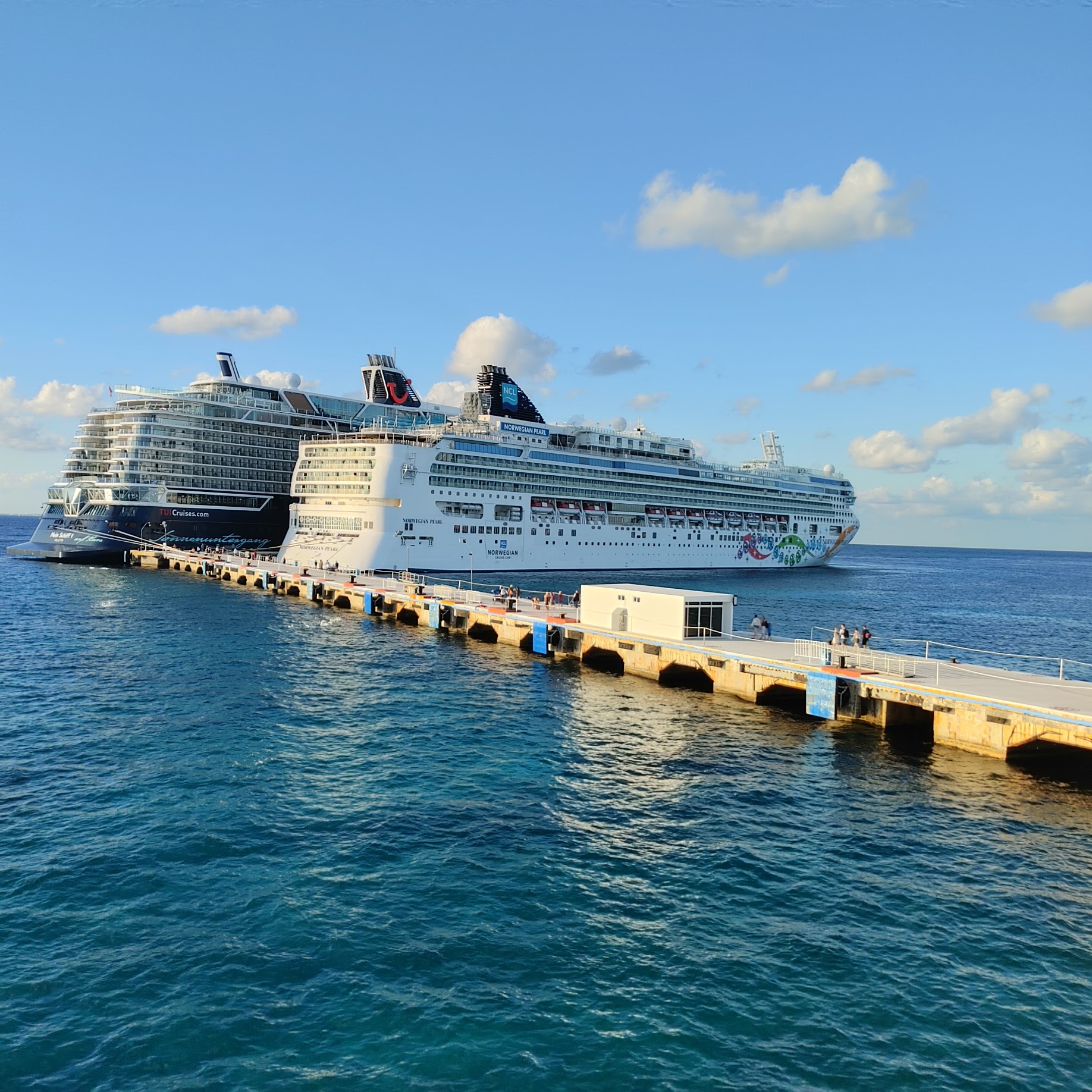 |
| Back to the port, we arrived after the All Aboard time so there was no chance to do any shopping. |
 |
| The next morning we were back in Miami at the dock when the Norwegian Sky passed by us. I laughed because we were on the Viking Sky cruise ship in 2021. |
 |
| So, what did all this cost me? The above is part of a screenshot off the Norwegian app on my phone. Yes, you read it right. The app said my total cost was $10,003,651.59. My sister's amount was the same. This was right after we added the pre-cruise night at the Miami Hilton. Obviously I didn't pay this much. I could do a lot of traveling with that kind of money! Turns out it was a glitch in the app. The Norwegian people couldn't see it from their end, so I ended up talking to tech support to get it fixed. |

No comments:
Post a Comment