
 |
| Just north of Mexican Hat, Utah is Goosenecks State Park. The park is just an overlook into the "gooseneck" canyons of the San Juan River. |
 |
| Because of these entrenched meanders, the river course is 6 miles in length over the distance of 1 mile. At one point the river makes a 3-mile curve around a ridge only 100 yards wide. |
 |
| Eventually the necks may be breached and natural bridges can be formed. |
 |
| We could see some of Monument Valley from the overlook. |
 |
| We continued north on SR 261 and encountered the Moki Dugway. I've also see it spelled Mokee and Moqui. It was constructed in 1958 by Texas Zinc, a mining company, to transport uranium ore from the "Happy Jack" mine in Fry Canyon, UT. to the processing mill in Mexican Hat. The three miles of unpaved, but well graded, switchbacks ascend 1100 feet to the top of Cedar Mesa |
 |
The term "mokee" is derived from the Spanish word moqui, which was a general term used by the 18th century Spanish explorers and settlers in this region to describe the Pueblo Indians they encountered and the vanished culture which had left behind the numerous ruins they discovered during their travels. This term continued to be used by the Anglo pioneers, who moved into southern Utah during the 1800's, and their descendants. |
 |
| The road is in really great shape but we were careful around the the switchbacks. The view along Cedar Mesa. |
 |
| Looking back down we could see SR 261 as it approached the mesa. |
 |
| We could also see the part of the road we had already traveled. |
 |
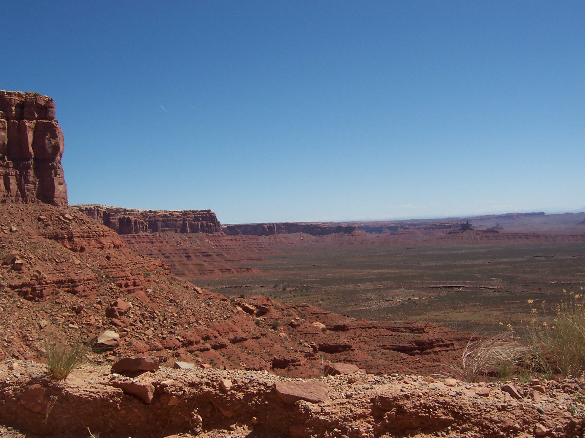
| When we got to the top of the mesa, we took a dirt/gravel road off to Muley Point at the edge of the mesa for another look at the scenery. |
 |
| We didn't take our car all the way to the edge because of the rough road. |

No comments:
Post a Comment