 The second day of our trip we headed north from Goldendale on Hwy 97. At first there were plenty of evergreen trees.
But before long, all we saw was brown.

Just south of Toppenish we caught this glimpse of what I think is Mount Adams.

There are currrently 70 murals in Toppenish. Every year they paint a new one during their Mural-In-A-Day event held the first Saturday in June.
 We walked around a took photos of a few. This is titled "The Rhythms of Celilo".
The Old Saturday Market.

Hot and Dusty Work
 Yakima Leaders
Ok now each mural will be proceeded
by its sign.


We could have taken this wagon ride to hear about all the murals.


This is the American Hop Museum
 Even it had a mural on the side.

Outside the museum they were growing hops.

First we watched a video about hops. It was very informative.
 Hop roots have been known to live up to 30 years but are usually replaced around nine to twelve years for more efficient crop production.
 Propigation is accomplished by root stock division from previous years growth on established roots. In the spring, farmers dig up new runners and cut 6 inch sections being sure to include two 'eyes' to insure growth.
There are two main groups of hop varieties, Aroma and Alpha. Nugget is one type of Aroma hop.

Old photos of how the hop trellises are made.

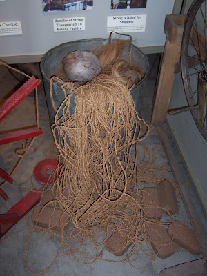
Stringing of the lines that run down to the hop.

In mid-June the hops are trained to run up the strings.

The string is made of coconut husks.


When the hops are ripe, the strings are cut about 1 foot from the bottom and then a wagon is run under it and the strings are cut at the top.

The hops are ran through a variety of machines to separate them from the vine and leaves.

The hops are laid out on the kiln floor where hot air is forced up through the layers to dry them.

This flow chart shows how hops are processed for different uses.


They had a wide variety of beer tap handles.
 The gift shop had lots of interesting items. Hop asparagus is tender shoots that have been pickled.
Our next stop was the Teapot Dome gas station in Zilliah. As the AAA book says, "This architectual oddity was built to parady the Wyoming oil lease scandel of the early 1920's."

Obviously it is no longer in service.

Nolan just had to go peek in the window.

Just north of Yakima on I-82 we stopped at a rest area. It had a good view of Mount Adams and Mount Rainier. Well it would have had if there weren't clouds in the way.

Mount Adams.

Mount Rainier.

Also visible from the rest area is the Fred G. Redmon Memorial Bridge, one of the longest concrete arch spans in the nation.

With Mount Adams in the distance.

Then we went to Vantage.


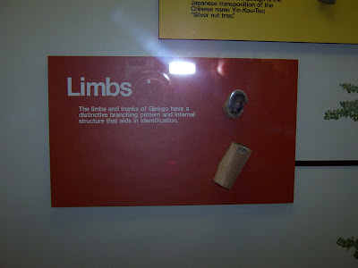
We didn't find most of the logs around the visitor center to be as pretty as the logs at Petrified Forest National Park in Arizona. These weren't as agatized.

From Vantage we crossed the Columbia River on this bridge.
 Our car with the cliffs that face the Columbia.
Just north of where we crossed the river we stopped to see the sculpture named "Grandfather Cuts Loose The Horses".

There was a trail to the top of the hill so we climbed it. It was very steep with lots of loose rocks so it was very difficult to climb.


We continued our trip north by taking SR 281 off of I-82. For that ten mile stretch the crop names were posted. We saw, coriander, alfalfa, grain corn, field corn, potatoes, cherries, sugar beet seeds, green peas and beans. The next 8 photos are from along SR 28.


Rock Island Dam

Don't ya just love the rock walls? These are loose rocks encased in wire fencing.


Notice how the crops are grown anywhere they can find a halfway level spot.

 Our last stop of the day was Rocky Reach Dam. The AAA book said they were open until 5:30 but when we got there at 3:05, we were told the museum closed at 3:30 and the visitor center closed at 4! We did a very quick tour of the museum and only left when the guard chased us out. We weren't the only late visitors.


No comments:
Post a Comment