 Today we took the car to Long Beach, WA via Hwy 6. Along the way we ran through areas where trees lined the roads....
 and places where it was fairly open.
Of course we saw many logging trucks along the way.

 There were several narrow bridges that I'm sure the truckers pray that they don't meet another truck on.
  A clear cut area that hadn't been cleaned up and re-planted.
 I don't know if this area had been cut and not harvested or if the trees had been felled by wind.
 After we got on Hwy 101 going south we crossed this bridge over an arm of Willapa Bay. The bridge curves on the west end.
 We ran along Willapa Bay for quite a few miles.
 Finally we made it to Long Beach.
 We found a parking place at a beach access.
 This is one fishy bicycle rack. It looks like they need to clear away some sand so it can be used. There were several of these in the beach area.
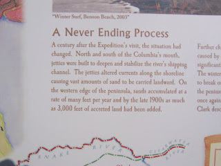
 We walked south on the boardwalk and read the interpretive signs as we went.
 Love the tsunami hazard symbol. Run, Dude, Run!!!
 Here's what the tsunami evacuation route signs looked like. We saw a lot of these along the road to Long Beach. Then we would see one with an arrow pointing up a narrow logging road. Hey any high spot would be good even if the road there to it is rough!

 I don't know if these were hotel rooms or condos but they sure aren't on the beach. Guests would get the view and the blowing sand but have to walk a distance to get in the water.


No comments:
Post a Comment