2 On The Road Blog

After 12 years of full-time rving, we've sold our truck and trailer but we're still traveling. Email us at wowpegasus@hotmail.com if you would like to contact us.


Friday, June 18, 2010

Wave Action

Nolan and I both love to sit and watch waves crash into rocks. I think this photo was taken by Yachats, OR.
South of Yachats looking back north.

We stopped at Cape Perpetua to check out Devils Churn and the Spouting Horn.
We came to Devils Churn first. Waves come up into this narrow inlet then continue up an even smaller fissure in the basalt. The fissure runs from the top center of the inlet about 100' further inland. There's a smooth log floating in the inlet. I wonder how long it's been trapped there. Of course we had to get closer so we took the stairs down the hill.

Me trying to get close to the fissure. The basalt is wet and can be slippery so I wasn't getting real close. It was at least 5' from the top of the fissure to down to the water level.
Then we went out toward the ocean and watched it crash into the rocks there. The waves would spray over the top of the rocks and end up in this pool that drained off toward the back.
The waves were churning things up out there.

Next we came to the Spouting Horn.
We never got a good photo of the spouting horn but this gives you some idea of what it looked like.
A whimpy spout with water coming out the hole.

Looking back north, we could see the rocks we had just been out on by Devils Churn.

Hatfield Marine Science Visitor Center

This interesting attraction is in Newport, OR.


And I thought it only existed in the words of a song.
There are lots of tanks displaying different types of sea life.
This is a Christmas anemone and and some strawberry anemone. Sorry, can't tell you what the fish are called.
It's hard to see this Coonstriped Shrimp because of the glare.

Another tank had a large array of starfish, anemone and fish.


Yes the skate has buried itself in the sand so it's hard to see.
Jellyfish in an interesting round tank.


Pollock.
Halibut sure look funny when they swim.

Clown fish (or Nemo to most kids). This and the next photo are from a salt water tank.


It was hard to get photos of the octopus named Dariq because of the glare on the glass.
Octopus suckers on the glass.


I wouldn't want to meet up with one of these!

We stuck our hands in the touch tanks and felt this abalone plus anemone, sea urchins and starfish.
There were lots of displays on how sea life from other areas of the world has arrived in this area and how they have disrupted the life cycles of the native creatures and flora.

Alsea Bay Bridge Interpretive Center

In Waldport, OR we checked out the Alsea Bay Bridge Interpretive Center. It told about the history of the area and the progress from people following animal trails to the present day highway system and bridges. The bridges were the last part of the system to be built.
This is the new Alsea Bay Bridge. It was completed in 1991. The old bridge was a McCullough design (see previous posts and following photo) that opened in 1937.
We've been over many of the bridges designed by McCullough.


It looks like they left the art deco pillars at each end of the new bridge. I'm assuming they had to be moved since the new bridge is four lanes wide and the old one was two lanes wide.


Tuesday, June 08, 2010

Golden and Silver Falls State Park

If you look at a map of Oregon, most are going to show a road going past Loon Lake, where we are working this summer, that also goes past Golden and Silver Falls State Park. Well it isn't possible to do this. The only way to get to the park is to go to Coos Bay and head back north on the Coos River Road to get to the park. Now the road starts out as a nice paved two-lane highway. It narrows and then turns into this unlined paved road.
But that's the good part! After that you travel on a gravel road that is 1/2 potholes. This photo doesn't show how bad it was. My pothole photos had a glare. Anyway off to the right is a river and many places you had to watch how far to the right you swung to get away from a pothole... you could end up in the river real easy!
Did you think that was the worst of it? Well think again. The last two miles to the park was this one lane path. At least it wasn't full of pot holes and we didn't meet anyone along it. The road ends at a parking lot for Golden and Silver Falls State Park. It took us an hour to drive from Coos Bay to the park.
Now, as the name implies, there are two water falls at the park.
First we went off to the Golden Falls lower trail. Lots of mud holes along the way.
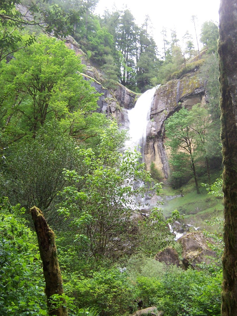
The falls were beautiful!


A closer look.
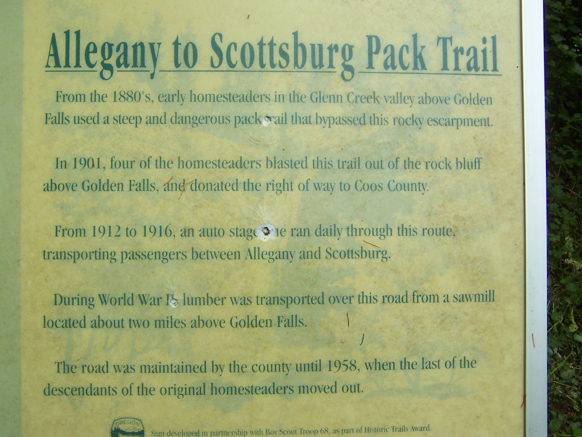
We retraced our path back to the trail for Silver Falls. Along the way we read this information panel.

This is what the road looks like now. I can't imagine how scary it would have been for those log truck drivers!
Silver Falls.
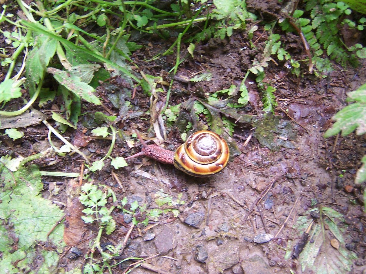
The only wildlife we saw during our walk.
Since this is a temperate rain forest, moss hanges on everything. I just thought this tree was interesting.
I wonder why these trees are so bumpy.
Large rock along the trail with a tree growing out of the top.
We followed a school bus along the gravel road on the way back to Coos Bay.
We've seen two signs like this in Oregon. What does it mean "sunken grade"? I make fun of the signs here. You'll see one saying "rocks". Ok, falling rocks, rocks in road, overhanging rocks... what kind of rocks. Yeah I know it means watch for rocks on road or falling rocks but I just poke fun at them.