 |
| Only in Australia are you going to see warning signs about watching for kangaroo as you drove. |
 |
| The lighthouse also has the nickname, "The White Queen". |

 |
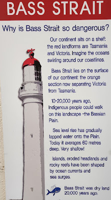
| Love this rendering of the depth levels of the area. Read about it on the previous photo. |
 |
| This poster showed the location of and information about some of the many shipwrecks in Bass Strait. |
 |
| Looking up at the underside of the staircase. |
 |
| Looking out a window during our climb to the top. |
 |
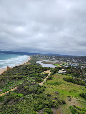
| The following photos are views from the top. |
 |
| Panoramic photo looking to the northeast |
 |
| The original lighthouse keepers' quarters, two detached houses adjacent to the tower, are now privately owned residences. |
 |
| Friendly spider ambling around the balcony didn't want to crawl into my hand. |
 |
| The only lens this lighthouse has ever had is still functioning |
 |
| This listing of the meanings of the maritime signal flags was interesting. |
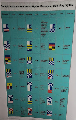 |
| There are different meanings when you combine flags. |
 |
| Testing rocket rescue apparatus in March of 1894. |
 |
| Breeches Buoy |
 |
| What the area around the lighthouse looked like in the late 1930's. |
 |
| In the popular Australian children's television series "Round the Twist", the Twist family lived in the lighthouse. |
 |
| Australia has a lot of lighthouses, and this is how they compare in size. |
 |
| We loved some of the flowers we saw on the way back to the car park. |
 |
| The birds liked them too. |
 |
| The original stables and work room, located to the right of this photo are now a cafe. |
 |
| As we continued our trip along the Great River Road, we saw that a home on the hill above the road had built an interesting observation room connected to the home by a covered walkway. |
 |
| Our next stop was the Memorial Arch south of Moggs Creek. |
 |
| There was also a walkway to the beach by the Memorial Arch, so we went down for a look. |
 |
| As I am known to do, I picked up a rock on the beach. |
 |
| Looking back, we could see the Split Point Lighthouse. |
 |
| Further down the coast, we stopped at the North Lorne rest area and headed out to the beach. This beach looked a bit like the tessellated pavement we had seen in southern Tasmania. |
 |
| My sister spotted this field of birds as we got to the Lorne Jetty, so we stopped for a closer look. |
 |
| Sulphur-crested Cockatoo. Of about 330 parrot species that inhabit our planet, 56 are found in Australia. |
 |
| Galah is a more reserved and gentle bird than most Australian cockatoos. It is one of the most common cockatoos throughout Australia. |
 |
| Ocean watching as we made our way along the coast. |
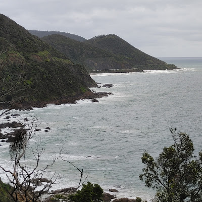 |
| View from Mount Defiance Lookout |

 |
| More ocean watching along the way. |
 |
| Kennett River was our stop because it was a known location for spotting wild koalas. This large koala was bellowing up a storm when we approached so it was easy to find. It was the only one we saw. |
 |
| We continued up Grey River Road for a while before coming back down. The helicopter was still there. |
 |
| Our next stop was Castle Cove Lookout. We saw this sign at the start of the walk. What caught my attention was the photo of the bird. |
 |
| As we were driving along, my sister mentioned that she had caught a glimpse of a red and blue bird. I assume this is what she saw. |
 |
| This is what the path looked like as I looked back toward the parking lot. |
 |
| Oh goody, more waves hitting rocks. |
 |
| The beach is a long way down there, but the sign did mention steps. |
 |
| Starting down... |
 |
| We had to take it slowly because the steps were wet and sandy. |
 |
| Almost down.. |
 |
| The cause for the puddle you saw in the previous photo. |
 |
| I'm not looking forward to going back up those. |
 |
| I found this on the beach. It is triangular, very light and |
 |
| has layers on three sides, one smooth, hard surface and a little rough on the final side. Part of baleen? |
 |
| Our last stop of the night was at Twelve Apostles to see the Australian Little Penguins some out of the ocean for the night. |
 |
| We left from the south side of the Visitor Centre, crossed under the road and continued on this path. |
 |
| The steps down to the first viewpoint. |
 |
| We enjoyed the view while we waited. |
 |
| The next day we continued past Port Campbell to the London Bridge viewpoint. |
 |
| Panoramic shot from the lookout. |
 |
| The furthest west we went on the Great River Road was The Grotto. |
 |
| The path was level as we started off. |
 |
| I believe this is called Carpobrotus, but commonly known as pigface or ice plant. |
 |
| Looks like our level path is starting to head downwards. |
 |
| Our first glimpse of The Grotto. Looks like a lot of steps. |
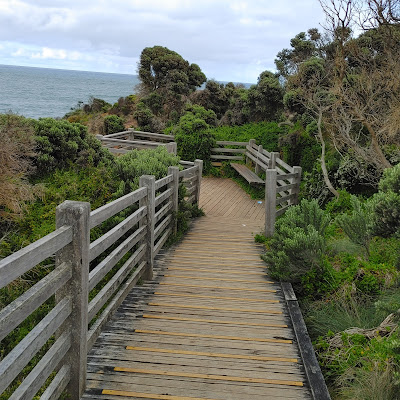 |
| Still no steps but the angle is steep enough they have put in grip strips on the wood. |
 |
| The steps begin. |
 |
| Finally made it to the bottom and looked through the hole to the ocean. |
 |
| Watched the waves wash up the ledge on the far side and slide back off. |
 |
| Looks volcanic down there |
 |
| At first I thought the white patches on the grass were litter but, as I looked closer, I could see they were bits of foam. I figure they were egg sacks from some animal.?? |
 |
| Next stop Loch Ard Gorge. |
 |
| We first walked up the peninsula on the Shipwreck trail |
 |
| Panoramic shot from the viewpoint. |
 |
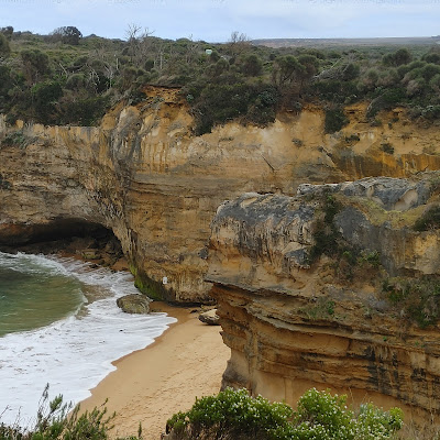
| You can definitely see the different layers of rock here. |
 |
| Another one of those snorkeled trucks. |
 |
| Island Archway viewpoint as we walked toward The Razorback |
 |
| What a dramatic viewpoint. |










No comments:
Post a Comment