 |
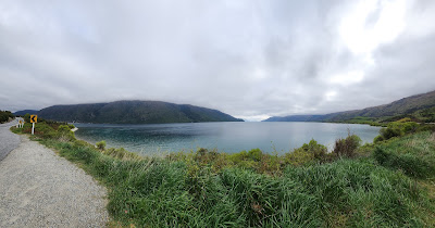
| The highway runs along the shoreline and would be a great motorcycle road. We found New Zealand's roads to be a bit better maintained than Australia's. |
 |
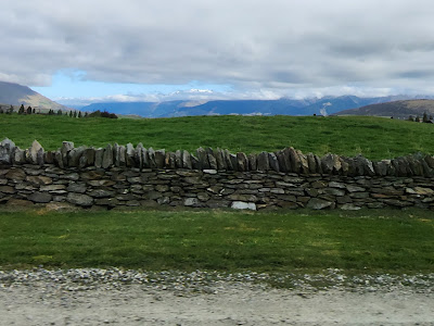
| We ran through an area south of Queenstown that had a lot of stone fences. The way they had put the top stones upright made for a pretty fence. |
 |
| We finally found a good place to pull over to get a photo of a deer farm. There were lots of them south of Queenstown but less as we headed north. |
 |
| For a bit more of an adventurous drive, we left the highway and took Crown Range Road. I missed the first two lookouts I had on our list. I was a bit bummed about that. But we did manage to find the bra fence that I had read about. |
 |
| I think it would take a day to count them now. I wonder how many of the bras added in the early 2000's are still there. There were some pretty extravagant bras there. Although I didn't do it, I had thought about taking one to add. |
 |
| Coming into Wanaka |
 |
| This photo and the next show the highway from Wanaka (at the bottom of the photo) to Haast (at the top left of the next photo). Many of our stops are marked. We stopped at the viewpoint along Lake Hawea, and where the highway started running along Lake Wanaka. |
 |
| We also stopped at the Blue Pools, Fantail Falls, Thunder Creek Falls, Roaring Billing Falls and a couple of places not on this map. |
 |
| Driving north along Lake Hawea |
 |
| We stopped at a rough parking area along Lake Hawea. The lot was hilly and rutted but it had a portapotty. |
 |
| One thing we noticed in New Zealand is that every bridge and culvert has a sign listing its number or name. |
 |
| Traveling onward the road crossed over a narrow strip of land to Lake Wanaka. |
 |
| I know this is hard to see but it contains information about Lake Wanaka and identifies the landforms around the lake. |
 |
| Looking south... |
 |
| southwest |
 |
| and west. |
 |
| Panoramic |
 |
| Remember, speeds and distances are in kilometers. |
 |
| We stopped at this waterfall but couldn't really get a good view of it because it was on the other side of the highway where there wasn't a place to stop. This is still along Lake Wanaka. |
 |
| Our next stop was to see the Blue Pools but there was a lot of information here about the area. |
 |
| So we walked down the track and crossed over the Makarora swing bridge on the way to the bridge over the Blue Pools. |
 |
| Some of the trail was more open to the sky... |
 |
| and some went through wooded areas. |
 |
| Loved this sign as we approached the Makarora swing bridge. Ten people on the bridge was ok but don't dare add one more or the bridge would collapse. I wonder how many times kids have tested that. |
 |
| Crossing the Makarora River on the swing bridge gave us views of the bridge at the Blue Pools. |
 |
| Just loved the color of the water in the Makarora River. |
 |
| Most of the rest of the trail to the Blue Pools was a boardwalk. |
 |
| The water changes color if it is flooded. |
 |
| The Blue River just before it passes under the Blue Pools bridge. |
 |
| Standing on the Blue Pools bridge looking toward the Makarora River. There were a couple adventurous souls who had been in the water. |
 |
| We made our way down to this very rock beach and looked back up towards the bridge. Rocks + kids = cairns. |
 |
| Dang these rocks were just too big to take home. |
 |
| I looked at this and saw snow on the mountain. My sister looked at it and saw a butterfly. I suppose that's just a lack of imagination on my part. |
 |
| View from the Blue Pools parking lot. |
 |
| Next stop - Fantail Falls. We took a very short walk down this path... |
 |
| to see Fantail Falls. |
 |
| We decided it was time to have some lamb since there were so many in New Zealand. |
 |
| According to the petkeen.com website, there were 25.97 million sheep in New Zealand as of June 2021. There has been a continuous decline over the past 11 years, when there were 32.56 million in 2010. Since the 1970s, sheep farming has decreased significantly. There were as many as 70 million sheep in 1982! As of 2020, it’s believed that there are about five sheep per person in New Zealand. While this does sound high, the numbers have dropped quite a bit from the statistic of 22 sheep per person in 1982! |


No comments:
Post a Comment