 Upon entering the park, we were given a paper called the Bugler, the Olympic National Park newspaper and most of the following commentary comes from that publication. Established in 1938, Olympic is home to over 3,500 miles of rivers and streams that provide habitat for 29 species of native freshwater fish. Three hundred bird and 70 mammal species call this place home.
 ONP occupies most of the interior of the upper portion of the Olympic Peninsula and some of the coast line. Most of the 923,000 acres that comprise the park is designated wilderness area.
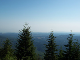
 Our trip started with a drive up to Hurricane Ridge. Along the way we stopped at this viewpoint where we could just make out the Strait of Juan De Fuca and the shoreline of Vancouver Island. See map below to visualize what we might have seen on a clear day. Washington was experiencing a heat wave and air stagnation that resulted in the hazy view. The next three photos can be combined to show the panoramic view we saw.


 This viewpoint was right before a series of three short tunnels.
 The hazy view from the visitor center.
 This map shows the names of the peaks in the photo below.

This map names the peaks in the photo below.


This map names the peaks in the photo below.


 There were many trails around the visitor center but we picked a short one since we had a full day planned. We hiked the High Ridge Trail and part of the Cirque Rim Trail. We have friends that recently hiked to Klahhane Ridge and up the Switchback Trail.
The trail started off paved.
 Since the park service had so kindly labeled the flowers for us, we decided to do a little flower-sniffen'.

A fellow trail walker pointed out this small bird, maybe a baby quail, and the mother bird in the tree that was upset over us being near her chick.


 Here's where the trail turned to dirt.
From here we looked down and could see the road we traveled to the top.

Once we got to the top of the first peak, we could have continued the hike to Sunrise Point but instead, we headed down.


 Even in a park drenched by 12' of rain a year, the summers are dry. When lightning strikes, small fires spread. This creates a natural patchwork of burned and unburned meadows, forests and silver snags like those at Hurricane Ridge. In September 2003 lightning ignited a fire near Griff Peak, two miles from the spot where this photo was taken. It was too dangerous for firefighters to dig a fire line on the steep slopes, amid falling trees and rocks. Instead crews used sprinklers, helicopter water drops and bare ridges to halt the fire's spread.
October rains had the final word, extinguishing embers that lingered in the 820-acre Griff fire.
 During the drive back down the mountains, we stopped to do some more flower-sniffen'. Looks like these wildflowers are holding some soil on the steep slopes.
The orignial planned called for us to stay at a cheap hotel in Forks for the night but that hotel didn't have air-conditioning and the temperature was 91° when we passed through the town. We ended up in Hoquim where the fog had moved in and the temperature was 61° at 8 pm. One of the coolest temperatures we had see all day. It was 79° when we left Sequim at 7:27 a.m.

No comments:
Post a Comment