2 On The Road Blog

After 12 years of full-time rving, we've sold our truck and trailer but we're still traveling. Email us at wowpegasus@hotmail.com if you would like to contact us.


Sunday, April 22, 2012

Goosenecks State Park, Moki Dugway and Muley Point

Just north of Mexican Hat, Utah is Goosenecks State Park.  The park is just an overlook into the "gooseneck" canyons of the San Juan River.   
Because of these entrenched meanders, the river course is 6 miles in length over the distance of 1 mile. At one point the river makes a 3-mile curve around a ridge only 100 yards wide.

Eventually the necks may be breached and natural bridges can be formed.


We could see some of Monument Valley from the overlook.


We continued north on SR 261 and encountered the Moki Dugway.  I've also see it spelled Mokee and Moqui.   It was constructed in 1958 by Texas Zinc, a mining company, to transport uranium ore from the "Happy Jack" mine in Fry Canyon, UT. to the processing mill in Mexican Hat. The three miles of unpaved, but well graded, switchbacks ascend 1100 feet to the top of Cedar Mesa


The term "mokee" is derived from the Spanish word moqui, which was a general term used by the 18th century Spanish explorers and settlers in this region to describe the Pueblo Indians they encountered and the vanished culture which had left behind the numerous ruins they discovered during their travels. This term continued to be used by the Anglo pioneers, who moved into southern Utah during the 1800's, and their descendants.

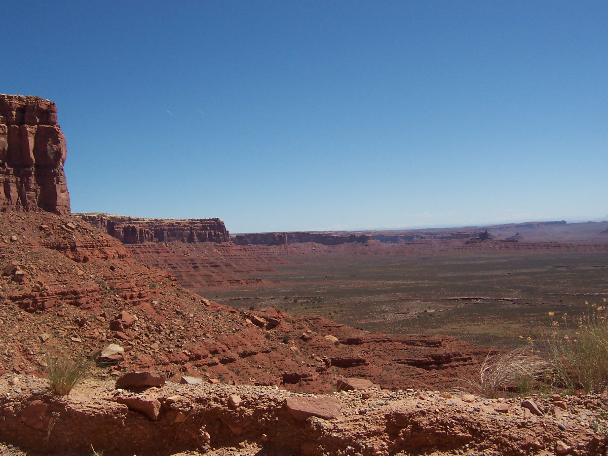
The road is in really great shape but we were careful around the the switchbacks.  The view along Cedar Mesa.


Looking back down we could see SR 261 as it approached the mesa.


We could also see the part of the road we had already traveled.


When we got to the top of the mesa, we took a dirt/gravel road off to Muley Point at the edge of the mesa for another look at the scenery. 


We didn't take our car all the way to the edge because of the rough road.


Saturday, April 21, 2012

Monument Valley


The view from the Visitor Center starting in the north and moving to the south.   That's Sentinel Mesa.  Some of this post is messed up.  Just keep going through the first few photos.  Double click to enlarge them so you can see the details better.


 <><><><>
<>


<><><><>
You can see the road that leads into the valley.  West Mitten, East Mitten and Merrick Butte.
  
Nolan did a close up so you can see the semi truck navigating the narrow, rocky and very bumpy road.  We could hear the vehicle rattling from the viewpoint.   It had unloaded equipment for the Disney film "Lone Ranger" starring Johnny Depp that is being filmed in the valley.


The Jeep our tour guide drove around the Valley so we could see the sights.

From the left - Sentinel Mesa with West Mitten Butte in the foreground.  I think the next one is Big Chief followed by Castle Butte.


Merrick Butte

Three Sisters

This is Camel Butte but I just don't see the resemblence.

Nolan out on John Ford's Point.  This is the place a lot of western movies were shot from.

A close up so you can see Nolan really was on the point.

Merrick Butte from Ford's Point.

Different view of Camel Butte.

Profile of Geronimo

This is really hard to see but the leftmost  place that juts out from the side of the Thunderbird Butte is what looks like a Thunderbird.

This one is easier to see in person.  It's called Sleeping Dragon.  See the head to the mid-left of the photo with the body to the right?

A close up of the head of the sleeping dragon with a horse in the foreground.

Another photo of the Thunderbird with Three Sisters and Mitchell Mesa in the background.

Pile of capstones that have fallen off Thunderbird Mesa.

The Hub.  Looks like a hub of a wagon wheel.


It's hard to see the pictographs her by Sun's Eye.

Sun's Eye

Ancient dwelling tucked up to the side of the butte.

Sun's Eye from a distance.

Moccasin  Arch

Lizard tracks in the sand.  Looks fresh.

Our guide standing in Big Hogan

Our guide J.T. played the flute for us in Big Hogan.  It echos in there.  The following is a video of him playing the flute.

The hole in the roof of Big Hogan.

Totem Pole

Sand Spring Aquifers.  Rain and snow melt drains down through the sand to form this spring.  T.J. said he has never seen the spring dry up and he's lived in the area all his life.

Totem Pole on the rigth with the Yie Bi Chei (Navajo Spiritual Gods) on the left.

T.J. said this was Red Rooster Rock but I don't see it on the park map.

Looking toward Artist Point Overlook.


View from North Wintdow Overlook.  There was a film stage here set up for Lone Ranger.

I saw this from North Window Overlook.  It's not Elephant Butte but it looked like one to me.

Bad time of day to be trying to take a photo of Thumb Butte.  From slightly back of this angle, it looks like a cowby boot.

Nolan says Sentinel Mesa looked like a rhinoceros.

Just west of the town of Mexican Hat on the way back to Bluff we saw this canyon backed up by the cool looking hills in the back.

Mexican Hat got its name from this formation.  It looks like a sombrero.  This is a 2,500-ton boulder that is 60' wide and 12' thick balanced on a 200' cliff. 

Another view of Mexican Hat

Those crazy colored hills by Mexican Hat.